2. Long-term water cycles: Wet cycle and flood risk in - - PowerPoint PPT Presentation

2 long term water cycles wet cycle and flood risk in the
SMART_READER_LITE
LIVE PREVIEW

2. Long-term water cycles: Wet cycle and flood risk in - - PowerPoint PPT Presentation

1. Climate change impact on glaciers and river runoff in the Kharkhiraa river basin, Mongolia 2. Long-term water cycles: Wet cycle and flood risk


slide-1
SLIDE 1

¡

  • 1. ¡Climate ¡change ¡impact ¡on ¡glaciers ¡and ¡river ¡runoff ¡in ¡the ¡

Kharkhiraa ¡river ¡basin, ¡Mongolia ¡

G.Davaa, Head, Hydrology section, IMHE, Mongolia

  • 2. ¡Long-­‑term ¡water ¡cycles: ¡Wet ¡cycle ¡and ¡flood ¡risk ¡

in ¡the ¡Tuul ¡river ¡basin, ¡ ¡ ¡

slide-2
SLIDE 2

Loca=on ¡ of ¡ Kharkhiraa ¡ and ¡ Turgen ¡ Mts. ¡ and ¡ river ¡ basins, ¡ Altai ¡ ¡Mts., ¡Mongolia ¡

The ¡ Kharkhiraa, ¡ Turgen ¡ river ¡ basins ¡ and ¡ the ¡ Uvs ¡ Lake ¡ valley ¡ experience ¡the ¡hoDest, ¡coldest ¡and ¡driest ¡climate ¡condi=ons ¡among ¡ any ¡place ¡on ¡Earth ¡at ¡similar ¡la=tudes. ¡These ¡basins ¡create ¡a ¡mosaic ¡

  • f ¡glacier ¡tops, ¡high ¡mountainous ¡tundra, ¡alpine ¡meadows, ¡coniferous ¡

forests, ¡ intermountain ¡ steppes, ¡ and ¡ finally ¡ the ¡ lowland ¡ Gobi ¡ desert ¡ steppe.

Glacier ¡sta=on ¡

slide-3
SLIDE 3

¡ ¡ ¡ ¡ ¡in ¡2010 ¡ ¡ ¡ ¡in ¡1910 ¡ Photos taken by D.A.Karruthers in 1910 and U.Kamp in 2010 The ¡glacier ¡has ¡retreated ¡by ¡600 ¡m ¡and ¡down ¡wasted ¡by ¡72 ¡m ¡during ¡this ¡100 ¡years. ¡ ¡ ¡

slide-4
SLIDE 4

Used data and methods

Ø Observation data on glacier mass balance Ø Observed hydrological data of the Kharkhiraa and Turgen streams Ø Current climate data from meteosations in the basin Ø Topographic and Remote sensing data (LANDSAT ETM) for glacier areas Ø Regional empirical equation for glacier volume vrs. area and for glacier melt vrs. altitude in the Altai Ø Simulated and projected with regional climate model results under A1B GHG scenarios Ø SMR model calibration and verification of daily discharge of the Kharkhiraa river Ø The RCM initial and boundary data is obtained from ECHAM5- GCM, which is shown comparatively most good skill for representing Mongolian climate (P.Gomboluudev, 2013).

slide-5
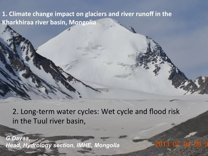
SLIDE 5

Current changes of glacier areas and water regime

Glacier area of the Turgen Mts. in 2000 and 2010 (LANDSAT data) River flow variation of the Kharkhiraa and Turgen rivers

Change in area depends on size of glacier areas

Glacier area of the Kharkhiraa Mts. in 2000 and 2010 (LANDSAT data)

Data source ¡

Total glacier area in Kharkhiraa

  • Mts. ¡

Kharkhiraa

  • Mts. glacier

area in Kharkhiraa river basin ¡ Total glacier area at Turgen

  • Mts. ¡

Turgen Mts. glacier area in Kharkhira a river basin ¡ Total glacier area in Kharkhiraa river basin ¡

Topographic map, scaled as S1:100000 ¡

64.20 ¡ 6.74 ¡ 45.06 ¡ 24.15 ¡ 30.89 ¡

Landsat ETM+ 25/6/1992 ¡

39.18 ¡ 4.31 ¡ 36.10 ¡ 18.98 ¡ 23.29 ¡

Landsat ETM+ 10/9/2000 ¡

34.06 ¡ 3.62 ¡ 31.27 ¡ 16.69 ¡ 20.31 ¡

Landsat ETM+ 4/07/2002 ¡

33.15 ¡ 3.49 ¡ 37.75 ¡ 19.70 ¡ 23.19 ¡

Landsat ETM+ 29/8/2010 ¡

31.20 ¡ 3.19 ¡ 29.41 ¡ 15.71 ¡ 18.90 ¡

Landsat ETM+ 6/08/2011 ¡

26.73 ¡ 2.43 ¡ 27.49 ¡ 14.63 ¡ 17.06 ¡

Change in depth depends on size of area of glaciers

slide-6
SLIDE 6

Current ¡changes ¡in ¡water ¡regime ¡and ¡resources ¡and ¡future ¡projec=ons ¡for ¡Kharkhiraa ¡

  • R. ¡

dAKharkhiraa ¡river ¡basin ¡= ¡2.306 ¡B ¡+ ¡3.7 ¡

  • ­‑6.00
  • ­‑4.00
  • ­‑2.00

0.00 2.00 4.00 6.00 8.00 1980 2000 2020 2040 2060 2080 2100 Annual ¡M, ¡A ¡and ¡B, ¡m Years Ablation ¡(M), ¡m

SMR ¡model ¡parameters ¡ were ¡calibrated ¡and ¡ verified ¡with ¡ hydrological ¡

  • bservaMon ¡data ¡of ¡

Tarialan ¡hydro-­‑staMon ¡ at ¡Kharkhiraa ¡River ¡for ¡ the ¡period ¡of ¡1980-­‑1999 ¡ and ¡2001-­‑2010. ¡ In ¡our ¡Kharkhiraa ¡river ¡case ¡the ¡efficiency ¡criterion ¡reaches ¡the ¡value ¡of ¡0.98 ¡the ¡simulated ¡ discharge ¡are ¡close ¡to ¡observed ¡discharge. ¡The ¡relaMve ¡volume ¡error ¡RVE ¡is ¡quite ¡small ¡as ¡ 0.007 ¡for ¡the ¡Kharkhiraa ¡River ¡flow ¡simulaMon. ¡

slide-7
SLIDE 7

Current ¡changes ¡in ¡water ¡regime ¡and ¡resources ¡and ¡future ¡projec=ons ¡Kharkhiraa ¡river ¡

Current (1982-2011) and projected in future monthly average discharge values of the Kharkhiraa River at Tarialan hydro-station, ECHAM5- GCM, A1B (2012-2030, 2046-2065, 2080-2099)

Annual ¡mean ¡discharge ¡of ¡the ¡Kharkhiraa ¡River ¡ at ¡the ¡Tarialan ¡hydro-­‑staMon ¡is ¡projected ¡to ¡ slightly ¡decrease ¡by ¡6.18 ¡percents ¡in ¡the ¡period ¡

  • f ¡2011-­‑2030, ¡significantly ¡decrease ¡by ¡76.9 ¡

percents ¡in ¡the ¡period ¡of ¡2046-­‑2065 ¡and ¡ moderately ¡decrease ¡by ¡24.0 ¡percents ¡in ¡the ¡ period ¡of ¡2080-­‑2099 ¡in ¡comparisons ¡with ¡ current, ¡1980-­‑2010 ¡discharges ¡ ¡ Monthly ¡average ¡discharge ¡will ¡increase ¡ by ¡9.0 ¡percents ¡in ¡the ¡June, ¡2.2 ¡percents ¡ in ¡the ¡August ¡and ¡slightly ¡decrease ¡by ¡4.0 ¡ in ¡July, ¡2011-­‑2030. ¡In ¡rest ¡periods ¡JJA ¡ discharges ¡will ¡decrease ¡by ¡88.5-­‑94.8 ¡ percents ¡in ¡2046-­‑2065 ¡and ¡by ¡39.3-­‑44.9 ¡ percents ¡in ¡the ¡period ¡of ¡2080-­‑2099 ¡due ¡ to ¡glacier ¡melt ¡and ¡retreat. ¡ ¡

slide-8
SLIDE 8

Conclusions ¡and ¡recommenda=ons ¡ ¡ Ø Water harvesting or building water accumulation “aside ponds” and aside reservoirs are highly recommended in the Kharkhiraa and Turgen river basin, especially in upstream area of Tarialan and Ulaangom soum area. Ø To increase irrigation efficiency and meet food security requirement in these basins, drip irrigation technology can be applied for vegetable and fruit production in Ulaangom, Tarialan, Turgen and Naranbulag soums. Feasibility study on integrated efficient irrigation and water resource development in the Kharkhiraa river basin including Tarialan, Ulaangom and Naranbulag soums is recommended. Natural aside lakes, located in the floodplain of the Turgen stream in the Kharkhiraa river basin

slide-9
SLIDE 9

Expected ¡results ¡and ¡logical ¡frame ¡

Ø Mean annual in-stream summer 30 day low flow will be improved

  • r maintained with increasing ecosystem resilience (reforestation,

plantation, improved pasture and other nature resource management) Ø Surface water quality and ground water recharge will be improved

  • r maintained

Ø Grazing rate meets pasture carrying capacity Ø Number of eco-regional EBA strategy programs will be fully

  • perational

Ø Total hectares of riparian and wetland habitat will be restored with native vegetation within project sites Ø All soums will be implementing watershed level EBA planning programs and combined with IWRM planning Ø Total hectares of cultivated land demonstrating EBA friendly cropping methods in project sites will be increased. Ø Total number of monitored wells increasing ground-water consumption efficiency in project sites will be increased.

slide-10
SLIDE 10

Long-­‑term ¡water ¡cycles: ¡Wet ¡cycle ¡ and ¡flood ¡risk ¡in ¡the ¡Tuul ¡river ¡basin ¡ ¡

slide-11
SLIDE 11

LocaMon ¡and ¡geographical ¡features ¡of ¡the ¡Tuul ¡River, ¡Mongolia ¡ ¡

Tuul-­‑Bosgo, ¡1985 ¡ Terelj-­‑Terelj, ¡1969 ¡ Tuul-­‑Ulaanbaatar, ¡1942 ¡ Uliastai-­‑Uliastai, ¡1992 ¡ Selbe-­‑Sanzai, ¡1993 ¡ Selbe-­‑Dambadarjaa, ¡1984 ¡ ¡

Ø Flash ¡flood, ¡ ¡ Ø Spring ¡flood, ¡ ¡ Ø Rainfall ¡flood ¡

slide-12
SLIDE 12

LocaMon ¡of ¡dendro-­‑chronological ¡sampling ¡points ¡and ¡hydrological ¡staMons, ¡Mongolia ¡ ¡ ¡ ¡ ¡ ¡ ¡source: ¡R.Mijiddorj, ¡G.Davaa ¡and ¡Baatarbileg, ¡2013 ¡ ¡

N Place Type of Tree Elevation (m) Period (year) Authors 6 Zuunmod Siberian Larch 1415 1582- 1996 G.C. Jacoby, B.M. Buckley, N.Pederson

Possible ¡way ¡to ¡reconstruct ¡past ¡hydrological ¡data ¡

slide-13
SLIDE 13

Q observed wrs. Q reconstructed for 1945-1968

Ø Average duration of high flow periods is 30 years . T= 4-51 years Ø Average duration of low flow periods is 62 years . T= 9-121 years Ø Observed almost one cycle during the observational period of 1945-2014. What option (building reservoirs) is optimal for the Tuul river flow regulation? To what extent climate change will impact on the river flow? Environmental flow requirements and standards?

Observed and reconstructed: Tuul river flow variation

Source: R. Mijiddorj, G. Davaa, N.Baatarbileg, 2012

¡ ¡1760th? ¡ ? ¡ ? ¡ ? ¡ 1915? ¡ ¡1966, ¡7 ¡P=?, ¡T=100 ¡years ¡ 1639 ¡UB ¡

slide-14
SLIDE 14

Dynamics ¡of ¡water ¡balance ¡ elements ¡in ¡the ¡Tuul ¡river ¡ basin ¡ Dynamics ¡of ¡runoff ¡ coefficient ¡in ¡the ¡Tuul ¡river ¡ basin ¡

slide-15
SLIDE 15

Levee ¡constructed ¡in ¡1966. ¡

slide-16
SLIDE 16
slide-17
SLIDE 17

Reducing ¡flood ¡risks ¡

¡ ¡2.Vulnerability ¡of ¡system ¡(social, ¡economical) ¡ ¡

¡

Dense ¡se_lement ¡in ¡flood ¡prone ¡area ¡due ¡to ¡improper ¡land ¡use ¡management, ¡urban ¡planning ¡ and ¡poor ¡public ¡awareness ¡are ¡common ¡problems. ¡ ¡

slide-18
SLIDE 18

These constructions are located inside flood protection levee extending northern shoe line of the Tuul river. That indicates current situation of preparedness of Ulaanbaatar against flooding. Strategic planning on protection of Ulaanbaatar against flooding was conducted in development stage.

slide-19
SLIDE 19

Monitoring ¡and ¡PredicMon ¡for ¡Early ¡Warning ¡against ¡Water-­‑Related ¡Disasters ¡ ¡

BUT!!!! Flood damage 10 person dead, about 2 km paved road destroyed. 3 cars, 276 fence and gers seriously damaged and 30 families totally lost shelter. Total flood damage is rather big. Flash flood along the dry bed western side of Mongolian TV Event ¡study ¡ ¡ Weak ¡flash ¡flood, ¡caused ¡by ¡54 ¡mm/hour, ¡occurred ¡in ¡18th ¡July, ¡2003 ¡in ¡Ulaanbaatar. ¡ ¡ ¡ ¡

slide-20
SLIDE 20

Reducing ¡flood ¡risks ¡

Rainfall ¡observa=on ¡by ¡Radar ¡

  • r ¡precipita=on ¡observa=on ¡

Conversion ¡of ¡radar ¡rainfall ¡into ¡rainfall ¡on ¡ground ¡ surface ¡and ¡use ¡of ¡quan=ta=ve ¡rainfall ¡forecas=ng ¡ products ¡ ¡ ¡ Flood ¡amount ¡es=ma=on, ¡hydrological ¡ modeling ¡and ¡forecas=ng ¡ ¡ ¡ Mapping ¡inunda=on ¡ area ¡ ¡ Free ¡passage ¡of ¡flood ¡water ¡ through ¡protec=on ¡structures ¡ and ¡reservoir ¡opera=on ¡ Warning ¡system ¡ ¡

y = 3E-08x 4.9439 R 2 = 0.8666 2 4 6 8 10 12 14 16 30 35 40 45 50 55 60 ¿¿ëí èé ¡î éö ¡/äöá/ õóð ¡áîðîîíû ¡ýð÷èìøèë ¡/ìì/ö/
slide-21
SLIDE 21

Monitoring ¡and ¡PredicMon ¡for ¡Early ¡Warning ¡against ¡Water-­‑Related ¡Disasters ¡ ¡

  • ­‑ ¡ ¡ ¡ ¡ ¡ ¡ ¡ ¡ ¡

¡ ¡Conclusions ¡

¡ ¡ ¡ Due to climate change and anthropogenic impacts, there is decline of water

resources and change in flow regime and water resources. Change in rainfall pattern with heavy rainfall increase, causes more frequent flash flood and river flooding and less recharge to the ground water, dropping GW water table. Ø Climate change impact assessment on flow regime and resources in the Tuul river basin scale Ø Development of adaptation options to CC in the basin scale Ø Defining technological needs in river basin Ø Environmental constraints and environmental flow standards in river basin.

slide-22
SLIDE 22