Cat I sland Chain Restoration 1845 Chart of Green Bay & Fox - - PowerPoint PPT Presentation
Cat I sland Chain Restoration 1845 Chart of Green Bay & Fox River 1820s Fox River Military Road Map to Fort Howard Cat Island Chain - 1938 Cat Island Brown County Aerial Photography, 1938 Historic Western view of lower Green Bay
1820s Fox River Military Road Map to Fort Howard 1845 Chart of Green Bay & Fox River
Cat Island Chain - 1938
Brown County Aerial Photography, 1938
Cat Island
Historic Western view of lower Green Bay
- Expansive emergent marshes (e.g. Duck Creek
delta, Peats Lake)
- Numerous small islands
- Beaches and mud flats
- Submerged aquatic plant beds
Photo Courtesy of Tom Erdman, 1966
Cat Island Lone Tree Island Willow Island Bass Islands Grassy Island
1966 during low water levels Islands extend 2.5 miles into Green Bay
Photo Courtesy of Tom Erdman, 1966
Duck Creek Delta Municipal incinerator and landfill
Long Tail Point Little Tail Point Cat Island Chain
Rock dikes hardened the shoreline Peter’s Marsh
Photo Courtesy of Tom Erdman , 1970
Duck Creek Delta Marsh Cat Island Long Tail Point I-43 Construction Bass Islands Landfill
90% of Coastal Wetlands Lost from Southern Green Bay
Agriculture
Photo by WDNR, 1969
Cat Island Chain – 1960-2010
- The Cat Island Chain
project developed out of the 1988 Lower Green Bay Remedial Action Plan (RAP) and was the top priority project for habitat restoration.
Members of the Citizens Advisory Committee and DNR staff worked together to develop the Lower Green Bay Remedial Action Plan. (Photo by Dave Crehore)
Project Beginning
Cat Island
Green Bay Shipping Channel
Annual Dredging
- Annual maintenance
dredging is necessary to keep the Port of Green Bay active
- Annual dredging of
100,000 to 250,000 CY
- f sediment that has
settled into the 14 mile long navigational channel
Project Goals
- Restore diversity of island and aquatic habitats
- Recreate 1960s island “footprint”
- Enhance spawning and nursery grounds for various
fish species (e.g. yellow perch, musky, pike, walleye, sunfish)
- Create disposal capacity
- Beneficially use dredged
material from the maintenance
- f the Port of Green Bay
Photo by WDNR 1969
- Partnership between:
Brown County, WDNR, WDOT, US Fish & Wildlife Service
US Army Corps of Engineers, USEPA, UW-Sea Grant, UW-Green Bay
Port Operators and the Fox River Group of paper mills
Project Partners
Cat Island Advisory Committee (CIAC)
Citizen Member
Lake Bed Grant
Brown County Aerial Photography , 2012
Cat Island
Construction Phase I - June 2012
December 17, 2012
Construction Phase II - October 2012
November 12, 2013 95% Complete May 16, 2013
Tons ($) Gravel 41,788 $ 158,379 Core Stone 504,411 $ 1,743,609 Armor Stone 161,666 $ 1,611,829 Total 707,865 $ 3,513,817
- Approx. 34,000 truckloads
Project Costs
Original Actual Project Cost $ 34,190,889 $ 19,281,931 Less Brown County GLRI Grant $ 1,500,000 $ 1,450,053 Total Project Costs $ 32,690,889 $ 17,831,878 65% Federal Share $ 21,249,078 $ 11,182,838 35% Non-Federal Share $ 11,441,811 $ 6,649,040 Total Project Costs $ 32,690,889 $ 17,831,878 Non-Federal Funding Sources WDOT Harbor Assistance Grant $ 7,141,835 $ 5,319,232 NRDA Funds $ 800,000 $ 800,000 Terminal Operator Harbor Fees $ 499,000 $ 529,808 Brown County $ 336,459 $
- Brown County In-Kind
$ 150,000 $ - Total Non-Federal Funds $ 8,927,294 $ 6,649,040 25% Non-Federal In-Kind Contribution $ 8,172,722 $ 4,457,970 10% Non-Federal Cash Contribution $ 3,269,089 $ 1,783,188
Island Area (acres) Storage Capacity (yards3)
Years Remaining (assume 2 yr cycles and sequential filling)
West Island 74 900,000 8 Central Island 92 1,140,000 22 East Island 106 1,680,000 40
Sediment Disposal
Only outer harbor “clean sediments” will be placed
- nto the islands
September 9, 2014
May 7, 2015
July 2, 2015
October 24, 2016
October 26, 2016
April 21, 2017
Habitat Impacts
- Colonial
Nesting Water Birds
- Shorebirds
- Waterfowl
- Fish Spawning
- Fish Nurseries
- Turtles
- Amphibians
- Invertebrates
Importance of the area
- Interior sites gaining
recognition for importance
- Lower Green Bay
identified as important shorebird staging area
- 35 species reported via
eBird in Wisconsin portion
- f Green Bay
American Avocets
Cat Island Habitat Projects
Brown County Aerial Photography, 2017
Plantings and Monitoring Tern Platforms Plover Habitat
Piping Plover
- Piping Plover successfully bred on
westernmost island in 2016 & 2017
- First local breeding in 75+ years
Tern Platforms
Wild Rice Planting
Courtesy UWGB, 2015, 2016
FY17 Dredging Activities
84,293 CY from transition area to Bay Port Cell 5 38,500 CY to Cat Island (100,000 to be placed in 2018) Rear Barrier placed in center cell
On-Going Issues
- Management
Cat Island Advisory Committee (CIAC)
- Public Access
Public Safety Sensitive Wildlife Habitat Area
- Filling
Sequence and Timing Removal of Causeway
Public Access
November 8, 2017
2017 CENTER CELL BARRIER INSTALLATION Approximately 2300 LF of geotextile lined gabion-style barrier placed across the back of the center island
Barrier
Barrier Construction
Cat Island Chain - 2017
Brown County Aerial Photography, 2017
Cat Island
Project Outcomes
- 30-50 years worth of disposal capacity
- Beneficial reuse of dredged material
- 2.5 mile wave barrier and re-establishment of 272 acres
- f islands
- Wave barrier protecting 1,225 acres and providing
critical habitat for birds, fish and mammals
- Improved water clarity increasing weed grown for fish
spawning and serving as a nursery and improved migratory bird sanctuary/lay over
Questions?
Mark Walter
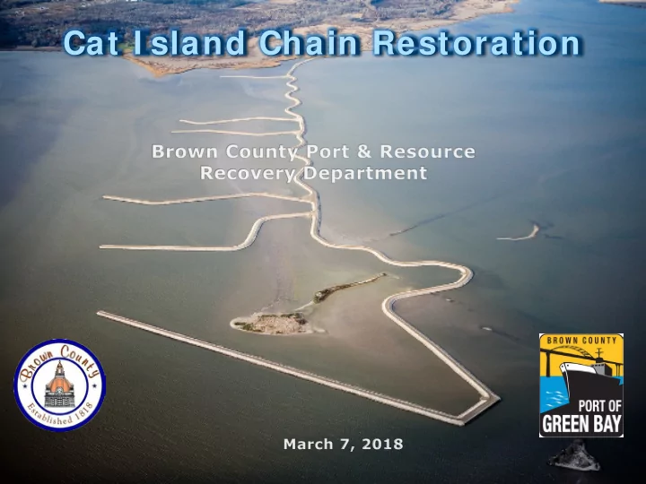
Brown County Port & Resource Recovery Department