City of Szekesfehervar Royal traditions Dominant economic role 1000 - - PowerPoint PPT Presentation
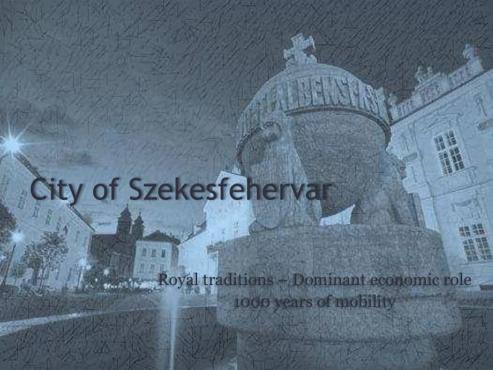
City of Szekesfehervar Royal traditions Dominant economic role 1000 years of mobility Strategic location nowadays Mid-East Transdanubian Region Capital of Fejr County 170 km 2 Gyr, Vienna 100 000 inhabitants Budapest
Strategic location nowadays…
Budapest Graz Győr, Vienna Zagreb, Trieste 65 km
- Mid-East Transdanubian
Region
- Capital of Fejér County
- 170 km2
- 100 000 inhabitants
- At the intersection of
European transport corridors
- Half way from the Capital
to Lake Balaton by Motorway 7 (E71)
- Economical center of the
region – logistic service center
Strategic location nowadays… Roads of Szekesfehervar
- Ring-road
- Motorway 7 (E71) –
Toll road
- About 42 km of national
roads
- About 85 km of municipal
roads
- About 230 km of
residential roads
- About 30 km of bicycle
roads
- Historical center is car free
19 679 8 731 4 361 13 980 8 363 8 424 22 247 5 486 4 257 12 194
...and it’s historical background
- Roman roads in Pannonia
– City of Gorsium
- The military road to
Fehérvár as a landmark
- Crusades’ routes –
pilgrims station
- Roads built on former
canals
- 19-20th century: intensive
growth
City of Champions
- Ice Hockey – in the Austrian
League
- Football – National Champ
2011, 2015
- Basketball –National Champ
2000, 2013
- Women Handball
- Penthatlon
- Athletics
- Sailing
Population
2015: 97000 residents 13000 temporary inhabitants
Population – density 595/km2
The number of inhabitants doubled in 50 years
- Commieblocks around the
city center
- Mobility problems in town:
▫ No inner ring roads ▫ All routes pass near the city center ▫ Missing raliway crossing possibilities
Moto-evolution
25 000 27 000 29 000 31 000 33 000 35 000 37 000
Number of registered cars
200 400 600 800 1 000 1 200 1 400 1 600
Number of registered motorbikes
354 motorized vehicles/ 1000 inhabitants in 2012
436 in 2015
‚The city with no unemployment’
- Employment rate over 45 %
- Industrial rate over 44,5 %
- Manpower needed exceeds
the number of workers in the city
- 25-30 km of agglomeration
- More than third of all
workers of the agglo- meration works in the city
Commuters
Elementary school students: 18,8 % High school students: 58 % Employees: 30% In a workday:
- 100K inhabitants
- 27K commuters
- 13K students
Over 140K on the move
Rate of commuters Travel time
Distribution of travels in time
sport, leisure, etc.
City’ s modal split
20,8% 0,9% 58,6% 19,6%
Regional commuter’s travel mode
Bus Train Contracted bus Individual
Travel modes
Challenges in Urban Mobility – ‚Not without my car!’
Challenges in Urban Mobility – Public Transport
- 41 bus lines
- 74 buses
- 3.2M vehicle kms
- 407K trips
- 1 million € loss (23%
- f total costs)
- Missing connections
- Changes in city layout
- Changes in travel
patterns
Challenges in Urban Mobility – Public Transport New network – under tendering:
- New areas taken into
service
- More connections
(hospital, railwaystation)
- More direct lines
- Less overlapping lines
- 51 bus lines
- 60 buses
- 3.4 million vehicle km
Challenges in Urban Mobility – Bike and Ride
Commuters’ bike storage problems
- There is no enough bike-stands
- Local bus decentrums
- Railway- and bus station
Bike routes are rarely connected
Challenges in Urban Mobility – School areas
Need for:
- Car-free zones - space
for culture and fun
- Kiss&Ride lanes
- Dedicated walking
paths, safe pedestrian crossings
- School mobility plans
Intermodality
Railway reconstruction:
- Rails, underpass and
signalling
- 129 million EUR
Intermodal junction:
- 24 million EUR
Problem Tree
Maintenance
- Condition of roads,
sidewalks, bike-routes, parks and paths
- Low frequency of
maintenance
Network
- Long walking distances
- Need for expanded bus bays
- Lack of B+R and P+R
possibilities - intermodality
- Lack of parking facilities
- Tight East-West corridors
- No practice in demand-based
and integrated planning
Traffic
- Bus network and
frequency
- Lack of public-bike system
- Harmonization of
different public transport networks and timetables
- Lack of road-safety audits
Legal and political regulation
- Lack of public and stakeholders
involvement
- Governmental level for agglomeration
does not exist
- Duration of investment preparation
- Pay parking system
- Lack of available information
- Project indicators do not meet the aims
The way to SUMP
- Transport and Road
Development Strategy
- 2009
The way to SUMP
- Transport and Road
Development Strategy
- Feher-Bike concept 2011
▫ Version 2.0 - 2015
The way to SUMP
- Transport and Road
Development Strategy
- Feher-Bike concept
- QUEST project 2013
The way to SUMP
- Transport and Road
Development Strategy
- Feher-Bike concept
- QUEST project
- Integrated Urban
Development Strategy 2014
Transport related measures:
- Various mobility optimized
transport networks
- Sustainable road
development (modality, reconstruction, connection)
The way to SUMP
- Transport and Road
Development Strategy
- Feher-Bike concept
- QUEST project
- Integrated Urban
Development Strategy
- BUMP project 2014
The way to SUMP
- Transport and Road
Development Strategy
- Feher-Bike concept
- QUEST project
- Integrated Urban
Development Strategy
- BUMP project
- Ecotale project 2014
CIVITAS – Magyar CIVINET
Magyar CIVINET- Hungarian-speaking regional CIVITAS network
- National workshops
- n sustainable urban
mobility and more
- Szekesfehervár is a
founding member
- Chairman: Attila
Mészáros, Vice- Mayor of Szekesfehervar
The way to SUMP
- Transport and Road
Development Strategy
- Feher-Bike concept
- QUEST project
- Integrated Urban
Development Strategy
- BUMP project
- Ecotale project
- Magyar CIVINET
- SUMP
▫ Reviewing
available datasets, conceptions, policies
▫ Analysing mobility situation
Sustainable city - What we achieved
Inner city rehabilitation
- 2013: Main Street
Led light strips, car free zone
- 2015: Várkörút (‚Castle boulevard’)
Cycling Infrastructure
- 2015: Sóstó bike route
- 2014-2015: bike-lanes
road space reallocation
▫ Rákóczi u. ▫ Balatoni u. ▫ Várkörút
Sustainable city - future
Modern City program:
- Green city: new trees, leisure park,
forest playground
- Expansion of inner city –
connecting Zichy Park to the Main street
- Budapest – Balaton Bike Highway
City full of life… leisure
City full of life… culture
Organization structure:
- Mayor’s Office
▫ Office of City Architect
▫ Transport Office (legal and authority-works, planning, investments, controlling,
traffic rules and road safety)
▫ Investments Office ▫ City Maintenance and Utility Supply Office
- Business Organization for City Maintenance („Citykeeper”)
Decision maker: Local Government (City Council) of Szekesfehervar
Process of local planning: Plans in hierarchy – managed by City Architect
- National Development Plan
- Regional Development Plan
- Master Plan (Land use, transport network) (2004)
- Urban Development Plan (traffic flow and infrastructure) (2001)
„New way” of thinking:
- Integrated City Development Strategy (2009, 2014) -> Action Plan (2015)
- Transport Development Strategy (2010)
SWOT on planning
S
- Feher-Bike Network concept
- Changes in pay -parking policy
- Green-city project
- Cooperation with:
- Cycling Club
- Police – road safety department
- Local environmentalist association
- Chamber of Architects
- Association for Transport Sciences
W
Lack of
- sustainable policy
- integrated data collection and analysis
- Integrated planning (focus on road
safety)
- evaluation process of measures
- public and stakeholders’ involvement
(only politicians’ local forums)
- campaigns to change vision (shared
space, sustainable mobility modes)
O
- City leader in CIVINET
- Calls requiring integrated and sustainable
actions
- Industrial companies’s involvement in
investments
- ‚Senate’: mayors’ consultancy (elder,
recognized, potent people, mainly not experts)
T
- Local government members’ pressure
- Demand base
- everyone knows better how to organize
traffic
- one can think only on one way
- mass or volume?
- Vision of sustainability is not clear
- National<– >municipal interests
- SUMP 1.0 without workgroup
- Measures to match EU calls
- Political lobby on national level without
professional background
SUMP oriented planning - fears
- Planning process is not known in policy and by citizens
- Until maintenance is still a problem higher visions are not in interest
- Vision of Sustainable City is not clear (road safety and green city so far)
- Members and their roles in WorkGroup - transport experts try to convince
leaders and citizens
- City development practice <-> European sustainable policies
- Vision and objectives could be too wide
- Bottom – up planning: calls->projects->measures->priorities
- Communication (consequences of project Várkörut, reactions on mobility
solutions...)
SUMP oriented planning – what we did
- Identified stakeholders and key actors
- Reviewed the resources -> the city will not contract out
the writing of SUMP
- Reviewed national and regional frameworks & plans
- Conducted self-assessment (~190 pages)
- Planning long-term bike route network
SUMP oriented planning – where we are
- The workgroup is established:
▫ Hungarian Bicycle Club ▫ Hungarian Automobile Club ▫ Gaia Environmental Organization ▫ Institute for Transport Sciences ▫ Department of City Architect ▫ Citykeeper of Szekesfehervar Ltd. ▫ Local public transport company ▫ Hungarian State Railways ▫ City Police
Two meetings held in the previous weeks and collected problems.
SUMP oriented planning – next steps
- Preparing analysis of problems and opportunities
- Setting up a vision, long-term and mid-term goals,
indicators
- Developing scenarios
- Latest news:
National government decided last week to support the intermodal center, but SUMP is a requirement for the
- subsidy. Therefore the mobility plan will be prepared
focusing on the intermodal center due to the insufficient time.
Thank you for your attention!
City of Szekesfehervar Transport Office Marton Papp marton.papp@pmhiv.szekesfehervar.hu http://www.szekesfehervar.hu