Ecosystem monitoring in the Snohomish estuary: project and landscape - - PowerPoint PPT Presentation

ecosystem monitoring in the snohomish estuary project and
SMART_READER_LITE
LIVE PREVIEW

Ecosystem monitoring in the Snohomish estuary: project and landscape - - PowerPoint PPT Presentation

Ecosystem monitoring in the Snohomish estuary: project and landscape contexts SBSRTC Meeting 12/3/2013 Casey Rice 1 , Josh Chamberlin 1 , Jason Hall 1 , Todd Zackey 2 , Holly Zox 3 , Hiroo Imaki 3 , Michael Rustay 4 , Frank Leonetti 4 , Phil Roni 1


slide-1
SLIDE 1

Ecosystem monitoring in the Snohomish estuary: project and landscape contexts

SBSRTC Meeting 12/3/2013

Casey Rice1, Josh Chamberlin1, Jason Hall1 , Todd Zackey2, Holly Zox3, Hiroo Imaki3, Michael Rustay4, Frank Leonetti4, Phil Roni1, Kurt Fresh1

1NOAA/NWFSC, 2Tulalip Tribes, 3Independent, 4Snohomish County

slide-2
SLIDE 2

Acknowledgements

Volunteers

Beach Watchers Pilchuck Audubon MRCs

Coworkers

Tim Beechie Anna Kagley Mindy Rowse Correigh Greene

Collaborators & Funding

NOAA Restoration Center Tulalip Tribes Snohomish County Skagit River System Cooperative

slide-3
SLIDE 3

Overview

  • Rationale and approach
  • Project and system wide overviews
  • Hydrology
  • 2013-14 field effort
  • Data and product update
  • Allen-Quilceda watershed project proposal
  • Discussion
slide-4
SLIDE 4

Why monitor?

  • salmon recovery information needs:

surveillance and response to actions (restoration) and other change (SLR)

  • estuaries rich and productive
  • critical to fish and wildlife
  • heavily altered by humans

hypothesis: estuary restoration = estuary rearing = population recovery

slide-5
SLIDE 5

Approach

  • 5 Factors (land, water, food, chemistry,

biological interactions) & biological response

  • 4 Levels of information (foundational,

diagnostic, prescriptive, performance)

slide-6
SLIDE 6

Questions

  • Project:

What are the pre-breach conditions at Qwuloolt? What is the likely future trajectory?

  • Whole estuary:

What are the patterns of fish use across the estuary? What are hydro and sediment dynamics?

  • Endpoints: whole assemblages, Chinook and coho detail,

abiotic variables (e.g., landforms and hydrology)

slide-7
SLIDE 7

Data from Brian Collins (UW)

Qwuloolt levee breach & Snohomish estuary

large potential area + wild populations

slide-8
SLIDE 8

Snohomish estuary restoration

past, present, future

slide-9
SLIDE 9

Qwuloolt design & expectation

Levee breach in late 2014 2015 Passive approach, except for some channel and berms with planting Dieback Accretion Colonization Mudflat Emergent marsh Scrub-shrub? Forested?

slide-10
SLIDE 10

Quilceda Ebey Island Qwuloolt Landfill Spencer Heron Pt. tide gates Ebey Slough Marysville mitigation Allen Creek Jones Creek

Monitoring design

Before-after with space-for-time and mature reference sites

Smith Island

slide-11
SLIDE 11

Sampling to date 2009-present

year round fish (3yrs) vegetation invertebrates birds mammals elevation hydrology

slide-12
SLIDE 12

Disconnection & subsidence

Tide gates Levees

slide-13
SLIDE 13

Subsidence effects-vegetation

vertical distribution of wetland plants in study area

0.5 1 1.5 2 2.5 3 3.5

PHAR CALY SCMA CALY CHAN-EDGE TRMA TYAN SCAC ROPI AGSP POPA SYAL TYLA LYAM RONU SPDO LITT LOIN OESA MAFU JUSC PISI ATFI GASH YEARS CENTURIES DECADES

Curveballs: freshwater, beaver, SLR, etc…

slide-14
SLIDE 14

Disconnect effects-fish/amphibians

214 samples; each dot = 1 site/month combination

slide-15
SLIDE 15

Pre-breach fish abundance—Ebey Slough 2012

101 beach seine sets

Extent and resolution

slide-16
SLIDE 16

Qwuloolt is…

  • Hydrologically isolated
  • Subsided
  • Biologically degraded

Less native, diverse, salty

  • Native biota (wild salmon) in the study area
slide-17
SLIDE 17

Estuary-wide sampling

Rowse/Fresh/Kagley 2001-2010 2011—suspended 2012, 2013— Expand to whole system Stratify and randomize Integrate intensive site efforts

slide-18
SLIDE 18

Estuary-wide gradients :

connectivity (main stem)

based on Beamer et al.

slide-19
SLIDE 19

Estuary-wide fishing 2012

February-October twice monthly beach seine limited fyke trapping complete catch detailed Chinook

slide-20
SLIDE 20

Fish assemblages by zone

(each dot = 1 zone/month combination)

slide-21
SLIDE 21

Estuary-wide salmon 2012

Whole estuary Cumulative mean CPUE %

slide-22
SLIDE 22

2012 (February –September, 526 seine sets)

Whole estuary

coho Chinook

slide-23
SLIDE 23

2013 (February –September, 526 seine sets)

Whole estuary

coho Chinook

slide-24
SLIDE 24

Estuary-wide Chinook size 2012

Whole estuary

yuk

F M A M J J A S

slide-25
SLIDE 25

Estuary-wide coho size 2012

Whole estuary

yuk

A M J J A S

slide-26
SLIDE 26

Estuary-wide effort 2013

Whole estuary

yuk

slide-27
SLIDE 27

SET installation 2013

Whole estuary

yuk

slide-28
SLIDE 28

SET installation 2013

Whole estuary

yuk

slide-29
SLIDE 29

SET installation 2013

Whole estuary

yuk

slide-30
SLIDE 30

Summary

  • Pre-breach Qwuloolt conditions well documented

Disconnected Subsided Degraded Native biota present

  • Snohomish system level monitoring is promising

Fish are not uniformly distributed Hydrology informative; long-term loggers in place SET installations started, complete in 2014-2015

  • Collaborations expanding but funding not…..
slide-31
SLIDE 31

Snohomish River Estuary Hydrology:

Monitoring Design and Data Synthesis

December 3, 2013

Jason Hall1 and Tarang Khangaonkar2, Casimir Rice1, Joshua Chamberlin1, Mindy Rowse1, Kurt Fresh1

1NOAA NORTHWEST FISHERIES SCIENCE CENTER 2MARINE SCIENCES LABORATORY, PNNL

slide-32
SLIDE 32

32

Monitoring Hydrology:

  • Hydrology is a primary

ecosystem driver:

– Abiotic and biotic features – Tidal dynamics and complex hydrology

  • Understanding hydrology has

high value:

– Restoration design/effectiveness – Status and trends (e.g., climate change and SLR)

  • System-wide monitoring design:

– Continuous water sensors – Discrete surface water sampling – Discrete water column profiles – Hydrodynamic model solutions

slide-33
SLIDE 33

33

Monitoring:

  • Continuous Water Sensors:

– Temp, salinity, and level – 10-minute intervals – 2010 – 2011 (limited deployments) – 2013 started system wide monitoring – 13 active sites (SP1, QTG, & JC1 not active) – 2 planned inside Qwuloolt – +Smith Island sites? – Solinst LTC Junior sensors being phased out – Replacing with Schlumberger CTD Divers

slide-34
SLIDE 34

34

Monitoring:

  • Discrete surface water

samples:

– Paired with fish sampling – Sampling on ebbing spring tides – Monthly or biweekly – February – September – 2001 – Present – YSI sensors – Temp and salinity (plus some DO)

slide-35
SLIDE 35

35

Monitoring:

  • Discrete water column

profiles:

– SeaBird CTD Profiler – Thalweg profiles – 0.5 m intervals – Targeted sampling based on tides and flow – High and low spring tides – High flow event:

  • 5/28/10 (538 CMS)
  • 5/29/10 (317 CMS)

– Extreme low flow event:

  • 8/19/09 (43 CMS)
slide-36
SLIDE 36

36

Monitoring:

  • Finite Volume Coastal

Ocean Model (FVCOM):

– 3D hydro model – Unstructured grid – Nested Snohomish model – Model output for 2006 – Hourly intervals – Salinity, temp, velocity, and depth – Model calibrations and validation with field data

slide-37
SLIDE 37

37

CTD and PNL Intrusion Extent SEWIP Intrusion Extent

Continuous Water Sensors:

Ebey Slough Downstream Upstream

slide-38
SLIDE 38

38

CTD and PNL Intrusion Extent SEWIP Intrusion Extent

Mainstem Steamboat Union

Continuous Water Sensors:

Downstream Upstream

slide-39
SLIDE 39

39

CTD: Mainstem

5 10 15 20 25 30 2 4 6 8 10 12 14 16 18 20 22 Maximum Profile Salinity (PSU) River Kilometer Low Tide - Low FLow High Tide - Low Flow Low Tide - High FLow High Tide - High Flow

Ebey Slough Confluence Union Slough Confluence

slide-40
SLIDE 40

40

CTD: Ebey Slough

2 4 6 8 10 12 14 16 18 2 4 6 8 10 12 14 16 18 20 22 Maximum Profile Salinity (PSU) River Kilometer Low Tide - High FLow High Tide - High Flow

Steamboat Slough Confluence Tidal Trapping

slide-41
SLIDE 41

41

CTD: Mainstem

Salinity (PSU) Depth (m)

High Tide Low Tide

Low Flow – Well Mixed Water Column

slide-42
SLIDE 42

42

CTD: Mainstem

Salinity (PSU) Depth (m)

High Tide Low Tide

High Flow – Stratified Water Column

slide-43
SLIDE 43

43

CTD and PNL Intrusion Extent SEWIP Intrusion Extent

FVCOM: 2006 Output

slide-44
SLIDE 44

44

CTD and PNL Intrusion Extent SEWIP Intrusion Extent

Synthesis: Habitat Condition Maps

  • Synthesizing data into

usable products:

– Multiple data sources – Temporally and spatially extensive – Combine to produce multiple products

  • Maximum extent of salt

intrusion:

– Oligohaline habitat conditions (0.5 – 5.0 ppt)

slide-45
SLIDE 45

45

Synthesis: Habitat Condition Maps

  • Historic habitat

classifications limited:

– Estuarine

  • Tidal wetlands
  • Maximum salinity 0.05 – 30 ppt

– Palustrine

  • Non-tidal marshes, salinity does not

exceed 0.05 ppt

  • Use hydrology data to classify

mixohaline habitats:

– Freshwater (0 – 0.5 ppt) – Oligohaline (0.5 – 5 ppt) – Mesohaline (5 – 18 ppt) – Polyhaline (18 – 30 ppt)

slide-46
SLIDE 46

46

Application: Historical and Current Habitat

slide-47
SLIDE 47

47

Application: Historical and Current Habitat

Freshwater Oligohaline Mesohaline Polyhaline All Mixohaline Total Scrub/Shrub Forested Scrub/Shrub Forested Scrub/Shrub Forested Emergent Scrub/Shrub Forested Emergent Scrub/Shrub Forested Historical 1420.3 47.9 379.0 833.6 100.9 1489.8 447.9 1032.2 486.0 447.9 2932.4 2857.2 6237.5 Current 2.5 0.0 0.1 3.8 21.5 275.4 232.8 194.4 70.2 232.8 218.5 349.5 800.9 Loss 1417.8 47.9 379.0 829.7 79.3 1214.3 215.0 837.8 415.7 215.0 2713.9 2507.7 5436.6 Recovery Goal 2007 Recovery Goal 20XX Restoration Projects Completed 0.0 0.0 19.1 8.7 0.0 0.2 0.0 0.0 0.0 0.0 19.1 8.8 27.9 Restoration Projects in Process or Full Design 0.0 0.0 226.9 0.0 0.0 182.7 0.0 26.0 115.6 0.0 252.9 298.3 551.3 Restoration Design at 30-60% 0.0 0.0 0.0 118.1 81.6 7.2 3.3 307.5 0.0 3.3 389.1 125.3 517.7 Restoration Project at Concenptual/Feasibility Stage or Preliminary Design 0.0 0.0 0.0 276.1 0.0 358.3 22.2 78.8 11.9 22.2 78.8 646.2 747.2 Restoration Total 0.0 0.0 246.0 402.8 81.6 548.3 25.5 412.3 127.5 25.5 739.9 1078.7 1844.1

  • Change analyses

– Historic verses current

  • Recovery goals analyses

– Targets based on functional habitat targets

  • Restoration planning and status

– Comparison to targets and status of recovery

slide-48
SLIDE 48

48

Future Directions:

  • Data analyses:

– Temperature analyses – FVCOM salinity duration analysis – Expand FVCOM model runs with calibration/validation data – FVCOM climate/SLR scenerios

  • Collaborations:

– Multiple projects within estuary – Long-term system wide CWS monitoring – Intensive project monitoring (e.g., Smith Island)

  • Reporting:

– Manuscript and GIS products

slide-49
SLIDE 49

2013 Fishing Effort

slide-50
SLIDE 50

2013 Fishing effort

# sets Channel Zone # index sites index random total Mainstem 1 2 20 14 34 2 2 25 4 29 4 3 45 35 80 Ebey 3 1 15 54 69 7 3 48 170* 102 Steamboat 5 28 28 6 2 30 22 52 Union 6 1 26 39 65 Nearshore 8 1 14 27 41 9 1 14 42 56 Totals 237 435 672 Month Index Random Total Jan 1 6 7 Feb 28 50 78 Mar 27 53 80 Apr 30 60 90 May 31 57 88 Jun 31 57 88 Jul 31 57 88 Aug 30 60 90 Sep 15 27 42 Oct 1 6 7 Nov 1 6 7 Dec 1 6 7 237 435 672

slide-51
SLIDE 51

Into the future…

  • Fish

Intensive Extensive

  • Sediment

12 addt’l SET sites

  • Hydrology

Groundwater?

  • Data Analysis and Publication

Current and historical

  • Watershed response project?
slide-52
SLIDE 52

Data Analysis and Publication

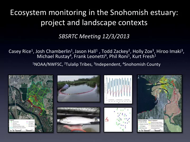
Snohomish Publication/Product Analyses Data Authors

Project and system level restoration monitoring Assemblage composition, density, size, hydro, elevation All…. CR, JC, JH, TZ, JK?, MR?, FL? Chinook landscape Habitat use by life history type Density, Size, Habitat, Life History, Origin, H/W, Site, Season SnohoCHK 01-13 KF MR Density Dependence Density & Size Snoho 01-13; Skagit, Nisq CG EB KF JK Fish Assemblages/ Species Composition Catch & Size Snoho All species01-13 CR JC ANK Hydrology Snoho 06-13 JH, CR, JC, Tarang Diet Chinook SnohoCHK01-13 JC Coho life history/ habitat use, multiple watersheds Coho SnohoSalmon01- 13, Skagit R JC Restoration “How to”, major taxa, abiotic variables Qwuloolt Monitoring plan, Snoho CR JC JK KF…. Forecasting: Juv/Adult Scales, oto, cwt, index, life stage, survival snoho CHK, smolt trap JH Kubo PhD ? A lot JK

slide-53
SLIDE 53

Allen & Quilceda Creeks

Quilceda Allen

slide-54
SLIDE 54

Allen & Quilceda Creeks

slide-55
SLIDE 55

Watershed response metrics

Nutrients:

Trace the source of P and N throughout the watershed: wastewater (urban), agricultural, or marine derived (MDN) Quantify primary production with nutrient diffusing substrates (NDS)?

Invertebrates:

Prey communities reflect functional performance of habitat (e.g., growth potential for fish)

Fish:

Site/system productivity and habitat use by juveniles; population estimates of adults via WDFW spawning survey and genetic mark recapture

slide-56
SLIDE 56

Thanks

slide-57
SLIDE 57

Discussion

Feedback on mapping Input on SET locations Support for sampling

slide-58
SLIDE 58

Hiroo Imaki

slide-59
SLIDE 59

Watershed response metrics

Nutrients:

Limitation of N and P via water chemistry 1 sample per site Total nitrogen, phosphorous, nitrate, nitrite, ammonium, and silicate If not limited, trace the source of P and N throughout the watershed: wastewater (urban), agricultural, or marine derived (MDN) Quantify primary production with nutrient diffusing substrates (NDS)? 2-4 per site

slide-60
SLIDE 60

Watershed response metrics

Invertebrates:

Prey communities reflect functional performance of habitat (e.g., growth potential for fish) Taxonomic and functional assemblages between sites and streams Slack sampler at riffle margins to collect benthic invertebrates 3 samples per site Paired fallout traps for terrestrial invertebrates 1-3 per site Stable isotope analysis Trace nutrient source

slide-61
SLIDE 61

Watershed response metrics

Fish:

Site/system productivity and habitat use by juveniles; population estimates of adults via WDFW spawning survey and genetic mark recapture. Juveniles Electro-fish, beach/pole seining Juvenile densities Length frequencies Diet composition Fin clips for potential productivity/survival estimates Assemblage composition Adults Spawner surveys (index sites); continuation of long term data set (NOAA participation) Genetic mark/recapture Improve population abundance estimates (could be the real link between estuary restoration and upstream productivity/effects) Fin clips during spawner surveys

slide-62
SLIDE 62

Year 1 (07/13-07/14) Year 2 (07/17-07/15) Uncommitted Matching Uncommitted Matching Component Task Category NOAA1 Contract NOAA1 Tulalip1 WDFW total NOAA1 Contract NOAA1 Tulalip1 WDFW total WATERSHED Data Collection Labor 35000 8000 8000 51000 35000 8000 8000 51000 Supplies/Equip 2000 2000 2000 2000 Data Processing Nutrients2 1000 1000 2000 1000 1000 inverts3 9600 9600 9600 9600 fish4 31000 31000 31000 31000 Analysis/Reporting 15000 15000 Sub total 92600 10000 8000 110600 76600 10000 8000 94600 ESTUARY Data Collection Labor 39000 29000 10000 78000 67000 29000 15000 111000 Supplies/Equip 10000 10000 10000 10000 Analysis/Reporting 13000 9500 22500 Sub total 39000 49000 88000 80000 63500 143500

total uncommitted 288200 total matching 148500 PROJECT TOTAL 436700

1 includes overhead and fringe 2 includes water chemistry and periphyton 3 includes benthic and stable isotopes 4 includes diet composition and DNA

Budget