
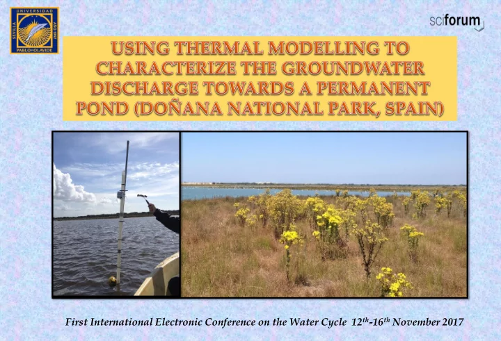
SLIDE 1
First International Electronic Conference on the Water Cycle 12th-16th November 2017
First International Electronic Conference on the Water Cycle 12 th - - PowerPoint PPT Presentation
First International Electronic Conference on the Water Cycle 12 th -16 th November 2017 1. Introduction A B Doana Biological Reserve (68 km 2 ) is located in Huelva province (southern Spain), where several ponds are found Doana
First International Electronic Conference on the Water Cycle 12th-16th November 2017
Doñana Biological Reserve (68 km2) is located in Huelva province (southern Spain), where several ponds are found Doñana Aquifer (3,600 km2) mantain the hydroperiod of such ecosystems Santa Olalla pond is the largest one (25 ha) and the
with permanent hydroperiod The objective of this study is to estimate the groundwater discharge from the sand aquifer to Santa Olalla pond by analysing temperature data using a numerical water and heat transfer model
A) Study zone B) Schematic intallation of the temperature sensors in Santa Olalla pond B) Santa Olalla pond from the East side (December 2016)
iButtons DS1922L-F5), with a separation of 25 cm among them, were installed inside a PVC tube in Santa Olalla pond during three months (February 14 th to May 15 th, 2017). They were programed to record temperature data hourly
analysis
vertical temperature profiles which numerically solves the flow and heat-transport equations
complementary research methods to interpolate the flow rates estimated by the thermistors
Modeling conditions 1D Temp PRO V.2 Porosity Φs 0.35 (m3/m3) Thermal conductivity (full saturation) λe 2 W( m°C) Sediment heat capacity Cs 2·106 J/(m3°C) Dispersivity α 0.01 m
A) Chain of sensors prepared to be installed. B)
sensors installed inside a PVC tube in Santa Olalla pond
Parameters introduced in 1-D Temp Pro V-2.
bottom) show almost no daily oscilations. IB3 and IB4, installed 0.15 and 0.4 m over the bottom illustrate a higher dependence on air temperature. Finally, IB5 and IB6, at 0.65 and 0.9 m over the bottom pond, record daily temperature oscilations. The water level in Santa Olalla pond at the beginning of the study period was 1.6 m and at the end of it 1.7 m
boundary condition in the sediment. Finally, bottom conditions were stablished by IB2
Groundwater discharge in Santa Olalla pond has been studied previously by several authors (Manzano et al., Rodriguez Rodriguez et al., 2017, Rodríguez- Rodríguez et al., in press, Sacks et al., 1992) . The volume of groundwater discharged estimated was 0.36 x 10³ m3/year with the water balance equation. The steady temperature values registered by the thermistors beneath the bottom are in accordance with temperature of the groundwater, which is
seems to be an overestimation of the actual groundwater discharge produced in Santa Olalla pond. The specific groundwater flux calculated by the water balance was 0.005 m/d. This fact reveals that aquifer discharges to this water body heterogeneously: the center of the pond (also its deepest area), where the temperature sensors were installed, seems to be one of the areas where more water is discharged.
It can be noticed oscilations of some centimeters on the water level of Zahillo (ZAH) , Taraje (TAR) and Santa Olalla (SOL) ponds from 1st to the 13th of June. These oscilations coincided with a decay on the piezometric level in Well 10, located at the coastal resort. The groundwater abstraction rights for urban water supply at the coastal resort are capped at 2.75 millions m3 per year, although some authors (Dimitrou et al., 2017) state that real consumption is higher. This water is capted by five wells located in the coastal resort.
0.6m/d) constitute a further advance in the knowledge of the hydrogeological functioning of Santa Olalla pond, and more specifically, it is an evidence about the existence of areas within the pond with high groundwater discharge.
coastal resort and the ponds situated at Doñana Biological Reserve, as piezometric level depletions on the former are sometimes translated into centimetric level oscilations in the ponds.
crucial water bodies such as Santa Olalla pond, since the existence of many biological communities depend on them.
Green, A. J., Bustamante, J., Janss, G. F. E., Fernández-Zamudio, R., & Díaz-Paniagua, C. (2016). Doñana Wetlands (Spain). The Wetland Book: II: Distribution, Description and Conservation, p 1-14. Constantz, J., Stewart, A. E., Niswonger, R., & Sarma, L. (2002). Analysis of temperature profiles for investigating stream losses beneath ephemeral channels. Water Resources Research, 38(12). Dimitriou, E., Moussoulis, E., Díaz-Paniagua, C., & Serrano, L. (2017). Hydrodynamic numerical modelling of the water level decline in four temporary ponds of the Doñana National Park (SW Spain). Journal of Arid Environments, 147, 90-102. Koch, F.W., Voytek, E.B., Day-Lewis, F.D., Healy, R., Briggs, M.A., Werkema, D., and Lane, J.W., Jr.,(2015). 1DTempPro: A program for analysis of vertical one-dimensional (1D) temperature profiles v2.0: U.S. Geological Survey Software Release, 23 July 2015, http://dx.doi.org/10.5066/F76T0JQS. Lozano-Tomás, E. (2007). Las aguas subterráneas en los cotos de Doñana y su influencia en las lagunas. Dissertation, University Politécnica de Catalunya. Lowry, C. S., Walker, J. F., Hunt, R. J., & Anderson, M. P. (2007). Identifying spatial variability of groundwater discharge in a wetland stream using a distributed temperature sensor. Water Resources Research, 43(10). Manzano Arellano, M. D. S., Custodio Gimena, E., Higueras, H., Puig Vidal, R., & Soler, A. (2009). Influencia de la gestión del acuífero sobre los humedales del manto eólico de Doñana. Boletín geológico y minero, 120(3), 377-392. Rodríguez-Rodríguez, M., Fernádez-Ayuso, A., & Moral, F. (2017). Cuantificación de los aportes hídricos subterráneos a la laguna de Santa Olalla a partir de balances hídricos diarios (Parque Nacional de Doñana, Huelva). Geogaceta, 61, 47-50. Rodríguez-Rodríguez, M, Martos-Rosillo. S, Fernández-Ayuso. A y Aguilar. R. (2017). Aplicación de un modelo de flujo y del método de Darcy segmentado al cálculo de la descarga en una laguna somera. Caso de la laguna de Santa Olalla. Geogaceta 63. In press. Rosenberry, D. O., & Hayashi, M. (2013). Assessing and measuring wetland hydrology. In Wetland techniques (pp. 87-225). Springer Netherlands. Sacks, L. A., Herman, J. S., Konikow, L. F., & Vela, A. L. (1992). Seasonal dynamics of groundwater-lake interactions at Doñana National Park, Spain. Journal of Hydrology, 136(1-4), 123-154 Stonestrom, D. A., & Constantz, J. (Eds.). (2003). Heat as a tool for studying the movement of ground water near streams (No. 1260). US
The funding for this research comes from the Guadalquivir River Basin Authority (Project: Hydrological monitoring and modeling of the pond- aquifer interaction in the stabilized dunes in Doñana). The technician Jose Manuel Bruque Carmona (Pablo de Olavide University) has helped in the elaboration of some of the figures.