
SLIDE 1
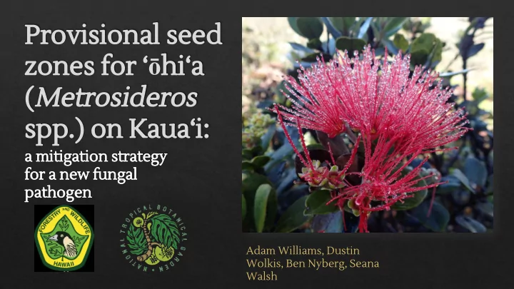
Provisional seed zones for ‘ōhi‘a (Metrosideros spp.) on Kaua‘i:
a mitigation strategy for a new fungal pathogen
Adam Williams, Dustin Wolkis, Ben Nyberg, Seana Walsh
Hawaii most remote Kauai archipelago on Earth Formed by - - PowerPoint PPT Presentation
Provisional seed zones for hia ( Metrosideros spp.) on Kauai: a mitigation strategy for a new fungal pathogen Adam Williams, Dustin Wolkis, Ben Nyberg, Seana Walsh Hawaii most remote Kauai archipelago on Earth
Adam Williams, Dustin Wolkis, Ben Nyberg, Seana Walsh
◈
Formed by volcanic “hotspot”
◈
Kaua‘i, around 5 myo, oldest of major islands
◈
Hawai‘i Island aka “the Big Island” youngest ~400k – 500k yo
◈
Plant colonization of islands:
◈
Birds (internal and external)
◈
Ocean
◈
Wind
◈
Stepping stone pattern, oldest to newest e.g. progressive colonization
Kaua‘i Hawai‘i Island
◈
Land clearing for agriculture
◈
Especially sugar
◈
Fire: avg. .5% of total area/year*
◈
Larger proportion than other States
◈
Invasive species
◈
Ungulates, weeds, inverts, and pathogens *From Hawai‘i Wildfire Management Organization
From www.hcsugar.com
◈
443 Endangered plant taxa, 10 Threatened species
◈
>40% of ESA plant listings, <1% of landmass
◈
At least 100 plant species already extinct in historical times (i.e. since 1778 European contact)
◈
Native land cover gone in many places,
elevation reserves/ conservation zoned lands Cyanea superba subsp. regina, extinct herbarium voucher in BISH
◈
One colonization event ~ 4 million years ago on Kaua‘i via wind dispersed seeds (Percy et al. 2008)
◈
Probably from Marquesas (Wright et al. 2001)
◈
Spread to all high Hian Islands except Ni‘ihau and Kaho‘olawe, following rule of progression (older to younger islands)
◈
Keystone species in Hawai‘i
◈
Nectar source for forest birds
◈
Host for many endemic invertebrates
◈
Nurse tree for epiphytic plants/seedlings
◈
Dominant tree in most HIan ecosystems from montane forest to new lava flows
◈
Extremely variable morphology
◈
Rock (1917) – single widespread indigenous species M. collina, from S. Pacific to HI and French Polynesia
◈
With endemic Hian varieties
◈
Skottsberg (1936) – single endemic species M. polymorpha Difficulty in discerning taxonomic units:
◈
Overlapping ranges
◈
Rampant hybridization
◈
Gene flow through intra and inter-island dispersal
◈
Tiny wind-dispersed seeds
◈
Pollen movement from insects and birds List of synonyms in Stemmerman n and Dawson (1990). Recognized taxa shown in bold
◈ Dawson and Stemmerman
◈ 5 species, 13 taxa
◈ 8 varieties of M. polymorpha ◈ 2 varieties of M. waialealae
◈ Each island has own unique
◈ 7 of 13 are single-island endemics ◈ Kaua‘i has 4 taxa, 2 island
endemics
◈
2013 – Trees dying of unknown cause, only in Puna District of Hawai‘i Island
◈
Trees completely dead within 2 – 3 weeks after first symptoms
◈
2015 – fungal pathogen Identified, Ceratocystis fimbriata, a wilt disease
www.rapidohiadeath.com photo J.B. Friday www.rapidohiadeath.com photo J.B. Friday
◈
Latest estimate 47,000 acres affected on HI island
◈
Hundreds of thousands of ‘ōhi‘a trees have died
◈
Other islands bracing for introduction
◈
Seed banking underway on all islands
◈
Ban on interisland movement of ‘ōhi‘a plants or plant parts
◈
Non-native ambrosia beetle possible vector Map from www.rapidohiadeath.org
◈
◈ the premise that ecological
regions can be identified through the analysis of the patterns and the composition of biotic and abiotic phenomena that affect or reflect differences in ecosystem quality and integrity (Wiken 1986; Omernik 1987, 1995)
◈
562 square miles
◈
Only 33 miles long by 25 miles across
Mount Waialealae 5,148 feet (1,569 m), “wettest spot on Earth” ~393 inches (9,989 mm)/year average Dunes of Polihale, ~18
average … and 16 miles (25.7 km) west
Waimea Canyon “Grand Canyon
deep Mesic Pandanus Forests
… and 6 miles (9.6 km) North
◈
Sea level to summit of Kawaikini, 5,243 feet (1,598 m)
◈
Many steep cliffs define landscape
◈
Indigenous Hawaiian land management units
◈
Contained within Moku
◈
Often represented a watershed
◈
Usually followed natural geographic features
◈
Political division
◈
Typical “pie slice” from mountain headwaters to shore, ridge to ridge
(aka PopRefs)
◈
Modern Plant Conservation Divisions
◈
Often mirror auh‘pua‘a/watersheds
◈
Usually followed natural geographic features
◈
Represented in biological databases by 3-letter abbreviation, combined with 6-letter taxon code and plant #
◈
Ex. GERKAU-KA-ALW-A-0 003
◈
US Geological Survey, Gap Analysis Program (GAP). August 2011. National Land Cover, Version 2
◈
Different Broad Categories
◈
11 categories of Native and 12 non-native
◈
Wet Windward and summits, North and East
◈
Dry Leeward, South and West
◈ We used a combination of
◈
Rainfall Isohyets
◈
GAP Landcover
◈
Ahupuaa/PopRef boundaries
◈ Local Ecological Knowledge and experience on the ground with
vegetation communities to combine and/or separate areas with similar rainfall/elevation
◈ Refined by picking certain elevational ranges (rather than isohyet lines)
and defining minimum and maximum rainfall amounts
◈ Came up with 10 distinct zones
X = Mean annual rainfall Y = Mean elevation
◈ Setting seed collecting priorities – for ‘ōhi‘a or any widespread native taxa
◈ Specific objectives to meet preparation goals for known threat of ROD ◈ Helping to define “suites” of common species to bank and where to collect them from
◈ Guiding where it is appropriate to reintroduce banked collections during
restoration projects for “common” Hawaiian plant species, like ‘ōhi‘a
Seed Zone Number of Herbarium Specimens at PTBG
Taxa per Zone East Side 5 6 1 Kokee 7 45 6 4 6 4 Na Pali Coastal 1 5 4 Na Pali Valleys 9 9 3 2 North Shore South and West Lowlands 1 1 1 Waimea Midlands 3 1 Wet Summits 1 5 2 3 3 Wet Windward 2 1 5 3 3 Windward Ranges 1 2 2 Zones per Taxa 2 9 2 na 4 Total taxa per zone = 21
◈ Test the model with more expansive herbarium searches specific to
Metrosideros taxa
◈
Determine seed zones that each taxon occurs within – augment herbarium record for undercollected areas
◈
possibly establish collection/banking goals per seed zone/taxa
◈ Test with other widespread taxa that have noticeable local
adaptation/morphological variation
◈
e.g. Dianella taxa, Acacia koa, Dodonaea viscosa, Pipturus spp., Sida fallax
◈ Replace elevation with temperature in analysis
◈
Correlate with climate change models to help prioritize collections
◈ Marian Chau “The #OhiaLove Project: Banking Seeds of a Hawaiian Keystone
Species During the Rapid ‘Ōhi‘a Death Crisis”
◈
Wednesday @ 1:20 p.m. in the Cabinet Room
◈ Dustin Wolkis “Picking From the Past in Preparation for a Pest: Assessing the
Potential for Herbarium Seeds to Combat ROD”
◈
Thursday @ 9:10 a.m. in the Cabinet Room
The preceding presentation was delivered at the This and additional presentations available at http://nativeseed.info
Washington, D.C. February 13-16, 2017