
SLIDE 1
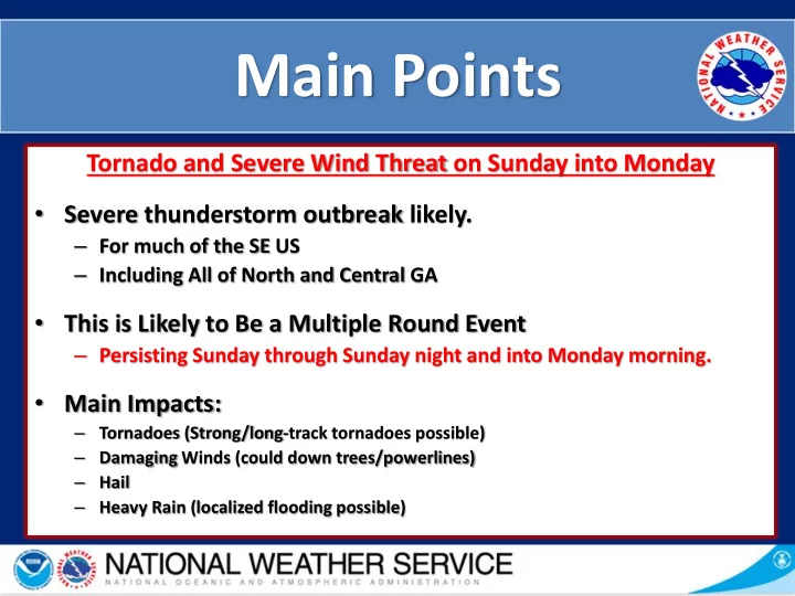
Tornado and Severe Wind Threat on Sunday into Monday
- Severe thunderstorm outbreak likely.
– For much of the SE US – Including All of North and Central GA
- This is Likely to Be a Multiple Round Event
– Persisting Sunday through Sunday night and into Monday morning.
- Main Impacts:
– Tornadoes (Strong/long-track tornadoes possible) – Damaging Winds (could down trees/powerlines) – Hail – Heavy Rain (localized flooding possible)