
SLIDE 1
Minutes from the ONNA Neighborhood Center Discussion 9/17/17
Meeting at the San Francisco Bakery garden, starting at 6:00 PM and ending at 7:35 PM 1. Mike Dexel (ONNA chairman) opened by explaining that ONNA (Olympia Northeast Neighborhoods Alliance):
- Is also called sub-area A, and is the pilot sub-area planning group in Olympia. It
was established in 2013 at the request of the City and approved 9/2015. The purpose of sub-area planning is for clusters of neighborhoods, having common needs, to help guide the City to spend resources on needs that its residents feel are most important.
- Has, during the last 4 years, surveyed ONNA residents to prioritize their needs
and wishes, and from the results, created a sub-area plan to guide actions for the next 5 years (adopted 9/2016 by the City Council)
- Has created a website (olynna.com) to communicate news, post surveys, give
background information on City procedures and codes, highlight ONNA-area assets, and provide helpful links.
- Has, with City resources, created an ONNA sub-area profile, which is found on the
website, and summarizes demographic data about our area.
- Has identified 3 main goals, to be reached in 5 years: Prioritize and increase
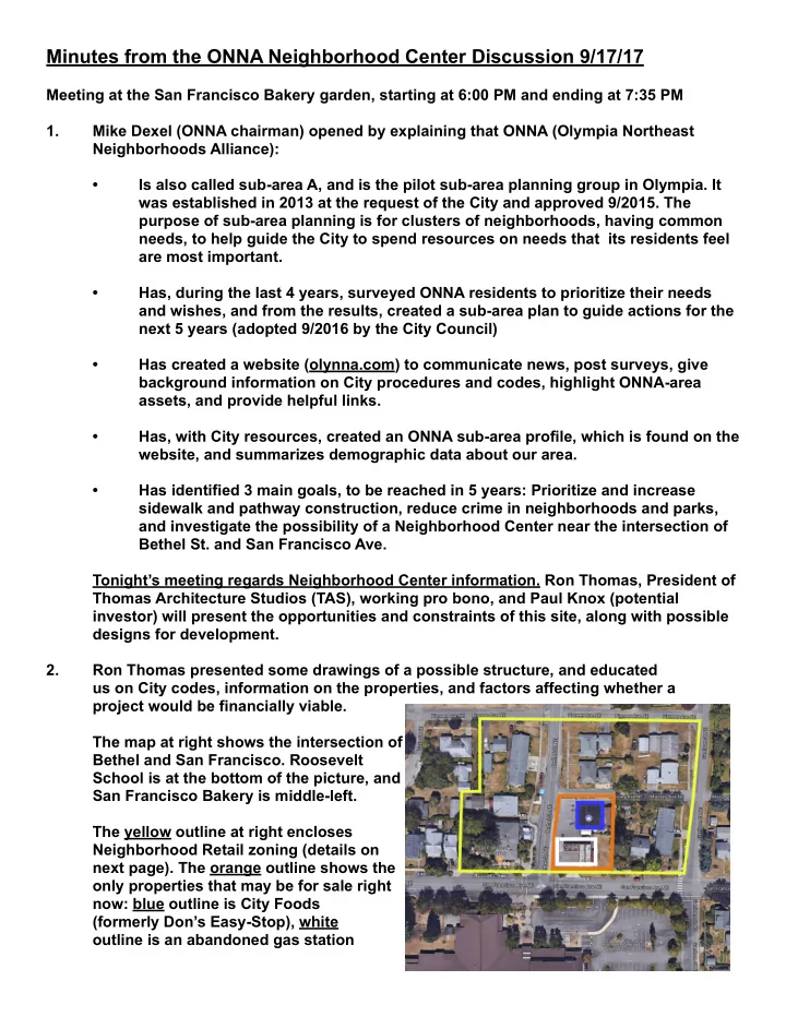
sidewalk and pathway construction, reduce crime in neighborhoods and parks, and investigate the possibility of a Neighborhood Center near the intersection of Bethel St. and San Francisco Ave. Tonight’s meeting regards Neighborhood Center information. Ron Thomas, President of Thomas Architecture Studios (TAS), working pro bono, and Paul Knox (potential investor) will present the opportunities and constraints of this site, along with possible designs for development. 2. Ron Thomas presented some drawings of a possible structure, and educated us on City codes, information on the properties, and factors affecting whether a project would be financially viable. The map at right shows the intersection of Bethel and San Francisco. Roosevelt School is at the bottom of the picture, and San Francisco Bakery is middle-left. The yellow outline at right encloses Neighborhood Retail zoning (details on next page). The orange outline shows the
- nly properties that may be for sale right
now: blue outline is City Foods (formerly Don’s Easy-Stop), white
- utline is an abandoned gas station