
SLIDE 1
\\H\13000\13351 2017 GP45 Call Out Photos
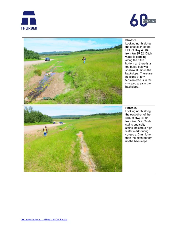
Photo 1. Looking north along the east ditch of the EBL of Hwy 43:04 from km 35.62. Ditch water is ponding along the ditch bottom an there is a toe bulge below a shallow slump in the
- backslope. There are
no signs of any tension cracks in the slumped area in the backslope. Photo 2. Looking north along the east ditch of the EBL of Hwy 43:04 from km 35.7. Oxide stains and salts stains indicate a high- water mark during surges at 3 m higher than the ditch bottom up the backslope.