SLIDE 1
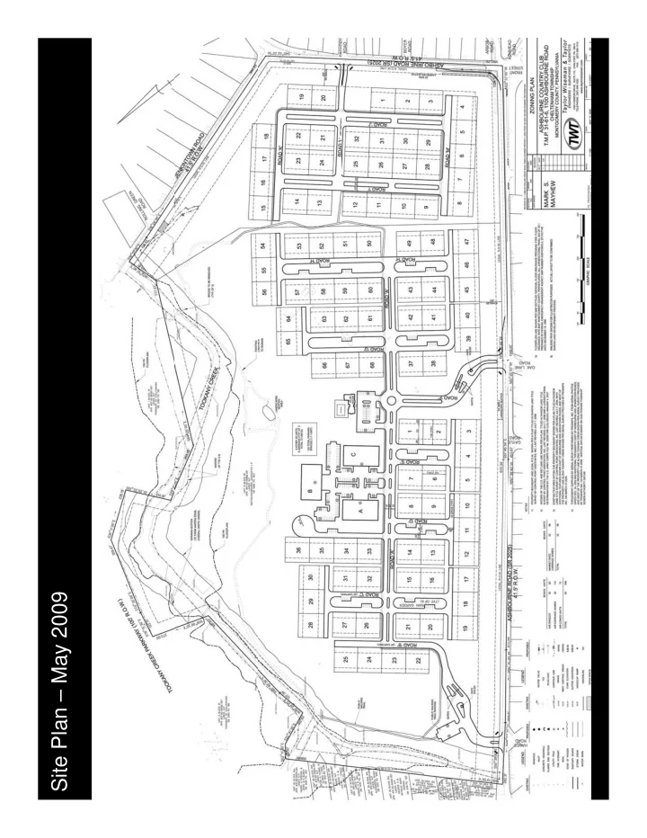
Site Plan – May 2009
SLIDE 2
Site Plan – February 2010
SLIDE 3
Site Plan – Current
SLIDE 4
Stormwater Management
SLIDE 5
Stormwater Management
SLIDE 6
Context Map
SLIDE 7
Local Neighborhoods – Existing Conditions
SLIDE 8
Local Neighborhoods – Existing Conditions
SLIDE 9
Local Neighborhoods – Existing Conditions
SLIDE 10
Architectural Elevations – Single Family
SLIDE 11
Architectural Elevations – Single Family
SLIDE 12
Architectural Elevations – Carriage Homes
SLIDE 13
Architectural Elevations – Carriage Homes
SLIDE 14
Architectural Elevations – Carriage Homes, Retail, and Clubhouse
SLIDE 15
Key Map – Illustrative Sections
SLIDE 16
Illustrative Section 3
SLIDE 17
Illustrative Section 2
SLIDE 18
Illustrative Section 1
SLIDE 19
Key Map – Perspective 1 – Mulberry Lane
SLIDE 20
Perspective 1 – Mulberry Lane – Before
SLIDE 21
Perspective 1 – Mulberry Lane – After
SLIDE 22
Key Map – Perspective 2 – Ashbourne Road South A
SLIDE 23
Perspective 2 – Ashbourne Road South A
SLIDE 24
Key Map – Perspective 3 – Ashbourne Road South B
SLIDE 25
Perspective 3 – Ashbourne Road South B
SLIDE 26
Key Map – Perspective 3a – Raingardens
SLIDE 27
Perspective 3a – Raingardens
SLIDE 28
Key Map – Perspective 3b – Backyards
SLIDE 29
Perspective 3b – Backyards
SLIDE 30
Key Map – Perspective 4 – Ashbourne Road East
SLIDE 31
Perspective 4 – Ashbourne Road East
SLIDE 32
Key Map – Perspective 5 – Jenkintown Road
SLIDE 33
Perspective 5 – Jenkintown Road
SLIDE 34
Key Map – Perspective 6 – Rolling Green Road
SLIDE 35
Perspective 6 – Rolling Green Road – Before
SLIDE 36
Perspective 6 – Rolling Green Road – After
SLIDE 37
Key Map – Perspective 7 – Tookany Creek Road
SLIDE 38
Perspective 7 – Tookany Creek Parkway – Before
SLIDE 39
Perspective 7 – Tookany Creek Parkway – After
SLIDE 40
SLIDE 41
Site Plan on Aerial
SLIDE 42
Zoning Plan
SLIDE 43
Zoning Plan