
SLIDE 1
TRANSIT NEIGHBORHOOD PLANS
LOS ANGELES CHAMBER OF COMMERCE AUGUST 26, 2015
Los Angeles Department of City Planning
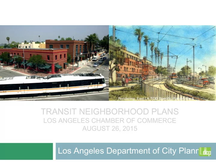
Rendering: East LA TOD Specific Plan(Moule & Polyzoides)
TRANSIT NEIGHBORHOOD PLANS LOS ANGELES CHAMBER OF COMMERCE AUGUST - - PowerPoint PPT Presentation
Rendering: East LA TOD Specific Plan(Moule & Polyzoides) TRANSIT NEIGHBORHOOD PLANS LOS ANGELES CHAMBER OF COMMERCE AUGUST 26, 2015 Los Angeles Department of City Planning Presentation Outline Introduction: Transit Neighborhood Plans
Rendering: East LA TOD Specific Plan(Moule & Polyzoides)
◻ Introduction: Transit Neighborhood
◻ Planning Context ◻ Expo Corridor Transit Neighborhood
Expo Line Orange Line Purple Line Crenshaw/LAX Line Downtown
◻
◻
◻
◻
◻
Street Trees
◻
Coordinated Street Furniture
◻
Additional Street Lighting
◻
Continental Crosswalks
◻
Mid-Block Crossings
◻
Integration with the Light Rail
◻
Special Paving
◻
Bicycle Facilities
◻
Expo Line Phase II to Santa Monica opening in 2016.
◻
New Specific Plan around five stations (4 new) in the City of Los Angeles.
◻ General Plan Framework (1996)
⬜
Direct housing and employment growth near transit
⬜
Preserve stable single family neighborhoods
⬜
Improve urban form and neighborhood design
◻ Industrial Land Use Policy (2008)
⬜
Reinforced previous policy to preserve industrially zoned land
⬜
Recommended new industrial zones tailored for specific areas in West LA
BUNDY SEPULVEDA WESTWOOD PALMS CULVER CITY
◻
◻
◻
◻
◻
Expo Corridor is an important jobs area today.
◻
Strong demand for both jobs and housing in the future.
◻
Strong office potential around Bundy and Sepulveda Stations.
◻
Strong demand for housing and neighborhood-serving retail around Palms Station.
◻
3,800 to 6,400 dwelling units
◻
3 to 6 million square feet of non-residential use
◻Includes office (4.28 million sf); industrial; and retail
◻ Land Use and Zone
◻ Public Benefits ◻ Urban Design Standards ◻ Streetscape Plans
◻
◻
◻
◻
Zoning Districts Purpose Examples New Industry
between users.
Hybrid Industrial:
Jobs Emphasis
commercial office.
residential. Hybrid Industrial:
Residential Emphasis
with residential uses.
ground floor activity.
Mixed-Use: Commercial/ Residential
use development while still allowing for all- commercial buildings
New Zoning Designations
◻ Within new zones, there is a range of allowable
◻ Public benefits can include:
⬜ Off-site streetscape improvements ⬜ Publicly accessible open space ⬜ Mobility hubs ⬜ Transit and bike amenities ⬜ TDM strategies ⬜ Affordable housing
◻
◻
◻
◻
◻
◻
◻
◻ Release of Draft EIR ◻ Adoption Process ⬜ Open House and Public Hearing ⬜ Staff recommendation ⬜ City Planning Commission recommendation ⬜ City Council decision
Patricia Diefenderfer
patricia.diefenderfer@lacity.org 213.978.1170
David Olivo
david.olivo@lacity.org 213-978-1205
Lameese Chang
lameese.chang@lacity.org 213-978-1178
Current Plan
(Above Existing)
Proposed Plan
(Above Existing)
Alternative Compliance
(Above Existing)
Market Demand Housing
(dwelling units)
+1,000 (4%) +4,400 (18%) +6,000 (24%) 3,800 to 6,400 Employmen t
(jobs)
+4,900 (38%) +16,700 (62%) +12,200 (45%) 8,000 to 15,600
Reasonable Expected Development through 2035
DWELLING UNITS DWELLING UNITS
Market Demand through 2035
JOBS JOBS
Reasonable Expected Development through 2035 Market Demand through 2035
With Proposed Expo TNP and Mobility Plan, a 3.1% decrease in Vehicles Miles Traveled (VMT) per capita in 2035 is anticipated, resulting from:
⬜ Shorter vehicle trips ⬜ More non-vehicular trips ⬜ Internalization of trips (mixed use)
Total VMT
Service Population
(Employees + Residents)
VMT per capita Existing (2013) 10.5 million 742,518 14.22 Future (2035)* 11.5 million 833,502 13.79 % Change +8.9% +12.2%
VMT within West LA+
*Assumes Proposed Expo TNP + Mobility Plan 2035 +Calculated using the West LA Area Planning Commission boundaries
With Proposed Expo TNP an increase in use of non-vehicular modes within the West LA area+ in 2035 is anticipated:
⬜ 17% increase in transit use ⬜ 11% increase in biking ⬜ 1% increase in walking
+Calculated using the West LA Area Planning Commission boundaries