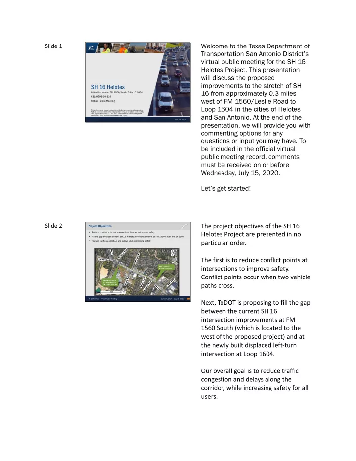
Welcome to the Texas Department of Slide 1 Transportation San - - PDF document

welcome to the texas department of
SMART_READER_LITE
LIVE PREVIEW

Welcome to the Texas Department of Slide 1 Transportation San - - PDF document

Welcome to the Texas Department of Slide 1 Transportation San Antonio Districts virtual public meeting for the SH 16 Helotes Project. This presentation will discuss the proposed improvements to the stretch of SH SH 16 Helotes 16 from


slide-1
SLIDE 1

Slide 1

SH 16 Helotes – Virtual Public Meeting June 30, 2020 – July 15, 2020

SH 16 Helotes

0.3 miles west of FM 1560/Leslie Rd to LP 1604 CSJ: 0291-10-114 Virtual Public Meeting

June 30, 2020 The environmental review, consultation, and other actions required by applicable Federal environmental laws for this project are being, or have been, carried-out by TxDOT pursuant to 23 U.S.C. 327 and a Memorandum of Understanding dated December 9, 2019, and executed by FHWA and TxDOT.

Welcome to the Texas Department of Transportation San Antonio District’s virtual public meeting for the SH 16 Helotes Project. This presentation will discuss the proposed improvements to the stretch of SH 16 from approximately 0.3 miles west of FM 1560/Leslie Road to Loop 1604 in the cities of Helotes and San Antonio. At the end of the presentation, we will provide you with commenting options for any questions or input you may have. To be included in the official virtual public meeting record, comments must be received on or before Wednesday, July 15, 2020. Let’s get started!

Slide 2

SH 16 Helotes – Virtual Public Meeting June 30, 2020 – July 15, 2020

Project Objectives

  • Reduce conflict points at intersections in order to improve safety
  • Fill the gap between current SH 16 intersection improvements at FM 1560 South and LP 1604
  • Reduce traffic congestion and delays while increasing safety

2 END PROJECT West of Loop 1604

BEGIN PROJECT 0.3 miles West of FM 1560/Leslie Rd

0.25 0.5 Mile

The project objectives of the SH 16 Helotes Project are presented in no particular order. The first is to reduce conflict points at intersections to improve safety. Conflict points occur when two vehicle paths cross. Next, TxDOT is proposing to fill the gap between the current SH 16 intersection improvements at FM 1560 South (which is located to the west of the proposed project) and at the newly built displaced left-turn intersection at Loop 1604. Our overall goal is to reduce traffic congestion and delays along the corridor, while increasing safety for all users.

slide-2
SLIDE 2

Slide 3

SH 16 Helotes – Virtual Public Meeting June 30, 2020 – July 15, 2020

Project Schedule and Funding

Began Project October 2019 Agency Stakeholder Meeting May 2020 Meetings with Affected Property Owners (MAPOs) June 2020 Virtual Public Meeting June 30, 2020 thru July 15, 2020 Begin Final Design Fall 2020 Anticipated Environmental Clearance Winter 2020 Begin Construction Spring 2022

3

  • Congestion Mitigation & Air Quality Improvement (CMAQ) Funding
  • Total Estimated Construction Cost - $8.6M
  • Estimated Construction Duration – 24 to 30 months

WE ARE HERE Schematic Design / Environmental Document Preparation ROW Acquisition / Utility Adjustment

The SH 16 Helotes Project is federally funded using Congestion Mitigation and Air Quality Improvement Funding with the estimated construction costs

  • f $8.6 million.

The project team started the project in October 2019. In May, TxDOT held an Agency Stakeholder Meeting with state and local agencies to receive their feedback on the proposed improvements. In June, TxDOT met with affected property owners to present proposed improvements and receive their feedback. We are now requesting the public’s input on the proposed improvements, which will be presented to you today as part of this virtual public meeting. We are requesting your feedback and will consider all comments received. After addressing comments received during this virtual public meeting, the project team will finalize the proposed improvements. Next, TxDOT will begin the final design plans for bidding and construction. TxDOT is currently conducting environmental studies to analyze potential project impacts to various environmental resources. Environmental clearance is expected by the winter of 2020.

slide-3
SLIDE 3

Next steps include right-of-way acquisition, as well as utility coordination and adjustments. The project is anticipated to begin construction in the Spring of 2022 and is estimated to take approximately 24 to 30 months.

Slide 4

SH 16 Helotes – Virtual Public Meeting June 30, 2020 – July 15, 2020

Proposed Project Improvements

  • Restricted Crossing /U-Turn (RCUT)

Intersections to fill the gap between existing RCUT intersection at FM 1560 South and Displaced Left Turn (DLT) intersection at Loop 1604

  • Three (3) continuous through lanes in

each direction

  • Continuous 6’ sidewalks on both sides
  • f SH 16
  • Continuous curb and gutter for traffic

calming

  • 5’ outside shoulders
  • Storm sewer system to improve

drainage

  • Signalized left-turn lane at Legend Trail

4

The proposed improvements include converting two intersections along the corridor to a type of intersection called a Restricted Crossing/U-Turn (RCUT) intersection, to fill the gaps between the existing RCUT intersection at FM 1560 South and the Displaced Left Turn (DLT) intersection at Loop 1604. SH 16 would consist of three (3) continuous through lanes in each direction with continuous 6’ sidewalks, curb and gutter and 5’ shoulders on both sides of the roadway. Currently, drainage in the project limits is accommodated with open

  • ditches. The proposed drainage

improvements would include open ditches and a storm sewer system beneath the roadway. The proposed project would also include adding a signalized left-turn at Legend Trail.

slide-4
SLIDE 4

Slide 5

SH 16 Helotes – Virtual Public Meeting June 30, 2020 – July 15, 2020

5

Existing and Proposed Typical Sections

24’

Grassy Median

2’ Varied

Grassy Ditch Section

Varied

Grassy Ditch Section 11’ Thru Lane 11’ Thru Lane 11’ Thru Lane 11’ Thru Lane 11’ Thru Lane 15’ Thru Lane 10’ Turn Lane

2’ 5’ Varied

Grassy Ditch Section

RIGHT-OF-WAY LINE RIGHT-OF-WAY LINE

11’

Thru Lane

11’

Thru Lane

11’

Thru Lane

11’

Thru Lane

11’

Turn Lane

11’

Thru Lane

5’

Shldr

6’

Sidewalk

Varied

Grassy Ditch

5’

Median

5’

Median

11’

Turn Lane

11’

Turn Lane

11’

Thru Lane

11’

Turn Lane

5’

Shldr

6’

Sidewalk

Varied

Grassy Ditch

Existing Typical Section

Existing Right of Way (Varies: 181 to 190 ft)

Proposed Typical Section

Existing Right of Way (Varies: 181 to 190 ft)

The top image is the existing typical section, which is a cross-section of what SH 16 looks like today. SH 16 currently consists of two-three through lanes in each direction. The bottom image is the proposed typical section, which shows what SH 16 would look like if the project is constructed. SH 16 would consist of three through lanes in each direction, right-turn lanes, and turnaround lanes. The project improvements would be primarily within the existing 181 to 190 ft right of way.

Slide 6

SH 16 Helotes – Virtual Public Meeting June 30, 2020 – July 15, 2020

Restricted Crossing/U-Turn (RCUT) Intersection Proposed at following intersections:

  • FM 1560/Leslie Rd
  • Cedar Trail

6

At FM 1560/Leslie Road and Cedar Trail, the project team is proposing to convert these intersections to Restricted Crossing/U-Turns, also known as RCUT intersections. The diagram you see here illustrates how the RCUT intersections would work. Now, let’s watch a short video that describes the major components of the proposed project.

slide-5
SLIDE 5

Slide 7

SH 16 Helotes – Virtual Public Meeting June 30, 2020 – July 15, 2020

Projected Growth and Congestion

7

Source: Alamo Area Metropolitan Planning Organization, Mobility 2045: Metropolitan Transportation Plan Each dot represents 50 people 2015 Population 2045 Forecasted Population

According to the Alamo Area Metropolitan Planning Organization, Bexar County’s population is expected to grow by 58% by the year 2045, with much of that growth occurring in west Bexar County around the project location. The current roadway design is not sufficient to meet the expected demand which is one of the reasons TxDOT is proposing to improve SH 16.

Slide 8

SH 16 Helotes – Virtual Public Meeting June 30, 2020 – July 15, 2020

Traffic Analysis

  • Traffic growth in the SH 16 Corridor at FM 1560/Leslie Road:

– 2019 Counted Average Daily Traffic: 45,400 vehicles per day – 2044 Projected Average Daily Traffic: 76,300 vehicles per day

  • Average travel time in the SH 16 Corridor from FM 1560 South to Loop 1604

8

14 min 3 min 2 4 6 8 10 12 14 16 Northbound Corridor (PM Peak) No Build (Projected 2044 Traffic) Proposed Design (Projected 2044 Traffic) Average travel time (minutes)

The project team conducted a traffic analysis of the project area based on the existing conditions and the proposed improvements. The team collected actual traffic counts in 2019, which showed that the average daily traffic on SH 16 at the FM 1560/Leslie Road intersection was 45,400 vehicles per day. Utilizing expected growth rates, the project team forecasted that the average daily traffic at this intersection is expected to increase to 76,300 vehicles per day in 2044. Utilizing traffic modeling software, the project team analyzed average travel times on SH 16 from FM 1560 South to Loop 1604 for no-build and proposed design scenarios based on future traffic in year 2044. In 2044, if the proposed project were not constructed, which is the no-build scenario, travel times would increase to 14 minutes for northbound traffic.

slide-6
SLIDE 6

By implementing the proposed project, in 2044, travel times would decrease to 3 minutes. A similar time difference is expected for the southbound traffic.

Slide 9

SH 16 Helotes – Virtual Public Meeting June 30, 2020 – July 15, 2020

Intersection Level of Service (LOS) Comparison AM Peak Hour

9

No Build Condition Proposed Design Condition

We also developed an intersection Level of Service analysis for both the morning and afternoon peak hours of traffic. Level of Service is a grading system where “A” is best, and “F” is worst; Level of Service “E” and “F” are considered undesirable conditions. Under the no-build condition for the morning peak hour, in 2044, SH 16 at FM 1560/Leslie Road and FM 1560 South would operate at a Level of Service F. FM 1560 South is projected to operate at a Level of Service F due to traffic backing up at the FM 1560/Leslie Road intersection. Under the proposed project, mobility would be improved and all intersections within the project limits would operate at a Level of Service C

  • r better in the morning peak hour.
slide-7
SLIDE 7

Slide 10

SH 16 Helotes – Virtual Public Meeting June 30, 2020 – July 15, 2020

Intersection Level of Service (LOS) Comparison PM Peak Hour

10

No Build Condition Proposed Design Condition

The Level of Service during the afternoon peak hour was also analyzed. For the afternoon peak hour in 2044, under the no-build condition, SH 16 would operate at a Level of Service F at FM 1560/Leslie Road and Cedar Trail. Similar to the morning peak hour, under the proposed project, all intersections would operate at a Level

  • f Service C or better in 2044 in the

afternoon peak hour.

Slide 11

SH 16 Helotes – Virtual Public Meeting June 30, 2020 – July 15, 2020

Benefits of RCUT Intersections

11

SAFETY EFFICIENCY AIR QUALITY

Reduce conflict points from

32 to 18

Reduce Crash Rate

30% (FHWA Projected) 44%

(Actual at SH 16/LP1604) Reduce Crash S Severity ty by up to

50%

(FHWA Projected) Green Time for SH 16 Through Traffic by up to 30% Delay measured vs. uncongested Travel Time

60%

Re Reductionin Total Delay in 2044 Shorter wait times at intersections

Source: FHWA Proven Safety Counter Measure: Reduced Left-Turn Conflict Intersections, Dec 2018, FHWA-SA-18-048 Actual TxDOT Intersection Crash Analysis SH 16 at Loop 1604 and SH 16 at FM 1560, Draft 2020. Delay as estimated by Traffic Simulation Model(VISSIM) for SH 16, Draft 2020 (7 - 9 AM & 4- 6 PM, Peak travel times) The greatest amount of emissions are produced by stop and go traffic. By increasing the efficiency of the signals, the proposed project is expected to provide critical air quality benefits.

This slide covers some of the benefits

  • f RCUT intersections identified by the

Federal Highway Administration, also known as FHWA, including improved safety, efficiency, and air quality. As mentioned, the proposed RCUTs would reduce conflict points at the FM 1560/Leslie Road and Cedar Trail intersections. Conflict points would be reduced from 32 to 18, which on average translates into 30% fewer crashes based on FHWA studies. The project team also analyzed crash rates at the newly built displaced left- turn intersection at SH 16 and Loop

  • 1604. Based on this analysis, crashes

have gone down by approximately 44% since the intersection was improved.

slide-8
SLIDE 8

Additionally, the severity of crashes can also be reduced up to 50% with RCUT intersections. This is largely due to a reduction in conflict points due to left-turn movements. RCUT intersections are efficient because they allow more traffic to go through green lights at traffic signals, which would allow for an improvement of up to 30%. Travel times and delays could also be improved by up to 60% due to reduced stop and go conditions at intersections. The reduction in stop and go traffic is also expected to improve air quality as vehicle emissions are greatest when a car is slowing down and speeding up. This is one of the reasons this project successfully received Congestion Mitigation and Air Quality funding.

Slide 12

SH 16 Helotes – Virtual Public Meeting June 30, 2020 – July 15, 2020

12

Left-Turn Comparison at FM 1560/Leslie Intersection PM Peak

18 min 5 min No Build in 2044 Build in 2044 22 min 6 min No Build in 2044 Build in 2044

The project team also analyzed travel time comparisons for FM 1560/Leslie Road left-turn traffic for the afternoon peak period in 2044. For eastbound Leslie Road traffic wanting to access northbound SH 16, under the no-build condition in 2044, it would take approximately 22 minutes to make the left-turn at this intersection and travel to north of FM 1560 South. Alternatively, under the proposed project, it would take approximately 6 minutes for eastbound Leslie Road traffic to turn right at the SH 16

slide-9
SLIDE 9

intersection, utilize the proposed turnaround, and continue on SH 16 northbound and travel to north of FM 1560 South. For westbound FM 1560 traffic wanting to access southbound SH 16, under the no-build condition in 2044, it would take approximately 18 minutes to make a left-turn at the intersection and travel to Loop 1604. Alternatively, under the proposed project, it would take approximately 5 minutes for westbound FM 1560 traffic to turn right at the SH 16 intersection, utilize the proposed turnaround, and continue traveling on SH 16 southbound and traveling to Loop 1604. To get a fair comparison, both the no- build conditions and the proposed project traffic models use the same projected 2044 traffic volumes. The traffic models also measure the travel time from the same point before cars are stopped for the first traffic signal for both the no-build and proposed design, to the point the vehicle exits the project corridor to ensure beginning and ending points match for each condition.

slide-10
SLIDE 10

Slide 13

SH 16 Helotes – Virtual Public Meeting June 30, 2020 – July 15, 2020

Proposed Improvements

13

Now, we will review the proposed

  • project. The proposed project

schematic, is also available under the ‘Participate’ tab on the virtual public meeting, where you will be able to make comments directly on the map, and the ‘Review’ tab where you can download it for your reference. Before we get started, I want to explain the different colors and symbols shown on this map. The legend is located on the left side of the schematic layout. [zoom to turnaround in front of high school] The existing right-of-way line is shown by the red dashed line, while the proposed right of way is shown as a thick black dashed line. The light blue shading represents the re-surfacing of existing roadway. Areas shaded in light purple are areas where roadway widening is needed. Proposed sidewalks are shown in light green, and raised medians are in

  • range. Driveways are shown in

yellow. As we’ve mentioned, SH 16 would consist of three (3) through lanes in each direction. [zoom to Leslie Road intersection] With the proposed RCUT intersection at FM 1560/Leslie Rd., traffic traveling

  • n FM 1560/Leslie Road would not be

allowed to turn left or travel thru the intersection but would instead turn right at the intersection and use a turnaround.

slide-11
SLIDE 11

[zoom to Cedar Trail] As you can see, similar improvements are proposed at Cedar Trail, where Cedar Trail traffic would turn right at the intersection and utilize turnarounds. [zoom to Legend Trail] At Legend Trail, we are proposing to add a signalized left-turn lane. This will help traffic turning left into Legend Trail avoid two additional signal lights. The project team anticipates needing minimal additional right of way for the proposed improvements, in 2 locations. [zoom to Sandra Day O’Connor] The first area we are proposing right

  • f way is at Sandra Day O’Connor High
  • School. As you can see, we are

needing a small clip of right of way between the school’s baseball and softball fields in order to construct the proposed turnaround. [zoom into Helotes Crossing] The second location for proposed additional right of way is at the Helotes Crossing Center to accommodate the turnaround proposed at this location.

slide-12
SLIDE 12

Slide 14

SH 16 Helotes – Virtual Public Meeting June 30, 2020 – July 15, 2020

Anticipated ROW Impacts

  • Information on the right-of-way acquisition process is available under the “Review”

tab of the Virtual Public Meeting, including: – Landowner’s Bill of Rights – Relocation Assistance – State Purchase of ROW Booklet

  • Information concerning services and benefits available to affected property owners

and information about the tentative schedule for right of way can be obtained from the TxDOT district office by calling Wini Bishop at (210) 615-6235.

14

Acquisition and relocation assistance would be in accordance with the Uniform Relocation Assistance and Real Properties Acquisitions Policies Act of 1970, as amended.

Information on the right-of-way acquisition process is available for download and review under the ‘Review’ tab of this virtual public meeting, including a Landowner’s Bill

  • f Rights, Relocation Assistance

document, and State Purchase of Right of Way Booklet. Information concerning services and benefits available to affected property

  • wners and information about the

tentative schedule for right-of-way acquisition and construction can be

  • btained from the TxDOT district
  • ffice by calling Wini Bishop at 615-

6235. Acquisition and relocation assistance would be in accordance with the Uniform Relocation Assistance and Real Properties Acquisitions Policies Act of 1970, as amended.

Slide 15

SH 16 Helotes – Virtual Public Meeting June 30, 2020 – July 15, 2020

Environmental Resources within the Project Area The P Proj

  • ject T

Team i identified e environ

  • nmental

constraint nts e early in t the project development nt p process and d designed t the p proposed p project to a avoid o

  • r

minimize i impacts t to these i impor

  • rtant resou
  • urces.

15

Environmental Resources in the Area:

  • Water R

Resources – Tributary to French Creek

  • Edwards A

Aquifer a and G Geolo logy – within Edwards Aquifer Recharge and Transition zones; geological fault crossing project limits

  • Community R

Resources – adjacent schools, municipal buildings, and neighborhoods

  • Threatened a

and E Endangered S Species– location of the project within Karst Zones 3 and 5

Adjacent Stanton Run Neighborhood Adjacent City Hall

The project team identified the various environmental constraints within the project area early in the project development process and designed the proposed project to avoid or minimize impacts to these important resources. A summary of some of the environmental resources located along the SH 16 corridor and project area include a tributary to French Creek; location of the project within the Edwards Aquifer Recharge and Transition Zones; a geological fault crossing the project limits; adjacent schools, municipal buildings, and

slide-13
SLIDE 13

neighborhoods; and portions of the project within Karst Zone 3, which is defined as areas that probably do not contain endangered karst invertebrate species but require karst surveys for confirmation.

Slide 16

SH 16 Helotes – Virtual Public Meeting June 30, 2020 – July 15, 2020

Environmental Resources within the Project Area

An en environmen ental c const straints m s map o

  • f the

e projec ect a area ea i is s availa lable le f for r revie iew a and download u under t the ‘ ‘Review’ ta tab o

  • n th

the V Virtu tual P Public M Meeti ting.

16

  • Section

n 4(f) P Properties – adjacent recreational areas including ballfields at Sandra Day O’Connor High School

  • Traffic N

Noise – several adjacent noise-sensitive receivers including residences, schools, and

  • utdoor recreational areas
  • Haza

azardous M Mat aterials – adjacent gas stations, auto repair shops, and water wells

  • Air Q

Quali lity – within a non-attainment area for

  • zone (O3)

Adjacent Auto Repair Shop Sandra Day O’Connor High School Baseball Field

Other environmental resources include recreational areas at Sandra Day O’Connor High School that are protected under Section 4(f) of the U.S. Department of Transportation Act; several adjacent noise receivers; adjacent gas stations, auto repair shops, and water wells; and location

  • f the project within a non-attainment

area for ozone. A map showing the environmental constraints in the project area that were considered during project design is available for download and review under the ‘Review’ tab on the virtual public meeting.

slide-14
SLIDE 14

Slide 17

SH 16 Helotes – Virtual Public Meeting June 30, 2020 – July 15, 2020

Environmental Analysis

17

Categorical Exclusion

  • Biological R

l Resources – Threatened and Endangered Species Analysis (including initial karst features survey)

  • Water R

Resources – Waters of the U.S. Delineation and Analysis, Geological Assessment

  • Edw

dwards A Aquifer a and d Geol

  • logy

y – Geological Assessment, Water Pollution Abatement Plan

  • Cultu

tural R l Resource ces - Historic and Archeological Resources Analysis

  • Section

n 4(f) A Analysis - Section 4(f) De Minimis Evaluation

  • Haza

azardous M Mat aterials - Hazmat Initial Site Assessment

  • Comm

mmunity I Imp mpacts - Community Impacts Assessment

  • Traffic N

Noise - Traffic Noise Analysis

The fol

  • llowing environ
  • nmental technical r

repor

  • rts

ts w will be prepared, to

  • assess pot
  • tential proj
  • ject impacts

ts to the h human a and natural e environme ment.

The SH 16 Helotes Project involves environmental analysis of the project under the National Environmental Policy Act of 1969 (also known as “NEPA”). Several environmental studies will be prepared to identify, minimize or avoid, and mitigate potential project impacts to environmental resources. This includes studies on biological resources, water resources, the Edwards Aquifer, geology, cultural resources, Section 4(f) properties, hazardous materials, community impacts, and traffic noise analysis. After environmental studies are complete, the project team will coordinate with various resource agencies, as necessary. Environmental clearance is anticipated in December 2020.

Slide 18

SH 16 Helotes – Virtual Public Meeting June 30, 2020 – July 15, 2020

Section 4(f) of the U.S. Department of Transportation Act TxDOT is r requestin ing public c comment on t the e effects of t the p proposed p proje ject o

  • n the

activities, f features, o

  • r attributes o
  • f t

the r recreational l areas at S Sandra Day O’Connor.

18

  • The proposed project would require less than

0.1 acre of right of way from Sandra Day O’Connor High School, between the school’s baseball and softball fields.

  • The high school’s recreational area is

protected under Section 4(f) of the U.S. Department of Transportation Act of 1966.

  • TxDOT has coordinated with the Northside ISD

and school officials to minimize impacts to the

  • property. TxDOT added a proposed concrete

barrier in front of the school property to act as a protective barrier between the roadway and the proposed sidewalk and school recreational area.

  • TxDOT anticipates making a de minimis

determination for the use of this property.

Sandra Day O’Connor High School Baseball Field

The proposed project would require less than 0.1 acre of right of way from Sandra Day O’Connor High School, located between the school’s baseball and softball fields. This portion of the high school is protected under Section 4(f) of the U.S. Department of Transportation Act of 1966, which is an act that requires TxDOT to consider potential impacts of the proposed project on significant and publicly-

  • wned parks and recreation lands.

TxDOT has coordinated with Northside ISD and school officials to discuss the proposed improvements and impacts

slide-15
SLIDE 15

to the school. Based on this coordination, TxDOT made design refinements to minimize impacts to the school property, including adding a proposed concrete barrier in front of the school property to act as a protective barrier between the roadway and the proposed sidewalk and school recreational area. TxDOT anticipates making a de minimis determination for the use of the property, which means it is anticipated that the proposed project would have a negligible (or minor) impact to the recreational activities at the school. TxDOT will seek concurrence of the de minimis determination from the ISD and school officials. TxDOT is also requesting public comment on the effects of the proposed project on the activities, features, or attributes of the recreational areas at Sandra Day O’Connor. Please submit your comments as part of this Virtual Public Meeting, using one of the various methods that will now be described.

slide-16
SLIDE 16

Slide 19

SH 16 Helotes – Virtual Public Meeting June 30, 2020 – July 15, 2020

Submit your comments and ask your questions!

19

Comments must be received on or before Wednesday, July 15, 2020 to be included in the official virtual public meeting record.

Download Comment Card under ‘Review’ Tab and mail it to: SH 16 Helotes Project Team c/o Linda Vela 5835 Callaghan Road Ste.200 San Antonio, TX 78228 Comment directly on the

  • nline interactive map
  • r online comment form

under the ‘Participate’ Tab Email comments or questions to the SH 16 Helotes Project Team at SH16Helotes@pozcam.com Call the TxDOT Project Manager, Richard De La Cruz, P.E., at (210) 615- 6434.

That concludes our presentation. Thank you for taking the time to view this presentation and participate in the virtual public meeting. If you have any questions or comments, we have multiple ways for you to share them. You can download the comment form under the ‘Review’ tab and mail in your comments. You can comment directly on the

  • nline interactive map or online

comment form under the ‘Participate’ tab. You can email your comments or questions to SH16Helotes@pozcam.com. Or you can call the TxDOT Project Manager at 210-615-6434. Comments must be received on or before Wednesday, July 15th to be included in the official public meeting record. Thank you again for participating and have a great day!