
SLIDE 1
Wheeler National Wildlife Refuge Gate Schedule Road JAN FEB MAR - - PowerPoint PPT Presentation
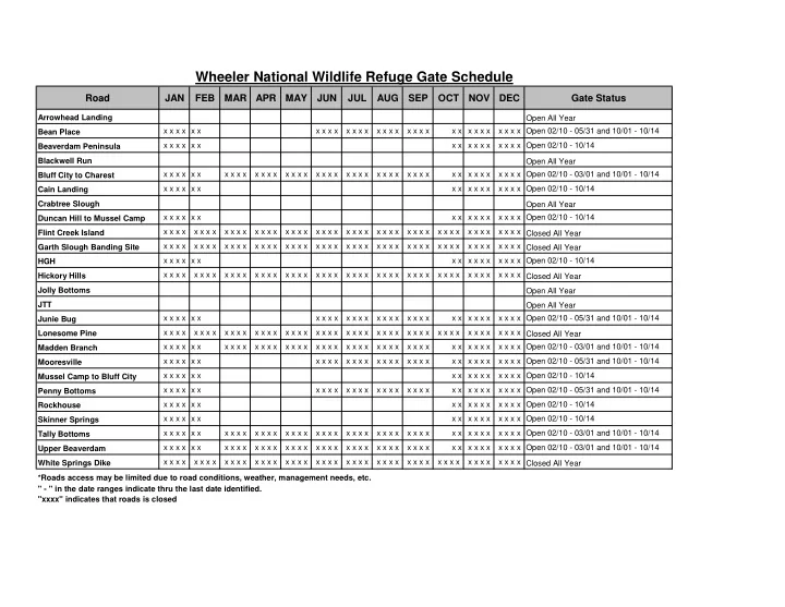
Wheeler National Wildlife Refuge Gate Schedule Road JAN FEB MAR APR MAY JUN JUL AUG SEP OCT NOV DEC Gate Status Arrowhead Landing Open All Year x x x x x x x x x x x x x x x x x x x x x x x x x x x x x x x x Open 02/10 - 05/31