
SLIDE 1
ANDERSON RIVER PARK SIDE CHANNEL HABITAT RESTORATION PROJECT Public - - PowerPoint PPT Presentation
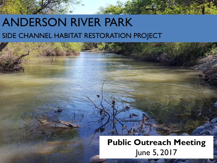
ANDERSON RIVER PARK SIDE CHANNEL HABITAT RESTORATION PROJECT Public Outreach Meeting June 5, 2017 Welcome and Introductions Providing Feedback Anderson River Park is an important part of the community and your input means a great deal to us.
harmony@westernshastarcd.org, 530-776-9433 Jan Raether – Project Coordinator jraether@westernshastarcd.org, 530-776-9427
Central Valley Project (CVP) is one of the world’s largest water storage and conveyance systems and provides water supply to most of California. Central Valley Project Improvement Act (CVPIA) includes responsibility to establish programs for fish and wildlife restoration. Anadromous Fish Restoration Program (AFRP) focuses on restoration actions for salmon species in the Central Valley and Trinity River basins of California. CVPIA (b)(13) ̄Spawning and Rearing Habitat Restoration Program focuses on the Stanislaus River, American River, and upper Sacramento River from Keswick Dam to former Red Bluff Diversion Dam.
Historic Range for Salmon Runs Current Range for Salmon Runs
Historically, endangered winter-run spawn in the uppermost reaches of the Sacramento River watershed. Dams cut off access to historic spawning and rearing areas and reduce watershed complexity. Complexity promotes salmon growth. Growth promotes survival.
Market Street Gravel North Cypress Channel North Tobiasson Rearing Structures Painter’s Riffle Channel/Gravel Shea Island Channel/Gravel South Cypress Channel
Anderson River Park Channel
Kapusta Side Channel
Green = Completed Orange = In Progress Yellow = Planning
Keswick Dam Gravel
North Cypress Side Channel Project Example…
Large Woody Debris Overhanging Vegetation Low Velocity, Ideal Depth
Followed Path of Least Resistance New Native Plantings Maintained Vegetation
Invasive species removal & improve access Clean-up & impede encampments
9/9/1998: 12,000 CFS 8/27/2013: 10,000 CFS
During high flows, juvenile salmon are stranded in low-lying areas
Source: Safe Haven Rescue Journal Source: Shastadogs.com Source: Record Searchlight Source: Record Searchlight
Number of mosquito larval treatments (2008-present)
Potential to create detailed trail map – this map includes administrative, horse, and walking trails
deeper low-lying areas + connection to backwaters + max suitable depth and velocity + large woody debris = 6 acres new juvenile rearing habitat
– Predict amount of excavated material for channel construction
– Up to 9 pits (~2’ w X 10’ l X 10’ d) – Material piled next to pit using backhoe, replaced when completed – Representative sample bagged, and tested offsite – Up to two days beginning mid-July* – Access along existing roads, trails and paths. – Biological Monitors on site throughout excavation
– Noise during operation – Minor temporary disturbance to soil and ground vegetation.
*Permit allowing
T est Pit #1 Location: western side channel Vegetation: none WOUS: cobble/gravel riverine
T est Pit #2 Location: western side channel Vegetation: grasses WOUS: vegetated riverine
T est Pit #3 Location: adjacent to central side channel Vegetation: grasses WOUS: vegetated riverine
T est Pit #4 Location: central side channel Vegetation: grasses, willow WOUS: palustrine emergent persistent
T est Pit #5 Location: central side channel Vegetation: grasses WOUS: palustrine emergent persistent
T est Pit #6 Location: central side channel Vegetation: grasses WOUS: palustrine emergent persistent
T est Pit #7 Location: eastern side channel Vegetation: none WOUS: cobble/gravel riverine
T est Pit #8 Location: adjacent to eastern side channel Vegetation: grasses WOUS: cobble/gravel riverine
T est Pit #9 Location: eastern side channel Vegetation: grasses WOUS: palustrine emergent persistent
(Minimal Flows)
Post-Construction Conditions Channels are designed to be ~1.5 feet deep at these minimal allowable flows Pre-Construction Conditions Relatively dry access to all areas of the park
(Typical Winter Flows)
Post-Construction Conditions Channels are designed to be ~3 feet deep at these typical winter flows Pre-Construction Conditions Relatively dry access to all areas of the park
(Typical Summer Flows)
Post-Construction Conditions Channels are designed to be ~5 feet deep at these typical summer flows Pre-Construction Conditions The “Island” is almost entirely inaccessible without getting wet
30 ft width Bank full Depth: 10ft 13,000 CFS Depth: 6ft 6,000 CFS Depth: 4ft 4,000 CFS Depth: 2ft
Typical Summer Flows: 11,500 cfs Typical Winter Flows: 4,000 cfs The standard channel would have approximately 3:1 slopes, and be at least two feet deep at minimal flows to provide optimal fish habitat at reduced flows.
60 ft width
Bank full Depth: 6ft 13,000 CFS Depth: 4ft 6,000 CFS Depth: 2ft 4,000 CFS Depth: 1ft Typical Summer Flows: 11,500 cfs Typical Winter Flows: 4,000 cfs In order to provide shallower depths, the shallow water crossings would be wider than
maintain velocity and allows us to maintain suitable habitat above and below crossings.
Standard Channel Depth: 10 ft Minimum: 2 ft Standard Shallow Crossing Depth: 2-4 ft Minimum: 1 ft
Dry* Crossing at 14,000 CFS Dry* Crossing at 14,000 CFS Consistently Wetted Channel Periodically Dry Crossing Dry Crossings indicate that you are likely to be stepping
deep in standing, or slowly moving water. Periodically dry crossings indicate that these areas may be dry crossings at the lowest flows, but typically the water is too deep to cross The consistently wetted channel is wet at all flows, and crossing without getting wet would be extremely difficult.
Articulated blocks at low-flow crossing Portable bridge Permanent bridge