Drafting Committee for the AsiaPacific Plan of Action for Space - - PDF document

drafting committee for the asia pacific plan of action
SMART_READER_LITE
LIVE PREVIEW

Drafting Committee for the AsiaPacific Plan of Action for Space - - PDF document

Drafting Committee for the AsiaPacific Plan of Action for Space Applications for Sustainable Development (20182030) New Caledonia Bangkok, Thailand 31 May 1 June 2018 Damien Buisson Head of the GIS and RS Service


slide-1
SLIDE 1

1

Drafting Committee for the ‘Asia‐Pacific Plan of Action for Space Applications for Sustainable Development (2018‐2030)’ New Caledonia

Bangkok, Thailand 31 May ‐ 1 June 2018

Damien Buisson – Head of the GIS and RS Service
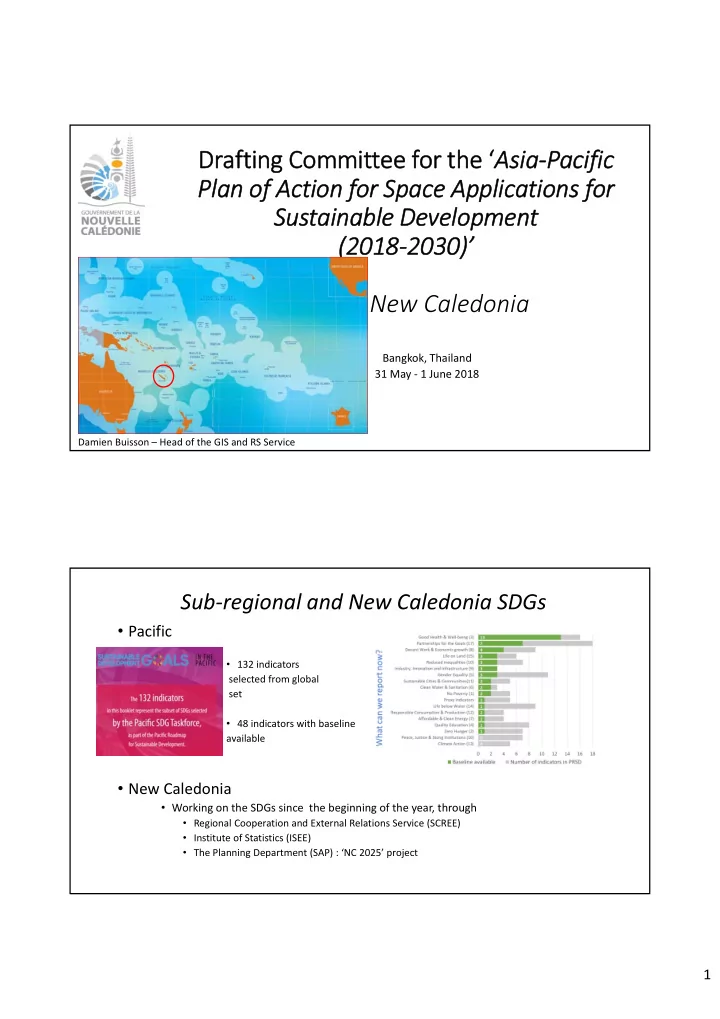
  • Pacific
  • 132 indicators

selected from global set

  • 48 indicators with baseline

available

  • New Caledonia
  • Working on the SDGs since the beginning of the year, through
  • Regional Cooperation and External Relations Service (SCREE)
  • Institute of Statistics (ISEE)
  • The Planning Department (SAP) : ‘NC 2025’ project

Sub‐regional and New Caledonia SDGs

slide-2
SLIDE 2

2

  • An active local Geomatic Network
  • “Geomatic Club”
  • More than 20 entities : Private/public sector, NGOs, University, research institute…
  • Main objectives :

‐ Promote cooperation and synergies; ‐ Communicate, exchange, value our actions;

  • Remote Sensing
  • 2 leading private companies specialized in satellite images processing with recognized expertise
  • Research topics (IRD‐Nouméa)

GIS and Remote Sensing in New Caledonia (1/2)

  • New Caledonia Government Geo portal : Georep.nc
  • Data Viewer
  • Metadata Catalog
  • Data download platform
  • Thematic cartographic explorer (geology, water…)
  • Newsletters

http://www.georep.nc

GIS and Remote Sensing in New Caledonia (2/2)

slide-3
SLIDE 3

3

Disaster risk :

Storm/Hurricane Flood/Ocean Wave Fire New Caledonia Civil Security Department is the Autorized User for the “International Charter Space & Major Disasters” since 2016

Climate Change :

The Observatory Of The Coast Of New Caledonia (OBLIC), since 2013 A tool for decision‐making and management: ‐ GIS integrating data on the maritime and coastal domain ‐ Perpetuates the data and information collected ‐ Web application http://carto.oblic.georep.nc

New Caledonia practices based on priority themes and targeted actions

New Caledonia Needs based on priority themes and targeted actions

Implementation of a Direct Receiving Station (DRS) for sustainable development (feasability study underway)

Visibility circle

  • f a Direct Receiving Station ( DRS) located in Noum ea

EEZ New Caledonia W allis and Futuna Rescue and Research Région Nouméa

slide-4
SLIDE 4

4

Additional Guidance / Recommendations

  • Monitoring and evaluation
  • f the Plan of Action
  • SPC 2017 ARCHIEVEMENTS

An example to follow? Available : http://www.spc.int (Coming soon)

OLETI MERCI THANK YOU

High resolution data somewhere in New Caledonia…