
SLIDE 1
HOW TO USE THE
Photo Credit: Marion Brenner
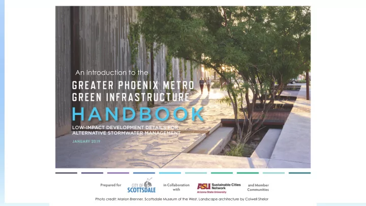
An Introduction to the
Photo credit: Marion Brenner. Scottsdale Museum of the West. Landscape architecture by Colwell Shelor
HOW TO USE THE An Introduction to the Photo Credit: Marion Brenner - - PowerPoint PPT Presentation
HOW TO USE THE An Introduction to the Photo Credit: Marion Brenner Photo credit: Marion Brenner. Scottsdale Museum of the West. Landscape architecture by Colwell Shelor TRAINING AGENDA What is low-impact development (LID)/ green
Photo Credit: Marion Brenner
An Introduction to the
Photo credit: Marion Brenner. Scottsdale Museum of the West. Landscape architecture by Colwell Shelor
What is low-impact development
(LID)/ green infrastructure (GI)?
Background Benefits of LID Purpose of Handbook Hydrologic design standards Content Additional resources Questions
Image courtesy of Leigh Padgitt
GI is an approach to water management that protects, restores, or mimics the natural
water cycle. LID is a low-cost GI technique that manages stormwater where it falls.
LID/GI is a landscape-based practice that can help maintain pre-development
hydrological conditions.
LID/GI allows water to:
Be cleansed and infiltrate into
the soil.
Evapotranspirate
(be transferred to the atmosphere through evaporation or transpiration by plants).
Be used for beneficial
purposes, such as landscape irrigation.
Courtesy of Mass.gov Smart Growth, Smart Energy Toolkit
Arizona State University’s Sustainable Cities Network (SCN) has
fostered discussion about sustainability and GI in Arizona since 2009.
LID is widely used in Pima County, but not in Maricopa County. With SCN guidance, the Specs & Standards Subgroup of SCN’s
GI Workgroup took up the challenge of creating a GI/LID handbook geared to the environment of the Phoenix Metropolitan Area. Core working team members include representatives of:
City of Scottsdale
City of Phoenix
Flood Control District of Maricopa County (FCDMC)
ASU Sustainable Cities Network (SCN)
In addition, a total of eight cities or local agencies provided review, comments, and input (see the Handbook for a list of participants)
Funding came from Arizona Department of Environmental
Quality (ADEQ) and Water Infrastructure Authority (WIFA) grants and the City of Scottsdale.
The Handbook contains 10 technical standardized details and
specifications (TSDS) selected by the core team and a stakeholder group of eight Phoenix Metropolitan Area municipal representatives.
Reduces water pollution by reducing nonpoint
source pollutant loads.
Helps conform with local first-flush
requirements.
Helps reduce stormwater peak flows and
volume, helping mitigate flood hazards and improving water quality.
Reduces the heat-island effect and quality of
life by increasing vegetation and shade.
Allows the use of stormwater as a
supplemental source of irrigation water.
Can help comply with MS4 and other general
permit requirements, where the permit requires the use of sustainable stormwater practices.
Sustainable practice that can help achieve
goals for implementing green infrastructure.
Courtesy of Southwest Urban Hydrology Courtesy of ADEQ
The Handbook encourages the use of LID
techniques in the Phoenix Metropolitan Area by providing technical standardized details and specifications(TSDS) for 10 LID elements.
Elements were chosen with input from eight
Phoenix Area municipal representatives.
Chosen elements were reviewed by a core
team that included the Cities of Scottsdale and Phoenix; Flood Control District of Maricopa County (FCDMC); and Arizona State University (ASU) Sustainable Cities Network.
Rainfall patterns in the Desert
Southwest are very different than elsewhere in the US.
High-intensity, short-duration
thunderstorms occur during the monsoon (July – September).
Disintegrating tropical storms
Lower-intensity frontal storms
Rainfall seasons are characterized
by prolonged periods of dry conditions and low humidity.
A large majority of rain events in
Maricopa County are less than 0.5 inches.
Image courtesy of AZFamily.com
First-flush rainfall of 0.5 inches is the design
criteria for this Handbook.
Rainfall of 1.5 inches is used to determine the
maximum storage capacity of LID facilities. Because these events cause floods, designing systems to accommodate these volumes can help mitigate flooding.
Data is based on rainfall information collected
by FCDMC across Maricopa County.
90 – 95 percent of all storms are below 1.5 inches. Rainfall events less than the first-flush rainfall
The design criteria for retention and detention
basins requires that any storm event must drain within 36 hours.
Permeable pavements Curb openings Sediment traps Stormwater harvesting basins Vegetated or rock bioswales Bioretention systems Curb extensions Bioretention planters Domed overflow structure Landscaping
Allow streets, parking lots, and other typically
impervious covers to utilize the infiltration capacity of underlying soils.
Are suitable for low to moderate vehicular use
areas.
Are not suitable for high-speed (>30 mph)
roadways or areas designed for high structural loads.
Are not recommended
where high pollutant loads are expected.
Must be maintained
regularly to remain effective.
Image courtesy of www.allpaving.com Courtesy of www.pavementinteractive.org/porous-on-purpose-permeable- pavements/ Image courtesy of.advancedpavement.com
Convey runoff into and out of LID features
such as bioswales or biorentention areas.
Can be new construction or retrofitted. Must be designed with roadway speeds and
clear zone offsets in mind.
Must be kept clear of debris and inspected
after storms of ≥ 0.5 inches to ensure they are not clogged.
Can be used in conjunction with
vegetated/rock bioswales; stormwater harvesting basins; sediment traps; and bioretention systems.
Image courtesy of City of Mesa
Collect sediment and other debris in
areas of concentrated stormwater flows before the water enters a stormwater capture or LID facility.
Must be maintained by removing
sediment and debris monthly and after storms of ≥ 0.5 inches.
Serve as an accessory to other LID
facilities or conveyance structures.
Can be used in conjunction with curb
bioswales.
Also referred to as rain gardens. Consist of shallow vegetated earthen
depressions that collect stormwater and cleanse it before percolation into the subsurface.
Provide subsurface storage within the
constructed facility.
Are typically landscaped and should be built
adjacent to impervious areas like parking lots.
Are scalable—can be built at any size. Must be checked for erosion, sediment,
debris, and clogging semiannually and after storms of ≥ 0.5 inches. Underdrains must be cleaned when standing water is present.
Serve as an accessory to other LID facilities or
conveyance structures.
Can be used in conjunction with curb
traps.
Image courtesy of Craig Coronato
Consist of open shallow channels with vegetation on
the bottom and side slopes, in addition to pervious plating (i.e. decomposed granite, rock, or mulch).
Are designed to slow runoff flows. May provide water harvesting opportunities and may
allow percolation of cleansed stormwater into the ground.
Must be checked for erosion, sediment, debris, and
clogging semiannually and after storms of ≥ 0.5
maintenance requirements.
Can be used in conjunction with curb openings,
sediment traps, bioretention facilities, and permeable pavements. Overflow structures are required when the system is connected to a downstream drainage or bioretention facility.
May require a series of checkdams to control
speed/velocity of stormwater runoff in steeper, sloping instances.
Image courtesy of Wayne Colebank
Are primarily designed to remove
pollutants through an engineered soil media.
Are typically landscaped. Can be designed to allow water to
percolate into the subsoil or to direct it to a downstream drainage system.
Are well-suited to urban areas with highly
impervious surfaces where space is limited.
Should be constructed with a sediment
trap at the inlet to prolong the facility’s lifespan.
Should be inspected quarterly and after
storms of ≥ 0.5 inch and cleaned of sediment and debris.
Can be used in conjunction with sediment
traps and curb openings.
Are designed to create an opportunity for
the bioretention of street runoff and to provide a space for trees and plants.
Are typically landscaped. Can be used along low-speed roadways,
driveways, and parking lots.
Can be used as a traffic-calming measure. Are easy to retrofit. Should be inspected quarterly and after
storms of ≥ 0.5 inch and cleaned of sediment and debris.
Can be used in conjunction with curb
pavements, and overflow structures.
Image courtesy of Watershed Management Group
Are small-scale bioretention cells typically
located in hardscaped areas between the curb and sidewalk.
Are typically landscaped. Do not connect to a downstream
drainage facility.
May require railings or curbs for pedestrian
safety.
Should be inspected quarterly and after
storms of ≥ 0.5 inch and cleaned of sediment and debris. Cleanout risers should also be inspected.
Can be used in conjunction with curb
Image courtesy of Tim Conner
Allow ponding within multiple
stormwater capture facilities and provide an outlet for larger storm events that exceed the capacity of each facility.
Drain into a downstream collection
facility.
Should be inspected quarterly and
after storms of ≥ 1.25 inch and cleaned of sediment and debris. Encroaching vegetation should be pruned or removed to maintain a landscape buffer.
Can be used in conjunction with LID
elements that involve surface water or ponding, such as vegetated or rock bioswales and stormwater harvesting basins.
LID/GI is a landscape-based technique. Native vegetation is sparse in Maricopa
County, so purposely installed landscaping is needed to provide vegetative cover for most LID elements.
LID/GI techniques must take into account
the soils in Maricopa County, which:
Result from the disintegration of mountain
ranges.
May have high a salt content. Are generally alkaline. May include impermeable layers like
caliche.
Have low organic content.
Plants best equipped to deal with conditions
in Maricopa County are native or desert- adapted.
Multiple agencies have produced plant lists,
such as the Arizona Department of Water Resources Low Water Use Drought Tolerant Plant List.
Many low water use/desert adapted plants
can survive on rainwater after a 1 – 2 year establishment period; others require some supplemental watering.
Plant size at maturity and planting locations
should be carefully considered.
Plant maintenance requirements are of
concern to those considering LID and have an effect on the efficiency of the techniques used.
Plants should be allowed to grow into their
natural shape; reduced pruning also reduces maintenance costs.
See the Handbook for recommendations for
landscaping, guidelines, details, Bioretention Soil Media (BSM), and maintenance.
An online version of the Greater Phoenix Metro Green Infrastructure Handbook is available
at https://sustainability.asu.edu/sustainable-cities/resources/lid-handbook/.
The Low Impact Development Toolkit prepared for the cities of Mesa and Glendale
(available at https://www.mesaaz.gov/home/showdocument?id=14999)
The Specifications and Standards Sub-Workgroup of the ASU Sustainable Cities Network
Green Infrastructure Workgroup (https://sustainability.asu.edu/sustainable- cities/about/workgroups/green-infrastructure/)
Pima County’s 2015 Low Impact Development and Green Infrastructure Guidance Manual
(http://webcms.pima.gov/UserFiles/Servers/Server_6/File/Government/Flood%20Control/Fl
Pima County LID Working Group
(http://webcms.pima.gov/cms/one.aspx?portalId=169&pageId=65263)
Reach out to us at:
Presenter 1 name, email, phone number Presenter 2 name, email, phone number