North Cambridge Business Park Public Information Centre No. 3 - - PowerPoint PPT Presentation

north cambridge business park public information centre
SMART_READER_LITE
LIVE PREVIEW

North Cambridge Business Park Public Information Centre No. 3 - - PowerPoint PPT Presentation

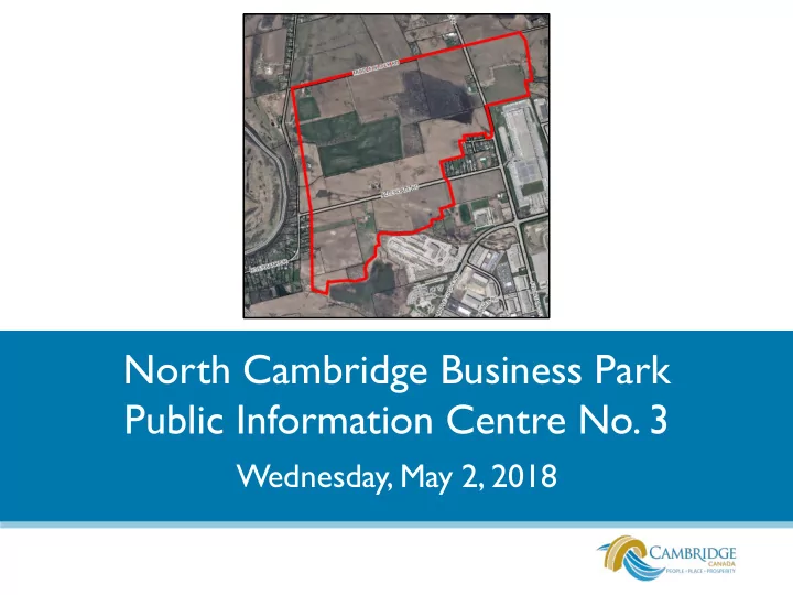
North Cambridge Business Park Public Information Centre No. 3 Wednesday, May 2, 2018 Agenda 1. Introduction 2. Project overview 3. Public feedback 4. Proposed land uses 5. Transition areas 6. Heritage and environmental considerations


slide-1
SLIDE 1

North Cambridge Business Park Public Information Centre No. 3

Wednesday, May 2, 2018

slide-2
SLIDE 2

Agenda

1. Introduction 2. Project overview 3. Public feedback 4. Proposed land uses 5. Transition areas 6. Heritage and environmental considerations 7. Parks and trails 8. Next steps Please hold your questions. The project team will be available at the display boards for questions after the presentation.

slide-3
SLIDE 3

Project Team

City of Cambridge

  • Planning – Elaine Brunn Shaw, Laura Waldie and Kathy Padgett
  • Economic Development – James Goodram
  • Development Engineering – Alex Nichols and Sarah Austin
  • Parks, Recreation and Culture – Shane Taylor and Paul Willms
  • Ward 1 Councillor – Councillor Reid

Region of Waterloo

  • Brenna MacKinnon and Sylvia Rafalski-Misch

Grand River Conservation Authority

  • John Brum
slide-4
SLIDE 4

Project Overview

slide-5
SLIDE 5

Project Overview

  • City initiated Official Plan

Amendment (OPA) and Zoning By-law Amendment (ZBA) for employment uses.

  • Lands are in the City’s

Urban Area Boundary.

  • Lands are within the East

Side Lands ‘Prime Industrial Strategic Reserve’.

  • Part A and Part B dealt

with by Cambridge Council on March 27, 2018

slide-6
SLIDE 6

Project Overview

  • Regional Growth Management Strategy (2003) identified lands around the

Region of Waterloo International Airport as a future development area intended primarily for employment purposes.

  • East Side Lands (Stage 1) Master Environmental Servicing Plan (2013)

identified “Prime Industrial Strategic Reserve” (PISR) lands.

slide-7
SLIDE 7

Project Overview

  • PISR lands identified

large-lot employment uses in proximity to Highways 8, 24 and 401 and the Region of Waterloo International Airport.

  • Purpose of PISR lands is

to ensure adequate supply of serviced industrial land is available within the Region.

  • Parcels of 8 hectares

(20 acres) or greater.

slide-8
SLIDE 8

Project Overview

  • January 2015 – Participation Group meetings with area

residents; further meetings were postponed due to outstanding appeals to the Regional Official Plan

  • December 2017 – Public Information Centre No. 2
  • February 2018 – Statutory Public Meeting required under the

Planning Act; Planning and Development Committee directed staff to hold an additional public information centre

  • March 2018 – Recommendation report to Council for a portion
  • f the lands south of Allendale Road (referred to as Part A and

Part B)

  • May 2018 – Public Information Centre No. 3
slide-9
SLIDE 9

Project Overview

  • Lands are currently designated

Prime Industrial Strategic Reserve, Future Urban Reserve and Natural Open Space System in the City’s Official Plan.

  • An OPA will be proposed to

change this designation to Business Industrial and Natural Open Space System.

slide-10
SLIDE 10

Project Overview

  • Lands are currently zoned for

Agricultural uses in the City’s Zoning By-law.

  • A ZBA will be proposed to

change this zoning to Industrial with limited complementary uses (such as restaurants, fitness establishments, etc.) and Open Space.

slide-11
SLIDE 11

Public Feedback

  • Land use compatibility with existing residential:
  • appropriate future employment uses (in the Transition Area development is

allowed with restrictions)

  • preference for residential instead of employment (planning for industrial

development has been underway for the past 15 years)

  • Employment lands include industrial and office uses with limited commercial

uses (clarification)

  • Transition Area – restrictions; size; visual barriers
  • Heritage – Riverbank Drive as a scenic route; properties on the Heritage

Properties Register

  • Environment – protection of environmental features
  • Parks and trails in the area
  • Roads,

Traffic and Servicing

slide-12
SLIDE 12

Public Feedback

  • Development concerns – noise; lighting; urban design (dealt with through

development review to the satisfaction of the City as per the policies in the City’s Official Plan)

  • Timing of development (this is subject to the amendments being approved,

servicing being available, development applications coming forward for the lands and market demand)

  • Information shared at the December Public Information Centre is

different than what was brought forward to Council at the February Public Meeting (the information presented in February was developed based

  • n feedback received from the December Public Information Centre)
  • East Side Lands (Stage 2) Master Environmental Servicing Plan (the

detailed planning for the Stage 2 East Side Lands will take into consideration the land uses proposed in the North Cambridge Business Park) City Planning staff is taking these concerns and comments into consideration when preparing the draft Official Plan and Zoning By-law Amendments.

slide-13
SLIDE 13

Proposed Land Uses

slide-14
SLIDE 14

Proposed Land Uses

The following land uses are being proposed for the North Cambridge Business Park:

  • Industrial uses (e.g. assembling, fabricating, manufacturing,

processing, etc.)

  • Limited stand-alone warehousing and distribution
  • Offices
  • Research and development
  • Information technology (e.g. data centres)
  • Couriers and delivery services
  • Accessory uses (e.g. warehousing and distribution)
slide-15
SLIDE 15

Proposed Land Uses

  • Limited complementary uses

within an industrial mall (e.g. fitness, restaurants, medical, financial institutions)

  • Limited retail sales and service

commercial uses as an accessory use

  • Hotel, conference centre,

banquet facilities

  • Transport uses
  • Prohibited: Noxious uses
slide-16
SLIDE 16

Transition Areas

slide-17
SLIDE 17

Transition Areas

  • Transition Area 1 – dealt with by

Cambridge Council on March 27, 2018

  • Transition Area 2 – 70 metres

(229 feet) wide adjacent to existing residential uses on Allendale and Banat Roads

  • Transition Area 3 – along

Riverbank Drive (width to be determined)

  • Minimize negative effects of one

land use on the other

  • Development is permitted

within the transition areas, subject to a number of restrictions

slide-18
SLIDE 18

Transition Areas

The following approach is being considered within Transition Area 2:

  • Industrial uses only within an enclosed

building;

  • No outdoor storage;
  • No outdoor speakers;
  • Screening for rooftop mechanical

equipment;

  • Minimum setback of 30 metres (98.4

feet) for a new building adjacent to residential uses (current zoning by-law requires 7.5 metres (24.6 feet));

  • Minimum 2.4 metre (7.87 foot) solid

fence or noise barrier wall; and

  • 7 metre (22.9 foot) planting strip.
slide-19
SLIDE 19

Transition Areas

slide-20
SLIDE 20

Transition Areas

The approach for Transition Area 3 (between Allendale Road and Middle Block Road along Riverbank Drive) to minimize negative effects on the scenic route and adjacent residential properties requires further review.

slide-21
SLIDE 21

Heritage and Environmental Considerations

slide-22
SLIDE 22

Heritage

  • Four properties included
  • n the Heritage

Properties Register as properties of interest (structures only).

  • Heritage Impact

Assessments (HIA) are required at the time a development application is received.

  • HIA may be waived if no

immediate impact on the cultural heritage resource.

slide-23
SLIDE 23

Heritage

  • The future North-South

Collector Road will divert traffic away from Riverbank Drive.

  • No direct vehicular access is

proposed to be permitted

  • nto Riverbank Drive from

the employment lands.

  • Riverbank Drive recognized as a scenic route in the City’s Heritage

Master Plan.

  • The curving alignment and road profile of Riverbank Drive will not

be altered by these amendments.

South on Riverbank Drive

slide-24
SLIDE 24

Environment

slide-25
SLIDE 25

Parks, Trails and Open Space Concept

South on Riverbank Drive

slide-26
SLIDE 26

Next Steps

slide-27
SLIDE 27

Next Steps

Staff will review and respond to the comments provided as a result of this public consultation in a future recommendation report to the Planning and Development Committee in June 2018. Please provide your input by May 14, 2018.

slide-28
SLIDE 28

www.cambridge.ca

CONTACT INFORMATION

Please provide your input by May 14, 2018 to:

Kathy Padgett, Senior Planner – Environment Community Development Department Phone: (519) 621-0740 ext. 4826 PadgettK@Cambridge.ca

For questions between May 7 and May 11 please contact: Paul Smithson, Senior Planner – Policy Phone: (519) 621-0740 ext. 4575 SmithsonP@Cambridge.ca