Observations that Support a Weather-Ready Nation: COSMIC-2 - - PowerPoint PPT Presentation

▶
observations that support a weather ready nation cosmic 2
SMART_READER_LITE
LIVE PREVIEW

Observations that Support a Weather-Ready Nation: COSMIC-2 - - PowerPoint PPT Presentation

Observations that Support a Weather-Ready Nation: COSMIC-2 Committee on Operational Environmental Satellites 18 March 2016 Joseph A. Pica Director, Office of Observations National Weather Service GPS Radio Occultation (GPS-RO) 2 National


slide-1
SLIDE 1

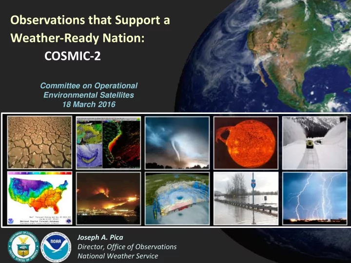
Observations that Support a Weather-Ready Nation: COSMIC-2

Joseph A. Pica Director, Office of Observations National Weather Service Committee on Operational Environmental Satellites 18 March 2016
slide-2
SLIDE 2

National Weather Service

GPS Radio Occultation (GPS-RO)

2

slide-3
SLIDE 3

National Weather Service

GPS-RO Characteristics

  • Limb sounding geometry complementary to ground and space nadir

viewing instruments

  • High vertical resolution (~100 m)
  • Lower ‘along-track’ resolution (~200 km)
  • All weather-minimally affected by aerosols, clouds or precipitation
  • High accuracy (equivalent to ~ 0.1 Kelvin from ~7-25 km)
  • Equivalent accuracy over ocean and over land
  • No instrument drift, no need for calibration
  • Global coverage
  • No satellite-to-satellite measurement bias
  • Observations can be used in NWP without a bias correction scheme
  • RO is one of the top contributors in improving global operational

weather forecast skill

3

slide-4
SLIDE 4

National Weather Service

GPS-RO

Temperature and moisture profiles Excellent vertical, Poor horizontal, Sensitivity ~8km – 60km Virtually no impact from cloud

Hyperspectral IR

Temperature and moisture profiles Ozone and trace gas sensitivity Good vertical, Good horizontal, Sensitivity Surface – 45km Greatly impacted by cloud

Microwave

Temperature and moisture profiles Poor vertical, Good horizontal, Sensitivity Surface – 90km Moderately Impacted by cloud

Role of GPS-RO Observations

Satellite sounding systems have a complementary nature balancing weaknesses in each to form a comprehensive observing system

T(z)

4

slide-5
SLIDE 5

National Weather Service

GPS-RO Data Impact

2 4 6 8 10 12 14 16 18 O3: Ozone from satellites METEOSAT IR Rad (T,H) MTSATIMG: Japanese geostationary sat vis and IR imagery GOES IR rad (T,H) MODIS: Moderate Resolution Imaging Spectroradiometer (winds) GMS: Japanese geostationary satellite winds SSMI: Special Sensor MW Imager (H and sfc winds) AMSRE: MW imager radiances (clouds and precip) MHS: MW humidity sounder on NOAA POES and METOP (H) MSG: METEOSAT 2nd Generation IR rad (T,H) HIRS: High-Resol IR Sounder on NOAA POES (T,H) PILOT: Pilot balloons and wind profilers (winds) Ocean buoys (Sfc P, H and winds) METEOSAT winds GOES winds AMSU-B: Adv MW Sounder B on NOAA POES SYNOP: Sfc P over land and oceans,H, and winds over oceans QuikSCAT: sfc winds over oceans TEMP: Radiosonde T, H, and winds GPSRO: RO bending angles from COSMIC, METOP AIREP: Aircraft T, H, and winds AIRS: Atmos IR Sounder on Aqua (T,H) IASI: IR Atmos Interferometer on METOP (T,H) AMSU-A: Adv MW Sounder A on Aqua and NOAA POES (T)

Note: 1) Sounders on Polar Satellites reduce forecast error most 2) Results are relevant for other NWP Centers, including NWS/NCEP

Courtesy: Carla Cardinali and Sean Healy, ECMWF

5

5

slide-6
SLIDE 6

National Weather Service

COSMIC provides 8 hours of gain in model forecast skill starting at day 4

Cucurull 2010 (WAF)

GPS-RO Data Impact at NCEP

6

slide-7
SLIDE 7

National Weather Service

Radio Occultation keeps the weather model from drifting away from reality.

Benefits of GPS-RO on Satellite Radiance Assimilation

Difference

  • f ~ 0.5 K

1 0.5 0 -0.5 -1 -1.5 0.5 0 -0.5 -1 -1.5 -2

with GPS w/o GPS with GPS w/o GPS

1Dec 2007 1Jan2008 1Feb2008 1Mar2008 Cucurull, Anthes and Tsao 2014 (JAOT) 1Dec 2007 1Jan2008 1Feb2008 1Mar2008

7

slide-8
SLIDE 8

National Weather Service

WRF Model Forecast After 3-day of Data Assimilation

No GPS RO Data With GPS RO Data

8

slide-9
SLIDE 9

National Weather Service

COSMIC-2 FORMOSAT-7

9

slide-10
SLIDE 10

National Weather Service

COSMIC-2/FORMOSAT-7 Coverage Compared to COSMIC/FORMOSAT-3

COSMIC-2 10

slide-11
SLIDE 11

National Weather Service

COSMIC-2 FORMOSAT-7 Mission Baselines

11

FORMOSAT-7/COSMIC-2 First Launch Second Launch Mission Objectives To be achieved after Full Operational Capability:

 8,000 atmospheric sounding profiles per day  45-min data latency for neutral atmosphere and 30-min data

latency for ionosphere and space weather Constellation 6 SC to low-inclination-angle

  • rbit (mission altitude 520

km)

 6+1 SC to high-inclination-angle

  • rbit (mission altitude ~800 km)

GNSS RO Payload TGRS TGRS Scientific Payload US furnished IVM and RF Beacon Instrument Taiwan furnished Launch Vehicle Falcon Heavy rideshare; ESPA Grande Ring Compatible with Falcon 9, Falcon Heavy, and EELV with a 5-m fairing Launch Schedule (goal) 2017Q1 2018 (TBR) Communication Architecture Via Ground Station

slide-12
SLIDE 12

National Weather Service

‒

FY16 NOAA Appropriation

  • Provides full funding for ground system
  • Does not contain funding for second set of mission payloads

‒

FY17 President’s Budget Request

  • Contains funding to secure polar RO data from C2B or from other sources if

available

  • Working with U.S. mission partners to identify launch rideshare options for C2B

‒

Completed Data Processing Center Critical Design Review Sept 23rd

‒

Conducted Joint Program Management Office (JPMO) Meeting Dec 14th

‒

Conducted Mission Operations Working Group (MOWG) Meeting Dec 15th

‒

Completed Data Processing Center Readiness Review #1 (RR#1) Dec 16th

‒

Completed Program Critical Design Review/Integration & Test Review (CDR/ITR)

  • Successfully completed February 1-4th in Taiwan
  • Went very well with only 4 formal action items generated

‒

Executive Steering Committee Meeting #8 held March 7-8 in Taiwan

COSMIC-2 FORMOSAT-7 Overall Program

12

slide-13
SLIDE 13

National Weather Service

Tri-Band Global Navigation Satellite System (GNSS) Receiver System (TGRS)

  • Description
  • Radio Occultation receiver tracks GNSS signals across

Earth’s limb

  • Provides global observations of refractivity,

pressure, temperature, humidity, total electron content, ionospheric electron density, and ionospheric scintillation

  • Recent Accomplishments
  • All TGRS flight units have been integrated and tested on

COSMIC-2 spacecraft

  • Flight software v3.0 completed acceptance test in

December 2015

  • Near Term Focus
  • Upload flight software v3.1 to all TGRS units in April 2016
  • Complete TGRS software development
  • Schedule
  • S/W v3.1 complete (Feb 2016)
  • S/W v4.0 (Jun 2016); v4.1 (Oct 2016)
  • Issues/Risks
  • Potential RFB interference with TGRS (see slide 11)

Fore RO Antenna (Troposphere) Aft RO Antenna (Troposphere) TriG GNSS Receiver Fore POD Antenna (Ionosphere) Aft POD Antenna (Ionosphere)

13

slide-14
SLIDE 14

National Weather Service

EMI/RF Interference Evaluation

– EMI/RF Interference Investigation

  • Phase I (Spacecraft Bus Evaluation)

– Spacecraft EMI testing conducted in October and December – EMI test results showed spacecraft is very quiet – Results showed all possible spacecraft EMI is below the sensitivity of the test equipment – Results showed the “worst case” noncompliance, if observed on-orbit, may be a reduction in Signal-to- Noise at TGRS of up to 0.3dB

  • US team reviewed the requirements and determined that margin exists so the requirement can be

relaxed with no impact on the overall mission objectives

  • An Engineering Change Request (ECR) was written and approved that updates the EMI requirements
  • Phase II (RF Beacon to TGRS Interference Evaluation)
  • RF Beacon to TGRS EMI testing was conducted in December
  • EMI test results are being assessed
  • Preliminary assessment shows the risk is going down, but we have not completed our assessment
  • US team expects to have final results of analysis in the next week
  • Air Force has stated/written intention to fly as-is and turn RF Beacon off if interference prevents

COSMIC-2 requirements from being satisfied

14

slide-15
SLIDE 15

National Weather Service

  • Description
  • Measures the in-situ plasma density, ion temperature

and composition, and drift velocity

  • Recent Accomplishments
  • All IVM flight units have been integrated and tested
  • n COSMIC-2 spacecraft
  • Near Term Focus
  • Closure of IVM magnetic cleanliness issue
  • Schedule
  • N/A
  • Issues/Risks
  • IVM magnetic cleanliness risk
  • Spacecraft thermostats are located near the IVM

instrument

  • US team is concerned that magnetic materials in the

spacecraft thermostats may result in significant degradation of IVM performance

  • Joint team is working to determine solutions to this

issue

Ion Velocity Meter (IVM)

15

slide-16
SLIDE 16

National Weather Service

Flight Model 4 in Preparation for Dynamic Test at NSPO

16

slide-17
SLIDE 17

National Weather Service

COSMIC-2A (Equatorial) Baseline Ground Station Architecture

17

slide-18
SLIDE 18

National Weather Service

Ground Segment Status

‒

Darwin, Australia Ground Site

  • Antenna installed successfully
  • Completed command/telemetry testing with COSMIC-1

‒

Cuiaba, Brazil Ground Site

  • Antenna installed successfully
  • EGSE damaged during shipment to Cuiaba
  • EGSE repair estimated to be completed by May 2016

‒

USAF Mark IV-B modifications under contract as of 1 October

  • Work has commenced (Lockheed Martin)
  • Will utilize four sites (Hawaii, Honduras, Guam and Kuwait)
  • Hawaii site testing planned for March

‒

Investigating Commercial Tracking Station Services:

  • Mauritius site planned to be added to the program via modification to an existing agreement between

NOAA and Norway (NSC/KSAT)

  • An additional ground sites is planned being for addition to the program via commercial providers
  • Ghana (TBD)
  • Sources Sought Request for Information (RFI) was released and closed March 3rd

18

slide-19
SLIDE 19

National Weather Service

New Cuiaba Brazil Antenna

19

slide-20
SLIDE 20

National Weather Service

STP-2 Mission Overview

Integrated Payload Stack (IPS)

  • Six COSMIC-2 Spacecraft
  • Demonstration and Science Experiment (DSX)
  • Six Auxiliary Payloads (APLs)
  • Dispensers plus ballast
  • Eight PPODs with Twelve Cubesats for LEO

Concept of Falcon Heavy from Launch Comlex-39A CCAFS

FORMOSAT-7 COSMIC-2 20

slide-21
SLIDE 21

National Weather Service

STP-2 Mission Orbits and Coast Profile

STP-2 will Deploy Spacecraft into Three Different Mission Orbits:

  • 28.5° - 300-860Km – LEO (OCULUS +PPODS)
  • 24° - 720 km – LEO (COSMIC 2 and APLs)
  • 45° - 6000-12,000 km– MEO (DSX)

21

slide-22
SLIDE 22

National Weather Service

SpaceX Falcon Heavy and Launch Pad

Falcon Heavy Launch Pad

  • Development
  • 20 year lease signed with NASA Apr 2014
  • Launch pad modifications nearing completion
  • Launch processing facility construction is

complete

  • Development Level Maturing
  • Landing legs
  • Thruster and structural upgrades
  • Sub-cooled propellants
  • Qualification In-Progress
  • Structures testing in-progress
  • Engine testing in-progress
  • FH Demo in build
  • MDR-2b Review Complete
  • Launch Vehicle development focus

22

slide-23
SLIDE 23

National Weather Service

Launch Vehicle Status

  • Falcon Heavy Launch Vehicle

– Development is maturing

  • Nearing CDR-level of maturity
  • Sub-cooled propellants increase performance of 1st stage

– Qualification testing is in progress – Leveraging previous development and upgrades from the Falcon 9

  • Schedule

– Falcon Heavy demonstration launch planned for Q4 CY 2016 – COSMIC-2 launch planned for Q1 CY17 – Mission Design Review (MDR) #2a & b

  • MDR #2a is mission specific (completed Nov 2014)
  • MDR #2b is launch vehicle centric plus (completed Feb 2016)

– Ground Operations Working Group(GOWG) at launch site March 15-17, 2016

  • Will review launch processing flow and logistics

23

slide-24
SLIDE 24

National Weather Service

Data Processing Centers Status Update

  • Significant Developments and Progress

– IT systems

  • Security certification is proceeding well (FIP199/200 Completed)
  • Data processing hardware deployed to geographically separate data centers February 2016
  • Conducting integration and testing through April 2016

– Data Management System

  • Significant portion of input/output interfaces already tested
  • Expect testing to be nearly complete by April 2016

– Day in the Life Test

  • End-to-end test of data distribution and processing system planned
  • Covers entire chain from simulated received Virtual Channel files, through data managements

systems and data processing centers, SOCC & end users/customers

  • Phase A: simulates external parties on a UCAR virtual host (Summer 2016)
  • Phase B: data transfers with real external parties (Fall 2016)
  • Already using streaming GNSS data architecture to process current missions

24

slide-25
SLIDE 25

National Weather Service

Summary

  • Radio Occultation is a proven high-impact and low-cost global observing system.
  • Only observing system to give information on ionosphere, stratosphere and

troposphere simultaneously

  • Significant (top 5) positive impact on weather forecasts at all major international

weather centers

  • Assimilation of GNSS-RO data improves the analysis of water vapor over tropical
  • ceans, which is critical for the prediction of tropical cyclones.
  • COSMIC-2/FORMOSAT-7 will continue data used operationally in global weather

forecasting and offer improved global coverage and advanced technology and support the National Weather Service goal of a Weather-Ready Nation.

  • The National Weather Service National Centers for Environmental Prediction (NCEP)

are ready to assimilate COSMIC-2 data as soon as they are available after launch.

  • COSMIC-2 Team is positioned for a successful mission and on schedule to

support a C-2A launch in 2017.

25

slide-26
SLIDE 26

National Weather Service

Questions?

26