
SLIDE 1
An Introduction to the Upgrade
- f the Waipaoa River Flood
of the Waipaoa River Flood Control Scheme (19 Sept 2018) Applicants - - PowerPoint PPT Presentation
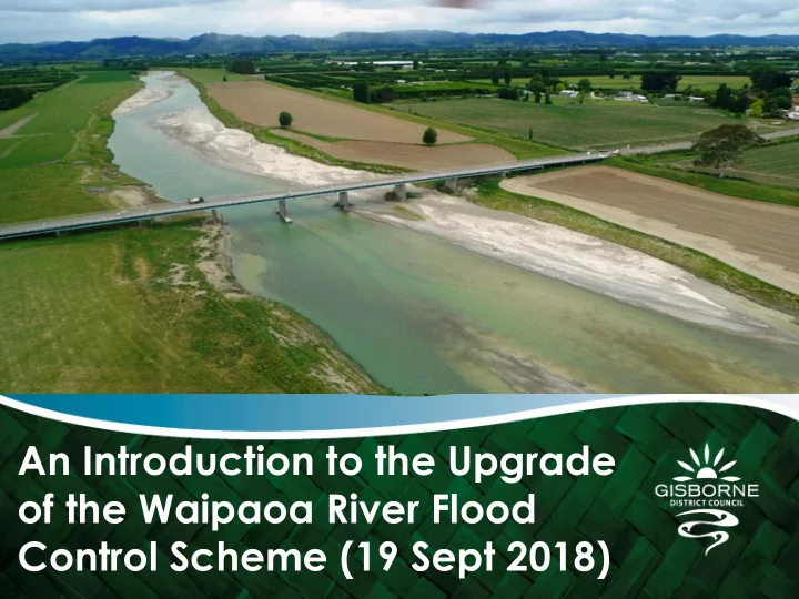
An Introduction to the Upgrade of the Waipaoa River Flood Control Scheme (19 Sept 2018) Applicants Team Name Position Role Neil Daykin Operations Manager Project Business Owner Joss Ruifrok Senior Project Project Manager Engineer
Name Position Role
Neil Daykin Operations Manager Project Business Owner Joss Ruifrok Senior Project Engineer Project Manager Stella Morgan Director of Sage Planning Planning Consultant Rachael Zame Associate with CooneyLeesMorgan Legal Representative Craig Goodier Principal Engineer with Hawke’s Bay Regional Council River Modelling Technical Expert Janic Slupski Senior Policy Advisor Landscape expert
1.0 Background 2.0 Project Overview 3.0 Investigations 4.0 Modelling & Design 4.1 Flood capacity 4.2 Design Flood Levels 4.3 Stopbank Design 4.4 Ormond Bypass 4.5 Mulloolys Bend 4.6 Upstream Properties 5.0 Wi Pere
The Waipaoa Flood Control Scheme (WFCS) began over 60 years
ago.
The WFCS was substantially completed by 1969 The WFCS consists of:
64km of stopbanks, Stopbank top widths of 2m, Stopbank heights range up to 6m, 638ha of productive land between the river & stopbanks (floodable berm), 76+ culverts, concrete walls, floodgates and related infrastructure.
The WFCS protects $7 billion worth of land and property In the 2006 LTCCP, Gisborne District Council (GDC) continued its
commitment to investigating upgrading the WFCS.
In the 2009/19, 2015/25, & 2018/28 Long Term Plans, GDC
committed to a WFCS upgrade resilience project.
Project involves the upgrade of the existing the Waipaoa Flood
Control Scheme (WFCS)
Project also includes for the provision cycle trails along the
stopbanks,
Flows (discharges) are forecast to increase by 25% between
now and 2090 due to a warming climate,
Design will cater for a 1:100 yr flood event, accounting for
climate change factors out to the year 2090, plus ‘freeboard’,
‘Freeboard’ is an additional height allowance to compensate
for variables inherent in the design (0.6m applied),
Will provide a ‘theoretical’ uniform LoS up to the design event Stopbank top width to be increased to 4m
1 2 3 4 5 6 7 8 9 10 1 2 3 4 5 6 7 8 9 10 11 12 13 14 15 16 17 18 19 20 21 22 23 24 25 26 Height (m) Distance (m)
1 2 3 4 5 6 7 8 9 10 1 2 3 4 5 6 7 8 9 10 11 12 13 14 15 16 17 18 19 20 21 22 23 24 25 26 Height (m) Distance (m)
Stability generally
good,
Lateral bank
erosion a problem in some locations,
Narrow berms in
Ground Penetrating Radar (GPR) Cone Penetrometer Tests (CPT) Scala Penetrometer Tests (SPT)
Stability generally very good. However 2m top widths too narrow for
safety and robustness. 4m now the industry norm.
Instability under earthquake conditions - generally not significant
(exceptions).
Liquefaction under seismic conditions is a risk (settlement and lateral
spreading) in the lower to mid reaches. Little that can be practicably done.
Generally good berm width Some locations in critical areas have narrow berm widths Strengthening or berm widening may be necessary in places
Cyclone Bola event used as our calibration event (4500
Design event is Bola plus 25% (Accounts for Climate Change
Bola +25% additional flow = 5625 cumecs = 2090 1% AEP
5625 cumecs is our ‘Design Event’ Stopbank heights are modelled flood levels from a 5625
Updated the hydraulic model of the river 1D-2D ‘coupled model’ being used for design Updated model reviewed by DHI modelling specialists Model assumes that all floodwaters are contained by the
0.5m variation in stopbank level Higher stopbank, likely to account for Super Elevation
0.5m variation in stopbank level
Proposed bypass