Quantifying the Functional Lift of Stream Restoration Projects Will - - PowerPoint PPT Presentation

quantifying the functional lift of stream restoration
SMART_READER_LITE
LIVE PREVIEW

Quantifying the Functional Lift of Stream Restoration Projects Will - - PowerPoint PPT Presentation

Quantifying the Functional Lift of Stream Restoration Projects Will Harman, PG Purpose of the Quantification Tool 1. Determine numerical differences between an existing (degraded) stream condition and the proposed (restored) stream condition.


slide-1
SLIDE 1

Quantifying the Functional Lift of Stream Restoration Projects

Will Harman, PG

slide-2
SLIDE 2

Purpose of the Quantification Tool

  • 1. Determine numerical differences between an

existing (degraded) stream condition and the proposed (restored) stream condition.

– Credit Determination Method

  • 2. Link restoration activities to changes in stream

functions (function-based parameters).

  • 3. Link restoration results to restoration potential.
  • 4. Incentivize high-quality stream mitigation.
slide-3
SLIDE 3

How can the tool be used?

  • Site Selection—Does a project reach have enough

functional lift and overall quality to justify as a project? Can use rapid assessment methods.

  • Quantify functional lift or loss
  • Stream mitigation credits

– For existing ratio methods, as a way to select the ratio. – Simply use the functional foot delta for new methods. – Not rapid, but not too intensive.

  • Permittee Responsible Mitigation – Can the

proposed mitigation activities offset the predicted losses in stream functions.

  • Debit Side – Coming in 2016
slide-4
SLIDE 4

Excel Workbook (For One Reach)

  • Project Assessment
  • Catchment Assessment
  • Parameter Selection Guide
  • Quantification Tool
  • Performance Standards

Five Worksheets:

slide-5
SLIDE 5

Functional Category

  • 1. Hydrology
  • 2. Hydraulics
  • 3. Geomorphology
  • 4. Physicochemical
  • 5. Biology

Function-Based Parameter Function or condition metrics that describes functions within the functional category. Measurement Method Quantifies the

  • parameter. There

may be more than one per parameter. Performance Standard Functional capacity. Functioning Functioning- At-Risk Not Functioning

Based on the Stream Functions Pyramid Framework: Harman, W., R. Starr, M. Carter, K. Tweedy, M. Clemmons, K. Suggs, and C. Miller. 2012. A Function-Based Framework for Stream Assessment and Restoration Projects. U.S. Environmental Protection Agency, Office of Wetlands, Oceans, and Watersheds, Washington, DC. EPA 843-K-12-006.

Terms You Need to Know

slide-6
SLIDE 6

Quantification Tool: Inputs

  • Project Information
  • Stratification that

determines the performance standards to use.

  • Selected from pull-

down menu.

Site Information and Performance Standard Stratification

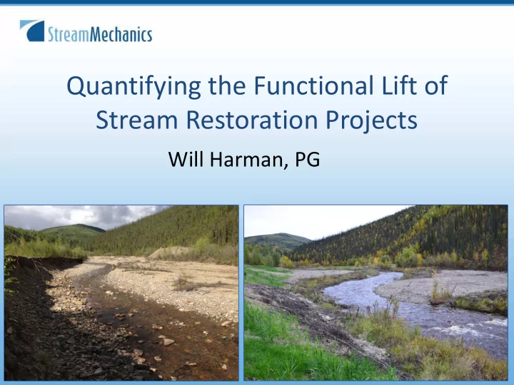
Project Name: Kraft Reach ID: 1 Restoration Potential: Level 3 - Geomorphology Existing Stream Type: E Proposed Stream Type: C Region: Mountains Drainage Area (sqmi): 4 Proposed Bed Material: Gravel Existing Stream Length (ft): 736 Proposed Stream Length (ft): 957 Stream Slope (%): 0.62 Flow Type: Perennial River Basin: Yadkin-PeeDee Stream Temperature:

slide-7
SLIDE 7

Quantification Tool: Scoring

Not Functioning Functioning-At-Risk Functioning 0.0 - 0.29 0.3 – 0.69 0.7 – 1.0

slide-8
SLIDE 8

Performance Standards

Pool-to-pool spacing is a Measurement Method for Bedform Diversity within the Geomorphology Functional Category.

slide-9
SLIDE 9

Quantification Tool: Existing and Proposed Condition Assessment

Functional Category Function-Based Parameters Measurement Method Field Value Index Value Hydrology Catchment Hydrology Catchment Assessment H1, H2, H3 M1, M2, M3 L1,L2, L3 0 to 1.0 Runoff Storm EZ & Impervious Cover (%) 0 to 100% 0 to 1.0 Flow Duration NATHAT-DHRAM Model result 0 to 1.0 Hydraulics Floodplain Connectivity Bank Height Ratio 1 to ___ 0 to 1.0 Entrenchment Ratio 1 to ___ 0 to 1.0 Geomorphology Bed Form Diversity Pool-to-pool spacing 0 to ___ 0 to 1.0 Depth Variability Ratio 0 to ___ 0 to 1.0 Physicochemical Biology

slide-10
SLIDE 10

Roll Up Scoring

  • Measurement Method Index Scores are

averaged to create Parameter Score.

  • Parameter Index Scores are averaged to create

Functional Category Scores.

  • Category Scores are multiplied by 0.2 and

summed to create Overall Score.

– Max Score through Level 3 Geomorphology = 0.6 – Max Score through Leve 4 Physicochemical = 0.8 – Max Score through Level 5 Biology = 1.0

slide-11
SLIDE 11

Basic Rules

  • Same parameters evaluated for existing and

proposed conditions.

  • Must include catchment health, floodplain

connectivity, bed form diversity, lateral stability, and riparian vegetation.

  • Add other parameters based on specific scenarios

and environments, e.g., adjacent BMP, cattle access, forested reference conditions,etc.

  • Practitioners cannot change parameters,

measurement methods or performance standards without approval of regulatory agency/owner.

slide-12
SLIDE 12

Results

  • Existing Condition Score (ECS)
  • Proposed Condition Score (PCS)
  • Condition Lift = PCS- ECS
  • Percent Condition Lift
  • Existing Functional Feet

– Existing Stream Length X ECS

  • Proposed Functional Feet

– Proposed Stream Length X PCS

  • Functional Lift

– Proposed Functional Feet – Existing Functional Feet

  • Percent Lift from Functional Feet

Condition Lift Functional Feet Lift

slide-13
SLIDE 13

Hypothetical Example

Existing Condition

slide-14
SLIDE 14

Construction

slide-15
SLIDE 15

2006 2002 2007

slide-16
SLIDE 16

Functional Lift Summary

Exisiting Condition Score 0.36 Proposed Condition Score 0.74 Functional Lift Score 0.38 Percent Condition Lift (%) 106 Existing Stream Length (ft) 736 Proposed Stream Length (ft) 957 Additional Stream Length (ft) 221 Existing Functional Foot Score 265 Proposed Functional Foot Score 708 Proposed Functional Foot Score - Existing Functional Foot Score 443 Functional Lift (%) 167

slide-17
SLIDE 17

Functional Lift Summary

Functional Category Function-Based Parameters Existing Parameter Proposed Parameter

Hydrology Catchment Hydrology 0.4 0.4 Hydrology Runoff Hydrology Flow Duration Hydraulics Floodplain Connectivity 0.5 1.0 Geomorphology Large Woody Debris 0.1 0.58 Geomorphology Lateral Stability 0.42 1 Geomorphology Riparian Vegetation 0.53 0.76 Geomorphology Bed Material Composition Geomorphology Bed Form Diversity 0.59 1.0 Geomorphology Sinuosity 0.70 0.93 Physicochemical Temperature Physicochemical Salinity Physicochemical Bacteria 0.0 0.79 Physicochemical Stream Metabolism Physicochemical Organic Matter 0.50 0.90 Physicochemical Nitrogen Physicochemical Phosphorus Biology Macros 0.36 0.60 Biology Fish 0.0 0.61

slide-18
SLIDE 18

Functional Category Summary

slide-19
SLIDE 19

Case Study Results

slide-20
SLIDE 20

Case Study Results

slide-21
SLIDE 21

Key Acknowledgements

  • Environmental Defense Fund (Funding)

– Will McDow, Project Manager

  • Ecosystem Planning and Restoration

– Cidney Jones, PE, Spreadsheet Development and Research

  • NC Division of Mitigation Services

– Periann Russell, Greg Melia, Michael Ellison, Lin Xu – Parameter selection, case studies, testing, modeling develop.

  • NC Division of Water Resources

– Eric Fleek and Larry Eaten, Biological parameter support

  • Watershed Science

– Dave Penrose, Physicochemical and biological support

slide-22
SLIDE 22

Questions

Will Harman, PG Stream Mechanics www.stream-mechanics.com www.Facebook.com/StreamMechanics wharman@stream-mechanics.com