The he Twent entieth C Cent entur ury Reanal eanalysis P Proj - - PowerPoint PPT Presentation

the he twent entieth c cent entur ury reanal eanalysis p
SMART_READER_LITE
LIVE PREVIEW

The he Twent entieth C Cent entur ury Reanal eanalysis P Proj - - PowerPoint PPT Presentation

The he Twent entieth C Cent entur ury Reanal eanalysis P Proj rojec ect Compo, Whitaker, Sardeshmukh (2006) Gilbert P. Compo, Jeffrey S. Whitaker, and Prashant D. Sardeshmukh U. of Colorado/CIRES Climate Diagnostics Center & NOAA


slide-1
SLIDE 1

The he Twent entieth C Cent entur ury Reanal eanalysis P Proj rojec ect

  • U. of Colorado/CIRES Climate Diagnostics Center &

NOAA ESRL/ Physical Sciences Division

Gilbert P. Compo, Jeffrey S. Whitaker, and Prashant D. Sardeshmukh

Compo, Whitaker, Sardeshmukh (2006)

slide-2
SLIDE 2

US and International calls for historical reanalyses

Reanalysis datasets “spanning the instrumental record” (WCRP 3rd conference on reanalysis, Trenberth, EOS, 2008)

 Group on Earth Observations/GCOS Task CL-06-01 Sustained

Reprocessing and Reanalysis Efforts

 U.S. GCRP Revised Strategic Plan (2008)

Goal 3 Reduce uncertainty in projections of how the Earth’s climate and environmental systems may change in the future Key research topics: Creating a Historical Reanalysis of the Atmosphere of the 20th Century

 NOAA Strategic plan (2006-2011) to meet NOAA and GCRP goals calls

for integrated observations and analysis with “quantified uncertainties”.

 Emphasis on reanalysis improvements for understanding multidecadal

variability of weather extremes and variations (eg., CCSP, 2008, Weather and Climate Extremes SAP3.3)

2

slide-3
SLIDE 3

1.

Effectively doubling the reanalysis record length 

2.

Climate model validation dataset for large-scale synoptic anomalies during extreme periods, such as droughts (30’s, 50’s).

3.

Better understand events such as the 1920-1940’s Arctic warming.

4.

Determining storminess and storm track variations over last 100-150 years.

5.

Developing new forecast products predicting changes in frequency and intensity of weather extremes, e.g., cold air outbreaks, severe storms.

6.

Developing and improving forecasts of low-frequency (e.g., Pacific-North America pattern, North Atlantic Oscillation) atmospheric variations and their interannual to decadal variability.

7.

Understanding changing atmospheric background state associated with interdecadal hurricane activity.

8.

Homogenizing upper-air and other independent observations.

9.

Offline forcing of models (e.g., ocean, land)

10.

Estimating historical probability distributions for wind energy.

11.

Estimating risks of extreme events for insurance and re-insurance.

3

Some Uses of Historical Reanalyses

slide-4
SLIDE 4

Challenges to meeting National and International goals for Historical Reanalyses

Satellite network only back to 1970’s, Upper-air network comprehensive only back to 1940’s, scant to non-existent in 19th century

3-D Var data assimilation systems such as used in NCEP-NCAR, NCEP-DOE, ERA-40 reanalyses depends on upper-air data for high quality upper-level fields (Bengtsson et al. 2004, Kanamitsu and Hwang 2005).

However, studies using advanced data assimilation methods (e.g., 4D-Var, Ensemble Filter) suggest surface network, especially surface pressure observations, could be used to generate high-quality upper-air fields (Bengtsson 1980, Thepaut and Simmons 2003, Thepaut 2006, Whitaker et al. 2003, 2004, 2009, Anderson et al. 2005, Compo et al. 2006).

Surface Pressure observations are consistent and reliable throughout 20th Century and provide dynamical information about the full atmospheric column.

4

slide-5
SLIDE 5

5

5500 m contour is thickened Full CDAS

(120,000+ obs)

EnsFilt 1895

(308 surface pressure obs) RMS = 49 m

EnsClim 1895

(308 surface pressure obs) RMS = 96 m

CDAS-SFC 1895

(308 surface pressure obs) RMS = 96 m

Feasibility Observing System Experiment (Compo, Whitaker, Sardeshmukh 2006) Blue dots show surface pressure

  • bservation locations

500mb Height Analyses for 20 Dec 2001 0Z

slide-6
SLIDE 6

Summary: An international collaborative project led by NOAA and CIRES to produce high-quality tropospheric reanalyses for the last 100+ years using only surface observations. The reanalyses will provide:

  • First-ever estimates of near-surface and tropospheric 6-hourly fields

extending back to the beginning of the 20th century;

  • Estimates of biases and uncertainties in the basic reanalyses;
  • Estimates of biases and uncertainties in derived quantities (storm tracks, etc.)

Initial product will have higher quality in the Northern Hemisphere than in the Southern Hemisphere. US Department of Energy INCITE computing award and NOAA Climate Goal support to complete 1871-2008 in 2010. Initially produce 1908-1958.

The Twentieth Century Reanalysis Project

6

slide-7
SLIDE 7

Ensemble Filter Algorithm

7

Analysis xa is a a wei eighted av average of

  • f the

he first gue guess xb and and obs

  • bservation yo

xa = ( = (I-KH) H)xb + K + Kyo

Using 56 member Ensemble T62 (about 2 degree), 28 level NCEP CFS03 model HadISST monthly boundary conditions (Rayner et al. 2003)

Algorithm uses an ensemble to produce the weight K that varies with the atmospheric flow and the observation network yo is only surface pressure, Hxb is guess surface pressure x is pressure, air temperature, winds, humidity, etc. at all levels and gridpoints.

slide-8
SLIDE 8

Subdaily observations assembled by GCOS AOPC/OOPC Working Group on Surface Pressure (co-convenors, R. Allan and G. Compo) GCOS/WCRP Working Group on Observational Data Sets for Reanalysis (convenor R. Vose) Atmospheric Circulation Reconstructions over the Earth (ACRE) NOAA NCDC, NOAA ESRL, and CU/CIRES: merging station data NOAA ESRL and NCAR (ICOADS): merging marine data Thank you to organizations contributing observations:

International Surface Pressure Databank (ISPD)

All Union Research Institute of Hydrometeorological Information WDC Atmospheric Circulation Reconstructions over the Earth (ACRE) Australian Bureau of Meteorology British Antarctic Survey Danish Meteorological Institute Deutscher Wetterdienst EMULATE Environment Canada ETH-Zurich GCOS AOPC/OOPC WG on Surface Pressure Hong Kong Observatory IBTRACS ICOADS Instituto Geofisico da Universidade do Porto IEDRO Japanese Meteorological Agency Jersey Met Dept. KNMI MeteoFrance MeteoFrance – Division of Climate Meteorological and Hydrological Service, Croatia National Center for Atmospheric Research Nicolaus Copernicus University NOAA Climate Database Modernization Program NOAA Earth System Research Laboratory NOAA National Climatic Data Center NOAA National Centers for Environmental Prediction NOAA Northeast Regional Climate Center at Cornell U. NOAA Midwest Regional Climate Center at UIUC Norwegian Meteorological Institute Ohio State U. – Byrd Polar Research Center Portuguese Meteorological Institute (IM) Proudman Oceanographic Laboratory SIGN - Signatures of environmental change in the

  • bservations of the Geophysical Institutes

South African Weather Service UK Met Office Hadley Centre

  • U. of Colorado-CIRES/Climate Diagnostics Center
  • U. of East Anglia-Climatic Research Unit
  • U. of Lisbon-Instituto Geofisico do Infante D. Luiz
  • U. of Milan-IFGA
  • U. Rovira i Virgili-CCRG

ZAMG

8

slide-9
SLIDE 9

9

Manual Analysis, courtesy B. Maddox Ensemble mean from Ensemble Filter (4 hPa interval, 1010 hPa thick) NOTE!!! This analysis did not use ANY

  • f the observations shown on the left.

Sea Level Pressure analyses for Tri-State Tornado Outbreak of 18 March 1925

(deadliest tornado in U.S. history)

slide-10
SLIDE 10

Range of possibilities for Sea Level Pressure 18 March 1925 18Z using 14 (of 56) members

10

Ensemble of 56 possible realizations consistent with the observations

slide-11
SLIDE 11

Analysis Ensemble Mean and Spread on 1 December 1918 00UTC

11

SLP

1 December 1918

500 hPa GPH

Contours- ensemble mean Shading- blue: more uncertain, white: more certain

Sea Level Pressure 500 hPa Geopotential Height

slide-12
SLIDE 12

Local Anomaly Correlation of Twentieth Century Reanalysis and upper-air geopotential height observations from radiosondes and other platforms

12

R=0.94

N=15138

R=0.92

N=6749

700 hPa 300 hPa

Agreement with Southern Hemisphere extratropics is good. 1908-1958

data from kites, aircraft, radiosondes at Lindenberg, Germany

Upper-air

  • bservations

with at least 730 ascents Courtesy ETH Zurich

slide-13
SLIDE 13

20th Century Reanalysis Version 2

 Atmospheric model upgrade to experimental NCEP Global

Forecast System (GFS2008ex), T62L28 (~2 degree latitude by longitude)

 GFS2008ex includes NOAH land model, and time-varying CO2,

solar variability, and volcanic aerosols

 Additional surface and sea level pressure observations from

ships and stations through ACRE, NOAA CDMP, and other partners

 All Australian observations at the correct time.  Dataset will span 1871 to present when completed.

13

slide-14
SLIDE 14

Weekly averaged anomalies during July 1936 United States Heat Wave

(997 dead during 10-day span) Reanalyses using only surface pressure observations

Anomalies averaged July 8 - 14

500 mb Height

Near-surface Temperature

* * 500 mb Height

Bismark Stn Reanalysis

Near-surface Temperature Jul 1 7 13 19 25

slide-15
SLIDE 15

July 18-14 Reanalyses using only surface pressure observations

500 mb Height

Near-surface Temperature

Anomalies averaged July 8 - 14

* * 500 mb Height

Detroit Station Reanalysis

Near-surface Temperature Jul 1 7 13 19 25

Weekly averaged anomalies during July 1936 United States Heat Wave

(997 dead during 10-day span)

slide-16
SLIDE 16

U.S Dust Bowl (July 1936)

Page 16

Soil moisture from 0 to 200cm below the surface as a percentile of 1891-2006

Using only surface pressure, 20CR appears to capture expected features in derived quantities.

slide-17
SLIDE 17

Historical Reanalysis Status and Plans

20th Century Reanalysis Project http://www.esrl.noaa.gov/psd/data/20thC_Rean

Data Access: Analyses and ISPD (with feedback) will be freely available from NCAR, NOAA/ESRL and NOAA/NCDC.

Spring 2009: Version 1, 1908-1958 (complete)

http://www.esrl.noaa.gov/psd/data/gridded/data.20thC_Rean.html (NOAA ESRL)

http://dss.ucar.edu/datasets/ds131.0 (NCAR)

Spring 2010: Version 2, 1871-2008 (including time-varying CO2, aerosols, upgraded GFS from NCEP). 1891-2008 online now.

http://www.esrl.noaa.gov/psd/data/gridded/data.20thC_ReanV2.html (NOAA ESRL)

http://dss.ucar.edu/datasets/ds131.1 (NCAR)

http://nomads.ncdc.noaa.gov (NOAA NCDC, coming soon)

Coordinate with PCMDI CMIP5 distribution and validation for IPCC AR5

ECMWF Reanalysis Archive-Climate (ERA-CLIM)

Series of reanalyses, including Surface-observation based back to 1900 (ERA-P1).

ERA-P1: T159 spectral (~125km grid spacing) 60 layers in the vertical, extending upward to 0.1 hPa (approximately 65km altitude)

ERA-P1: Available 2012 (Contingent on EU funding)

17

slide-18
SLIDE 18

Advances and Improvements towards Surface Input Reanalysis for Climate Applications (SIRCA) 19th-21st centuries over the next 2-10 years

1.

More land and marine observations back to early 19th century, especially Southern Hemisphere and Arctic.

2.

User requirements for, and applications of, reanalyses

3.

Higher resolution, improved methods, other surface variables (e.g., wind, T, Tropical Cyclone position) Requires international cooperation, e.g., Atmospheric Circulation Reconstruction over the Earth initiative

http://www.met-acre.org

18

slide-19
SLIDE 19

Surface Input Reanalysis for Climate Applications (SIRCA) SIRCA 1850-2013

Higher resolution (T254 ~50km or higher)

improved methods (e.g., Kalman Smoother)

More input data (e.g., CDMP & ACRE, Zooniverse, maybe winds and T, storm position)

latest model from NCEP (maybe multi-model, e.g., NASA, NCAR, GFDL, ESRL)

Include uncertainty in forcings (e.g., ensemble of SSTs and Sea Ice, CO2, solar)

Available 2014 Chemical and Surface Input Reanalysis for Climate Applications CSIRCA 1800-2016

Higher resolution (T382 or higher)

improved methods (e.g., include coupled Cryosphere-Ocean-Land-Atmosphere-Chemistry system, link with NOAA CarbonTracker advances)

More input data (e.g., ACRE-facilitated, maybe winds and T, storm position, trace gases)

latest model from NCEP, multi-model with other models (e.g., NASA, NCAR, GFDL, ESRL)

Available 2017

19

Historical Reanalysis Status and Plans (con’t)

slide-20
SLIDE 20

 Summary: The Twentieth Century Reanalysis

Project dataset could be used to place current atmospheric circulation patterns into a historical perspective.

 Challenges: Validating the dataset in regions of

sparse observations and rapid change, e.g., the Arctic.

 Contact :

 Jeffrey.S.Whitaker@noaa.gov  compo@colorado.edu

20

slide-21
SLIDE 21

Extra Slides

21

slide-22
SLIDE 22

Co-authors on 20th Century Reanalysis Project

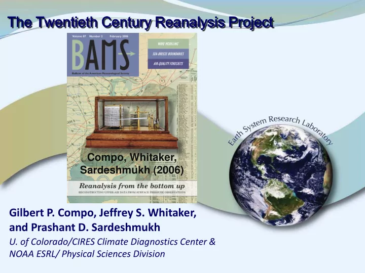
Gilbert P. Compo, co-Lead Twentieth Century Reanalysis Project, CU/CIRES, Climate Diagnostics Center & NOAA ESRL/PSD

Jeffrey S. Whitaker, co-Lead Twentieth Century Reanalysis Project, NOAA ESRL/PSD

Prashant D. Sardeshmukh, CU/CIRES, Climate Diagnostics Center & NOAA ESRL/PSD

Nobuki Matsui, CU/CIRES, Climate Diagnostics Center & NOAA ESRL/PSD

Robert J. Allan, ACRE Project Manager, Hadley Centre, Met Office, United Kingdom

Xungang Yin, STG Inc., Asheville, NC

Byron E. Gleason, Jr., NOAA National Climatic Data Center

Russell S. Vose, NOAA National Climatic Data Center

Glenn Rutledge, NOAA National Climatic Data Center

Pierre Bessemoulin, Meteo-France

Stefan Brönnimann, ETH Zurich

Manola Brunet, Centre on Climate Change (C3), Universitat Rovira i Virgili

Richard I. Crouthamel, International Environmental Data Rescue Organization

Andrea N. Grant, ETH Zurich

Pavel Y. Groisman, University Corporation for Atmospheric Research & NOAA National Climatic Data Center

Philip D. Jones, Climatic Research Unit, University of East Anglia

Michael Kruk, STG Inc., Asheville, NC

Andries C. Kruger, South African Weather Service

Gareth J. Marshall, British Antarctic Survey

Maurizio Maugeri, Dipartimento di Fisica, Università delgi Studi di Milano

Hing Y. Mok, Hong Kong Observatory

Øyvind Nordli, Norwegian Meteorologisk Institutt

Thomas F. Ross, NOAA Climate Database Modernization Program, National Climatic Data Center

Ricardo M. Trigo, Centro de Geofísica da Universidade de Lisboa, IDL, University of Lisbon

Xiaolan L. Wang, Environment Canada

Scott D. Woodruff, NOAA Earth System Research Laboratory, Physical Sciences Division

Steven J. Worley, National Center for Atmospheric Research

22

slide-23
SLIDE 23

23

SLP

1 December 1945

500 hPa GPH

Sea Level Pressure 500 hPa Geopotential Height

Analysis Ensemble Mean and Spread on selected dates in the 1918-1945 reanalysis period

Contours- ensemble mean Shading- blue: more uncertain, white: more certain

slide-24
SLIDE 24

Higher resolution example of Surface Input Reanalyses for Climate Applications (SIRCA)

24

slide-25
SLIDE 25

2008 NCEP GFS at ~50km resolution September 1938 New England (movie)

25

T254L64 (~50 km) Is the extraordinary upper-level trough correct?

slide-26
SLIDE 26

2008 NCEP GFS at ~50km resolution 21 September 1938 00 UTC

26

Is the extraordinary upper-level trough correct? Sea Level Pressure 500 hPa geopotential height

slide-27
SLIDE 27

Any Skill Forecasting the Track?

27

using 56 ensemble members T254L64 (about 0.5 degree) 36 hour forecast verifying 21 Sept 1938 18Z HURDAT Track Ensemble Forecast

slide-28
SLIDE 28

Local Anomaly Correlation of Twentieth Century Reanalysis (20CR), NCEP-NCAR Reanalysis (NNR), and ERA40 twice-daily geopotential height anomalies (1958)

28

Northern Hemisphere agreement is excellent. Southern Hemisphere agreement is moderate to poor. Is 20CR useful in Southern Hemisphere?

700 hPa 300 hPa

0.975 correlation between NNR and ERA40

20CR

  • vs. NNR

20CR

  • vs. ERA40

NNR

  • vs. ERA40

Southern Hemisphere agreement with ERA40 is poor.

0.975 0.95 0.85 0.65 0.45 0.25

slide-29
SLIDE 29

12 and 24 hour Root Mean Square difference of Marine Observations and Forecasts from NCEP-NCAR Reanalysis, Twentieth Century Reanalysis, and ECMWF Reanalysis Archive 40 (1948-1958)

29

Southern Hemisphere Northern Hemisphere Substantially better skill for 20CR than for NCEP-NCAR Reanalysis or ERA40 in southern hemisphere despite the lack of upper-air observations.

1948 1958 1948 1958

Root Mean Square Error (hPa) Root Mean Square Error (hPa)

slide-30
SLIDE 30

30

Northern Hemisphere Southern Hemisphere 1891 2006 1891 2006 4 1 4 1 Uncertainty estimates are consistent with actual differences between first guess and pressure observations even as the network changes over more than 100 years!

Surface Pressure uncertainty estimate poleward of 20(S,N) blue actual RMS difference between first guess and observations

red expected difference

slide-31
SLIDE 31

Publications using the Twentieth Century Reanalyses

Page 31

Brönnimann, S., A. Stickler, T. Griesser, A. M. Fischer, A. Grant, T. Ewen, T. Zhou, M. Schraner, E. Rozanov, and T. Peter, 2009: Variability of large-scale atmospheric circulation indices for the Northern Hemisphere during the past 100 years. Meteorol. Z., 18, 365-368, DOI: 10.1127/0941-2948/2009/0392. Giese B.S., G.P. Compo, N.C. Slowey, P.D. Sardeshmukh, J.A. Carton, S. Ray, and J.S. Whitaker, 2009:The 1918/1919 El Niño. Bull. Amer. Meteor. Soc., in press, DOI: 10.1175/2009BAMS2903. Whitaker, J.S., G.P.Compo, and J.-N. Thepaut, 2009: A comparison of variational and ensemble-based data assimilation systems for reanalysis of sparse observations. Mon. Wea. Rev., 137, 1991-1999. Wood, K. R., and J.E. Overland, 2009: Early 20th century Arctic warming in retrospect, Intl. J. Clim., in press, DOI: 10.1002/joc.1973.

slide-32
SLIDE 32

Ensemble Filter Algorithm

32

xj

b =

= <x> <x>b + + x’ x’j

b = first guess jth ensemble member ( j=1,…,56 )

yo = single observation with error variance R First guess interpolated to observation location: <y>b = H <x> <x>b , y’j

b = H x’

x’j

b

Form analysis ensemble xj

a =

= <x> <x>a + + x’ x’j

a from

<x> <x>a = = <x> <x>b + K K ( yo - <y>b ) x’ x’j

a =

= x’ x’j

b +

+ ΚM

M (-y’j b ) Note the different gain

K K = Σj

j x’

x’j

b y’j b (Σj j y’j b y’j b + R)-1 Kalman Gain

ΚM

M = (1

1 + {R {R/(Σj

j y’j b y’j b + R)} –1/2 )-1 K Modified

ed Kalman Gain shrinks the ensemble (1/(n-1)) is included in Σj

j

Analysis ensemble becomes first guess ensemble for next observation.

slide-33
SLIDE 33

Tropical Validation

 Force global Parallel Ocean Program (POP)

with daily 20th Century (1908-1956) reanalysis fields

 2m Air Temperature  2m Specific Humidity  Downwelling Shortwave at Surface  Total cloud cover  10 m Wind Speed  Precipitation  Zonal and Meridional Wind Stress

(Giese et al. BAMS 2009)

33

slide-34
SLIDE 34

Nino3.4 Time series from Kaplan SST, POP Simulation, SODA Data Assimilation

34

+20th Century reanalysis forcing fields with no adjustment generate realistic Nino3.4 variability in simulation +Encouraging for Ocean and Coupled Data Assimilation. (Giese et al. BAMS 2009)

Simulation using 20C reanalysis

slide-35
SLIDE 35

Storm Track

Skewness of Northern Hemisphere 250 hPa daily Vorticity (Dec-Feb) 1989/90-2005/06

35

ERA Interim (~50km) Uses satellite data 20CRv2 (~200km) Surface pressure only NCEP-NCAR (~200km) Uses satellite data

  • 0.2
  • 1.0

0.2 1.0 1.8

  • 0.6
  • 1.4

0.6 1.4

slide-36
SLIDE 36

Skewness of 250 hPa Vorticity from 20th Century Reanalyses

36

  • 0.2
  • 1.0

0.2 1.0 1.8

  • 0.6
  • 1.4

0.6 1.4

DJF 1989/90-2005/06 DJF 1891/92-2005/06 Storm Track Features are remarkably robust