Weather, Climate Change, and Impacts in Minnesota Dr. Mark Seeley - - PowerPoint PPT Presentation

weather climate change and impacts in minnesota
SMART_READER_LITE
LIVE PREVIEW

Weather, Climate Change, and Impacts in Minnesota Dr. Mark Seeley - - PowerPoint PPT Presentation

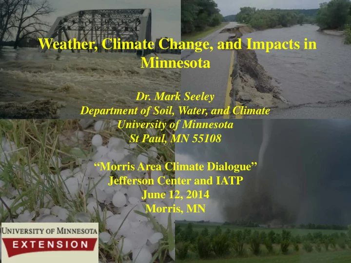
Weather, Climate Change, and Impacts in Minnesota Dr. Mark Seeley Department of Soil, Water, and Climate University of Minnesota St Paul, MN 55108 Morris Area Climate Dialogue Jefferson Center and IATP June 12, 2014 Morris, MN 102


slide-1
SLIDE 1

Weather, Climate Change, and Impacts in Minnesota

  • Dr. Mark Seeley

Department of Soil, Water, and Climate University of Minnesota St Paul, MN 55108 “Morris Area Climate Dialogue” Jefferson Center and IATP June 12, 2014 Morris, MN

slide-2
SLIDE 2

8” thunderstorm rainfall at Minnesota City, MN June 12, 1899

102 degrees F at Crookston, MN June 12, 1893

  • 23 degrees F at Remer, MN

June 12, 1985

Ice pa pack i in Du Dulut uth H Harbor bor fina inally b breaks up up June 12, 12, 1917 1917

slide-3
SLIDE 3

TOPICS

Brief History Climate Change Disparities Changing Minnesota Climate Features Climate Consequences Comments on Extremes

slide-4
SLIDE 4

Chronology of Minnesota Weather and Climate-Related Disasters: A sample listing since 1976

1976 Drought-Creation of Extension Climatologist Faculty Position 1978 flash floods in Rochester area (Zumbro R. July and Sept) 1979 flooding, late planting, delayed harvest 1980 drought in western MN counties Threat of snow loads in winters of 1981-82, 1983-84. 2000-2001, 2010-2011 1983, 1995, 1999, 2001, 2005, 2011 Heat Waves (Health and Livestock Stress) 1984 drought in western Minnesota 1987 , 1989, 2013 severe winterkill of forage crops 1988* drought statewide 1989 Red River spring flooding 1991 floods in southern Minnesota 1992 Chandler tornado 1993 floods on Minnesota and Mississippi Rivers 1995 derecho Itasca State Park and heat wave 1997* statewide spring floods 1998* March tornado outbreak in southern MN 1999 derecho in BWCA and heat wave *Denotes over $1 billion in losses

slide-5
SLIDE 5

Chronology of Minnesota Weather and Climate-Related Disasters: A sample listing (continued)

2000 Granite Falls Tornado 2001 spring floods on Minnesota and Mississippi Rivers 2002 flash floods in northern Minnesota 2004 flash floods in southern Minnesota 2007 Flash floods in SE Minnesota (simultaneous with drought) 2005-2012 Drought response every summer 2009 Red River spring snow melt flooding (66 days Moorhead) 2010 Tornado Outbreak (48 on June 17th, 113 total), Red River Flooding 2011 Red River Flooding/Hennepin/Anoka Tornadoes 2012 Flash floods Cannon River and Duluth (simultaneous with drought) 2013 Winterkill, April Ice Storm, Prevented Planting from a wet spring

slide-6
SLIDE 6

A Wea eath ther Singulari arity ty Torna nado

  • Warni

ning ng and T Torn rnad ado Warning in in Lac Qu Qui i Parle C Coun

  • unty on
  • n

Mar March 31, 31, 2014 2014

slide-7
SLIDE 7

Di Disparity i in th the pac ace o

  • f climate

te chan ange and th the res esponse to e to it

slide-8
SLIDE 8

Geographic Di Dispa parity in Precipi pitation Ch Change-IPCC 2013 2013

slide-9
SLIDE 9

Globally averaged annual temperature for 2013 tied for the 4th warmest year since 1880 and was the 37th consecutive year with a global average that was above the 20th Century mean.

slide-10
SLIDE 10
slide-11
SLIDE 11
slide-12
SLIDE 12

RECENT SIGNIFICANT CLIMATE TRENDS IN MINNESOTA AND THE WESTERN GREAT LAKES

  • TEMPERATURE: WARM WINTERS AND HIGHER MINIMUM

TEMPERATURES

  • DEWPOINTS: GREATER FREQUENCY OF TROPICAL-LIKE

ATMOSPHERIC WATER VAPOR

  • MOISTURE: AMPLIFIED PRECIPITATION SIGNAL,

THUNDERSTORM CONTRIBUTION

slide-13
SLIDE 13

Temp trend is upward and more frequently above the 90th percentile

slide-14
SLIDE 14

Seasonal Temperature Trends in MN

Winter (D,J,F) Spring (M,A,M) Summer (J,J,A) Fall (S,O,N)

slide-15
SLIDE 15

Historical ranking and distribution of statewide mean daily temperature over the past 17 heating seasons (Nov-Mar) in MN: 1=warmest

Winter Mean Temp (F) Ranking (since 1895- 120 years) 1997-1998 24.2 4th 1998-1999 23.0 8th 1999-2000 26.0 2nd 2000-2001 15.8 79th 2001-2002 25.0 3rd 2002-2003 19.3 34th 2003-2004 20.3 23th 2004-2005 21.2 16th

2005-2006 23.2 7th 2006-2007 22.3 11th

2007-2008 16.9 63rd 2008-2009 16.4 69th 2009-2010 21.5 13th 2010-2011 17.1 61st 2011-2012 27.8 1st 2012-2013 18.6 40th 2013-2014 11.7 113th

slide-16
SLIDE 16
slide-17
SLIDE 17

Trends in average winter minimum temperatures Milan, MN

Period of Record 1951 - 1980 1961 - 1990 1971 - 2000 1981 - 2010 1951 - 1980 1961 - 1990 1971 - 2000 1981 - 2010 1951 - 1980 1961 - 1990 1971 – 2000 1981 - 2010 Ave Min Temp in Deg. F Jan -4.3 Jan -0.9 Jan 0.3 Jan 3.7 Feb 2.3 Feb 5.3 Feb 8.2 Feb 9.3 Mar 15.1 Mar 19.2 Mar 21.0 Mar 22.0

slide-18
SLIDE 18

Warming is weighted towards minimum temperature change IPCC-2007

slide-19
SLIDE 19

Frequency of temperatures -25 degrees F and colder at Morris, MN 1885-1940 average 4 nights per year Since 1940 average 2 nights per year Since 1980 14 years have brought no readings of -25 F or colder

slide-20
SLIDE 20

Trends in mean monthly temperatures at St Cloud, MN 1971-2000 normals vs 1981-2010 normals (F)

Month Min Change Max Change Mean Change January +3.0 +2.7 +2.8 February +0.8 +1.1 +0.9 March +0.7 +1.3 +1.0 April +0.5 +1.4 +0.9 May +0.1 -0.2 -0.1 June +0.7 +0.2 +0.5 July +0.5 +0.6 +0.5 August +0.5 +0.7 +0.6 September +0.9 +1.3 +1.2 October +0.6 +0.3 +0.4 November +1.3 +1.8 +1.6 December +1.6 +1.5 +1.5

slide-21
SLIDE 21

Trends in mean monthly temperatures at Willmar 1971-2000 normals vs 1981-2010 normals (F)

Month Min Change Max Change Mean Change January +3.4 +1.5 +2.9 February +0.8 +0.9 +0.8 March +0.9 +1.2 +1.0 April +0.7 +1.5 +1.1 May +0.1 -0.1 NC June +0.5 +0.2 +0.3 July +0.7 +0.5 +0.6 August +0.4 +0.7 +0.5 September +0.9 +1.0 +0.9 October +0.5 +0.5 +0.5 November +1.3 +2.3 +1.7 December +2.1 +1.7 +1.8

slide-22
SLIDE 22

Trends in mean monthly temperatures at Fergus Falls, MN 1971-2000 normals vs 1981-2010 normals (F)

Month Min Change Max Change Mean Change January +2.8 +2.5 +2.6 February +0.9 +0.3 +0.6 March +1.6 +1.0 +1.3 April +0.8 +1.1 +0.9 May -0.2 -0.4 -0.4 June +0.4 NC +0.2 July +0.3 +0.2 +0.3 August +0.6 +0.4 +0.4 September +1.5 +0.6 +1.1 October +0.8 -0.2 +0.3 November +0.6 +1.8 +1.6 December +1.0 +1.6 +1.5

slide-23
SLIDE 23

Consequences of Warm Winters and Higher Minimum Temperatures

  • Change in depth and duration of soil and lake freezing
  • More rapid breakdown of crop residues
  • Later fall nitrogen applications (soil temp too high)
  • Longer outdoor construction season, fewer adverse

weather days

  • Change in over winter survival rates of insect pests and

plant diseases, and soil microbes

  • Reduced energy use for heating (fewer HDD)
  • Change in Plant Hardiness Zones
  • Longer frost-free growing seasons
  • Increased number of freeze/thaw cycles (damaged roads)
  • Change in animal migration, hibernation, and foraging
  • Longer exposure times to mold and allergens
slide-24
SLIDE 24

Trend in episodes of dewpoints of 70 F or higher Hours with dewpoints of 70 degrees F or higher at Voyageurs National Park

Latitude 45 degrees Latitude 48.5 degrees

100 200 300 400 500 600

1945 1948 1951 1954 1957 1960 1963 1966 1969 1972 1975 1978 1981 1984 1987 1990 1993 1996 1999 2002 2005 2008 2011

hours

year

Annual Hours of Dew Point Temperature Greater than or equal to 70 degrees F Minneapolis/St. Paul, MN

annual total

incomplete data

slide-25
SLIDE 25

Dewpoint Temperatures Greater than or equal to 80 degrees F Since 1996

State Climatology Office - DNR Waters

  • 10 or more days
  • at least one day

Since 1996 dewpoints of 80 F or

  • higher. Readings

have been statewide with highest frequencies in central and southern counties

No history of dewpoints of 80 F or higher prior to 1983

slide-26
SLIDE 26

Frequencies of tropical-like dew points (70 F or higher) and associated Heat Index values for the Twin Cities since 1945

Year Hours with DP of Range of Heat 70 F or greater Index Values (F) 1947 256 99 - 112 1949 303 98 - 112 1955 345 98 - 113 1957 243 98 - 112 1959 317 99 - 113 1960 259 98 - 112 1978 252 99 - 114 1983 392 102 - 110 1987 302 98 - 104 1995 387 98 - 116 1997 264 98 - 113 1999 254 98 – 116 2001 357 98 - 110 2002 512 98 – 109 2010 256 98 - 111 2011 347 98 – 118 (*134) 2013 248 99 - 105

slide-27
SLIDE 27

1883, 1894, 1901, 1910, 1917, 1921, 1931, 1933, 1934, 1936, 1937, 1947, 1948, 1949, 1955, 1957, 1959, 1964, 1976, 1977, 1983, 1988, 1995,1999, 2001, 2005, 2006, 2007, 2010, 2011, 2012, 2013

(pattern is episodic but increasing in frequency)

Historical Minnesota Heat Waves:

Red denotes dewpoint driven

slide-28
SLIDE 28

Consequences of Increased Frequency in Tropical-like Dew Points

  • Dynamics of pathogen, insect, and microorganism

populations

  • Efficacy and persistence of herbicides (volatility)
  • Elevated water temperatures, algae blooms
  • Increased workload in heat related health care

(exposure differentials, MS, COPD, Obesity)

  • Increased stress on livestock (change in ration, water,

reduced milk production and reproduction problems)

  • Increased demand for air conditioning
slide-29
SLIDE 29
slide-30
SLIDE 30

Winter-D,J,F Spring-M,A,M Summer-J,J,A Fall-S,O,N Seasonality in MN Precipitation Trends

slide-31
SLIDE 31

Average Annual PPT 1891-1920, in Average Annual PPT 1921-1950, in Average Annual PPT 1951-1980, in Average Annual PPT 1981-2010, in

  • Avg. Annual PPT, in

< 20 21 - 25 26 - 28 29 - 30 > 30

Source: MN-SCO

slide-32
SLIDE 32

Change in Annual Precipitation Normal at Milan, MN PERIOD AMOUNT (IN.) 1921-1950 21.53” 1931-1960 23.57” 1941-1970 25.53” 1951-1980 25.13” 1961-1990 24.12” 1971-2000 24.71” 1981-2010 26.14” 21 percent increase since 1921-1950

Extremes 7.91” in 1976, 39.58” in 1995

slide-33
SLIDE 33

Change in Annual Precipitation Normals at Glenwood, MN PERIOD AMOUNT (IN.) 1931-1960 20.64” 1941-1970 20.60” 1951-1980 24.09” 1961-1990 24.19” 1971-2000 24.71” 1981-2010 25.71” 25 percent increase since 1931-1950

Extremes 16.55” in 1987, 36.90” in 2005

slide-34
SLIDE 34

Change in Annual Precipitation Normals at Hutchinson, MN PERIOD AMOUNT (IN.) 1941-1970 24.52” 1951-1980 25.13” 1961-1990 26.44” 1971-2000 27.12” 1981-2010 28.38” 16 percent increase since 1941-1970

Extremes 14.83” in 1958, 38.73” in 1991

slide-35
SLIDE 35

Quantity Type (liquid,frozen) Intensity (9-15”) Frequency (74-145 days) Duration (10 days) Seasonality (shifting) Landscape relationship (interception, absorption,

runoff, evaporation)

Measurable Attributes of Precipitation

slide-36
SLIDE 36
slide-37
SLIDE 37

Access to NOAA-Atlas 14

WEB EB SI SITE: http://www.dnr nr.sta tate.mn. n.us us/climate te/no noaa_ aa_atlas as_14. 4.htm tml

slide-38
SLIDE 38

Rainfall Recurrence Table for Alexandria, MN

slide-39
SLIDE 39

NWS Atlas 14

5 5 6 6

100-year 24-hour rainfall event (in) 1961 Estimate 2013 Estimate

slide-40
SLIDE 40

Trends in MN Flash Flooding Events

Top 10 Flash Flooding Years from 1961-2011 (1) 2002 (2) 2010 (3) 1978 (4) 2004 (5) 2005 (6) 1991 (7) 2000 (8) 1995 (9) 1973 (10) 1981

Rocky Mountain Climate Organization and Natural Resources Defense Council

slide-41
SLIDE 41

Shift in Precipitation Recurrence Intervals Three one thousand year events since 2004

slide-42
SLIDE 42

Wright Flood July 17-19, 1867 All-time greatest MN flash flood with 30-36 inches of rainfall Chippewa River 4 miles wide Mississippi River rose by 12 ft in 24 hours All log booms on the Mississippi were flushed (35 million logs)

slide-43
SLIDE 43

1829, 1852, 1856 1863-1864, 1871-1872 1894, 1896, 1900, 1910, 1918, 1921-1923 1926, 1929-1934, 1936-1939, 1948, 1954-1956, 1961, 1976, 1980, 1984, 1987, 1988, 1997, 2006, 2007, 2009, 2010, 2011, 2012, 2013

Historic Droughts

(Associated fires)

slide-44
SLIDE 44

MN Counties designated for federal disaster assistance in 2012 All are associated with drought except those with which designates for flood or severe storm

slide-45
SLIDE 45

June 14, 14, 2012 2012

near early 9 9 inches of rainfall at Cannon Falls.

June 1 19-20, 20, 2012 2012

7-10 i 10 inches es o

  • f rainfal

all in parts ts of Carlto ton, St Louis, and L Lake C e Counti ties es

slide-46
SLIDE 46

St L t Louis R River er a at t Scan canlon, M MN 90 90 fold differ erence ce i in 5 5 months

Nov, 201 2012

Jun, 201 2012

slide-47
SLIDE 47

Possible Implications of Changes in Precipitation Quantity and Character

  • Altered irrigation, drainage, runoff, sediment, and

shoreline management

  • Change in storm sewer runoff design
  • Modified fisheries management
  • Mitigation of soil erosion
  • Mitigation of flooding potential
  • Better management of blowing snow and spring

snowmelt runoff

slide-48
SLIDE 48

fr from B Brooks e et al, NO , NOAA-SSL SSL, 2 , 2012

slide-49
SLIDE 49

48 on June 17, 2010

First ever EF-5 Tornado in Canada, (Elie, Manitoba) June 22, 2007 First 4 inch thunderstorm rainfall Churchill, Manitoba, Aug 24, 2010

slide-50
SLIDE 50

www.cloudappreciationsociety.org

For those who doubt or wish to dismiss the evidence that climate is changing ….the data indicate it is happening and already producing

  • consequences. It is clearly poor judgment to ignore this!

Rabbits in the sky A Poodle in the sky Snail in the sky Pig in the sky

slide-51
SLIDE 51

The A1 scenarios are of a more integrated world: characterized by: rapid economic growth; A global population that reaches 9 billion in 2050 and then gradually declines; The quick spread of new and efficient technologies; income and way of life converge between regions; extensive social and cultural interactions. A1B - A balanced emphasis on all energy sources.

1971-2000 Annual Mean Annual Temperature Map

198 1981-1990 990 203 2031-2040 040 206 2061-2070 070

Decadal average annual temperature from 16 GCM models runs showing 275 mile northern migration of the 44 degrees F isotherm Source: CMIP-Lawrence-Livermore and MN State Climatology Office