Earthquake Preparedness Earthquake Preparedness Your role Council - - PowerPoint PPT Presentation

earthquake preparedness earthquake preparedness your role
SMART_READER_LITE
LIVE PREVIEW

Earthquake Preparedness Earthquake Preparedness Your role Council - - PowerPoint PPT Presentation

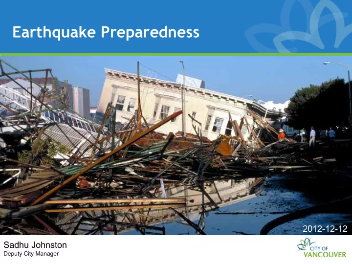
Earthquake Preparedness Earthquake Preparedness Your role Council Staff Workshop 2012-12-12 Sadhu Johnston Deputy City Manager Overview We live in an earthquake-prone area. We are providing an update to Council on: Overview of our


slide-1
SLIDE 1

Council – Staff Workshop Earthquake Preparedness Your role Earthquake Preparedness

Sadhu Johnston

Deputy City Manager

2012-12-12

slide-2
SLIDE 2

Overview

We live in an earthquake-prone area. We are providing an update to Council on:

  • Overview of our EQ planning scenario
  • An overview of the Earthquake Risk

Management Project (ERMP) – what the City is doing to address this risk

slide-3
SLIDE 3

What can we expect?

slide-4
SLIDE 4

Preparedness Now Video

http://www.youtube.com/watch?v=opXZY1zZ8xk

slide-5
SLIDE 5

What can we expect here?

Cascadia Subduction Earthquake

Crustal EQ (e.g. Hypothetical Georgia Strait EQ) Kendall Fault Earthquake

slide-6
SLIDE 6

Vancouver’s Credible Planning Scenario

  • M 7.3 crustal EQ in Georgia Strait
  • Epicenter 30 km west of Vancouver
  • 60 seconds of violent shaking in Vancouver
  • Aftershocks of M 4.0 to M 6.0
  • Submarine landslides
  • Widespread structure damage- Pre-1970s

most impacted

  • Communications system damage and
  • verload
slide-7
SLIDE 7

Source: Natural Resources Canada

slide-8
SLIDE 8

Impacts – some numbers (regional)

  • $15 billion to residential buildings
  • 5 million tonnes of debris – 200,000

truckloads

  • Injuries and deaths

– 6000 people require medical attention – 1000 require hospitalization – 200 require hospitalization w life threatening injuries – 300 people killed

slide-9
SLIDE 9

Infrastructure Damage

  • Transportation:

– Significantly damaged with a potential for partial collapse of bridges and tunnels – Damage to the airport

  • Water and sewer:

– General disruptions but extent unknown

  • Energy and telecommunications:

– Localized failures and system overload – Over 200 K households without power, restoration could take 2 months

9

slide-10
SLIDE 10

Fires

  • 40 to 50 ignitions
  • burn about 2.6 km² or 0.1% of Metro

Vancouver

10

slide-11
SLIDE 11

What’s the City doing?

slide-12
SLIDE 12

What we’ve done

What we’ve done

  • DFPS
  • HUSAR
  • Seismic Upgrades (bridges/structures)
  • Non-seismic retrofitting of City buidings
  • Consolidated radio & dispatch (E-Comm)
  • Emergency Supply Containers
  • Public Preparedness Education
  • Emergency Operations Centre
  • Emergency Telecommunications
  • Disaster Response Routes
  • Building code improvements

Recent events Chile Christchurch Japan Learnings

  • Need to better

understand risk and consequences

  • Need to assess and

strengthen City’s resilience

  • Require more

coordinated community response

slide-13
SLIDE 13

Developing an Earthquake Risk Management Strategy

Identifying impacts, gaps, and solutions to earthquake risk in Vancouver

slide-14
SLIDE 14

Developing an Earthquake Risk Management Strategy

Built Environment

  • COV Facilities

Condition Audit (Seismic)

  • Upgrade/retrofit of

essential facilities

  • Identifying priority

locations for water infrastructure upgrades Communications and Engagement

  • Engagement with

business community

  • Rolling out

earthquake plans to staff

  • Revamp public

education program Emergency Response

  • Rapid Damage

Assessment Teams training

  • Integrated

Sheltering Plan

  • Coordinate with

schools & hospitals for response planning Earthquake Impact and Loss Estimation Modelling – improving the fact base to support mitigation, preparedness, and response planning.

slide-15
SLIDE 15

Engaged in Regional Planning

  • IPREM Working Groups

Integrated partnership for regional emergency management

– Disaster Debris – Regional Concept of Operations – Emergency Communications – Disaster Response Routes – Critical Infrastructure

slide-16
SLIDE 16

Conducting Exercises

  • Magnitude 2012 - HUSAR
  • Tumbling Dice – COV Field Staff
  • Policy Group table-top (CMT, MHO, CBO)
slide-17
SLIDE 17

Planning for response

  • Earthquake Concept of Operations
  • Vancouver Volunteer Corps

– Emergency Social Services, NEAT

  • VECTOR (Emergency Amateur Radio)
  • HUSAR
  • Staff-Family Reunification
slide-18
SLIDE 18

Your role Your role

Emergency Responder Muster Locations

slide-19
SLIDE 19

Concept of Operations

Based on BCERMS (BC Emergency Response Management System)

slide-20
SLIDE 20

Moving Forwards

Sept | Oct | Nov | Dec | Jan | Feb | Mar | Apr | May | Jun | July 2012 | 2013

Project Kick-off Report back to Council with Action Plan Analyzing Impacts and Gaps Identifying Risk- Reduction Actions and Solutions Implementing Quick Start Actions Draft Report Multi-stakeholder working groups On-going risk assessment and modeling

slide-21
SLIDE 21

Summary

  • We live in an earthquake-prone area
  • The City has implemented a number of

mitigation and preparedness measures and has plans in place to respond.

  • We continue to assess the risk, exercise

plans, and improve upon them.

  • We will report back to Council with an

Earthquake Risk Mitigation Action Plan in May 2013

slide-22
SLIDE 22

What can the public and business community do?

Get prepared!

Call 3-1-1 to register for one of our free Emergency Preparedness Workshops.

Develop Business Continuity Plans! Help out – volunteer!

Call 3-1-1 to find out how you can volunteer for the Vancouver Volunteer Corps or other City

  • pportunities.